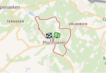
![](/images/other/stat-length.png)
20210920 - Plombières 6 Km
pierreh01
Benutzer GUIDE
![Länge](/images/other/stat-length.png)
![Maximale Höhe](https://static1.geolcdn.com/siteimages/upload/files/1508320355ic_sort_altitude_max_24dp.png)
![Positive Höhendifferenz](https://static1.geolcdn.com/siteimages/upload/files/1508320355ic_sort_den_pos_24dp.png)
![Km-Effort](/images/other/stat-length.png)
![Min. Höhe](https://static1.geolcdn.com/siteimages/upload/files/1508320355ic_sort_altitude_min_24dp.png)
![Negative Höhendifferenz](https://static1.geolcdn.com/siteimages/upload/files/1508320355ic_sort_den_neg_24dp.png)
![Boucle](https://static1.geolcdn.com/siteimages/upload/files/16400158638029165_repeat_loop_refresh_sync_direction_icon.png)
![Wandern](https://static1.geolcdn.com/sitytour/trail-icons/101.png)
1h40
Schwierigkeit : Medium
![Scannen Sie diesen QR-Code, um die Tour in der SityTrail-Anwendung zu öffnen](https://capi.geolives.com/qq0zvz2zws4bq2lad0pu/sitytour/trails/2942838/qr.png?size=200)
Kostenlosegpshiking-Anwendung
Über SityTrail
Tour Wandern von 5,9 km verfügbar auf Wallonien, Lüttich, Bleiberg. Diese Tour wird von pierreh01 vorgeschlagen.
Beschreibung
Circuit en boucle au départ de l'église de PLOMBIERES.
Parcours pédestre de sensibilisation à la nature agrémenté par une dizaine de panneaux explicatifs traduits en 4 langues (français, néerlandais, allemand et patois).
Suivre fléchage "Natagora". (parfois très discret et/ou manquant à certains endroits)
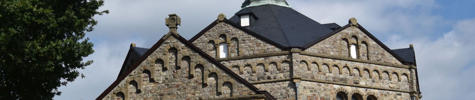
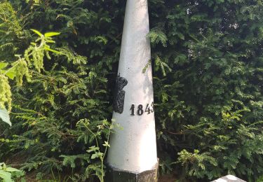
Ort
Kommentare
Touren in der Umgebung
![Tour Wandern Bleiberg - Hombourg. Natura 2000, des sites qui valent le détour ! Lg6 - Photo](https://media.geolcdn.com/t/375/260/ext.jpg?maxdim=2&url=https%3A%2F%2Fservices.sitytrail.com%2FGeolivesWS%2FDownloadMedia.ashx%3FTrailID%3D142693%26Media%3D08dbd372-9409-44af-92fd-51b9576d1e78.JPG)
![Wandern Wandern](https://static1.geolcdn.com/sitytour/trail-icons/101.png)
Wandern
![](/images/other/stat-length.png)
![](https://static1.geolcdn.com/siteimages/upload/files/16400158638029165_repeat_loop_refresh_sync_direction_icon.png)
![Tour Wandern Gulpen-Wittem - 2024-10-26_19h39m19_1518.gpx.xml - Photo](https://media.geolcdn.com/t/375/260/8521698d-6278-4db9-b85e-3d349e5101aa.jpg&format=jpg&maxdim=2)
![Wandern Wandern](https://static1.geolcdn.com/sitytour/trail-icons/101.png)
Wandern
![](/images/other/stat-length.png)
![](https://static1.geolcdn.com/siteimages/upload/files/16400158638029165_repeat_loop_refresh_sync_direction_icon.png)
![Tour Wandern Kelmis - Le pays calaminaire - Photo](https://media.geolcdn.com/t/375/260/30655fe2-e81a-47ed-96f4-20092bed94b7.jpg&format=jpg&maxdim=2)
![Wandern Wandern](https://static1.geolcdn.com/sitytour/trail-icons/101.png)
Wandern
![](/images/other/stat-length.png)
![](https://static1.geolcdn.com/siteimages/upload/files/16400158638029165_repeat_loop_refresh_sync_direction_icon.png)
![Tour Wandern Gulpen-Wittem - Epen - Vijlen - Mechelen - Photo](https://media.geolcdn.com/t/375/260/5bb62a81-94e0-4aeb-8671-819fde7ee6b3.jpg&format=jpg&maxdim=2)
![Wandern Wandern](https://static1.geolcdn.com/sitytour/trail-icons/101.png)
Wandern
![](/images/other/stat-length.png)
![](https://static1.geolcdn.com/siteimages/upload/files/16400158638029165_repeat_loop_refresh_sync_direction_icon.png)
![Tour Wandern Kelmis - La Calamine - Photo](https://media.geolcdn.com/t/375/260/606e5792-434a-491a-b5eb-2bfc2ef6f1ed.jpg&format=jpg&maxdim=2)
![Wandern Wandern](https://static1.geolcdn.com/sitytour/trail-icons/101.png)
Wandern
![](/images/other/stat-length.png)
![](https://static1.geolcdn.com/siteimages/upload/files/16400158638029165_repeat_loop_refresh_sync_direction_icon.png)
![Tour Wandern Kelmis - 2022-01-18_14h17m25_kelmis - Photo](https://media.geolcdn.com/t/375/260/9eea9d75-ea39-4660-b255-7d2a2255555e.jpg&format=jpg&maxdim=2)
![Wandern Wandern](https://static1.geolcdn.com/sitytour/trail-icons/101.png)
Wandern
![](/images/other/stat-length.png)
![](https://static1.geolcdn.com/siteimages/upload/files/16400158638029165_repeat_loop_refresh_sync_direction_icon.png)
![Tour Wandern Vaals - 2021-07-14_08h55m00_1431 - Photo](https://media.geolcdn.com/t/375/260/be698cb8-a234-4803-8ecd-dfa4be54f61b.jpg&format=jpg&maxdim=2)
![Wandern Wandern](https://static1.geolcdn.com/sitytour/trail-icons/101.png)
Wandern
![](/images/other/stat-length.png)
![](https://static1.geolcdn.com/siteimages/upload/files/16400158638029165_repeat_loop_refresh_sync_direction_icon.png)
![Tour Wandern Gulpen-Wittem - 2021-07-01_12h32m15_730 - Photo](https://media.geolcdn.com/t/375/260/6d525f96-e75b-473b-8ed3-0e3441be1b34.jpg&format=jpg&maxdim=2)
![Wandern Wandern](https://static1.geolcdn.com/sitytour/trail-icons/101.png)
Wandern
![](/images/other/stat-length.png)
![](https://static1.geolcdn.com/siteimages/upload/files/16400158638029165_repeat_loop_refresh_sync_direction_icon.png)
![Tour Wandern Kelmis - 20200730 - Les 3 Bornes 7.3 Km - Photo](https://media.geolcdn.com/t/375/260/ab7b3f98-4235-4a73-ba70-1bedd5c785f3.jpg&format=jpg&maxdim=2)
![Wandern Wandern](https://static1.geolcdn.com/sitytour/trail-icons/101.png)
Wandern
![](/images/other/stat-length.png)
![](https://static1.geolcdn.com/siteimages/upload/files/16400158638029165_repeat_loop_refresh_sync_direction_icon.png)