![](/images/other/stat-length.png)
![Tour Wandern Vendôme - Forêt de Vendôme Circuit 2 - Photo](https://media.geolcdn.com/t/1900/400/5b70f413-74fc-440a-a723-99e52f0524c2.jpg&format=pjpeg&maxdim=2)
Forêt de Vendôme Circuit 2
guydu41
Benutzer
![Länge](/images/other/stat-length.png)
![Maximale Höhe](https://static1.geolcdn.com/siteimages/upload/files/1508320355ic_sort_altitude_max_24dp.png)
![Positive Höhendifferenz](https://static1.geolcdn.com/siteimages/upload/files/1508320355ic_sort_den_pos_24dp.png)
![Km-Effort](/images/other/stat-length.png)
![Min. Höhe](https://static1.geolcdn.com/siteimages/upload/files/1508320355ic_sort_altitude_min_24dp.png)
![Negative Höhendifferenz](https://static1.geolcdn.com/siteimages/upload/files/1508320355ic_sort_den_neg_24dp.png)
![Boucle](https://static1.geolcdn.com/siteimages/upload/files/16400158638029165_repeat_loop_refresh_sync_direction_icon.png)
![Wandern](https://static1.geolcdn.com/sitytour/trail-icons/101.png)
1h07
Schwierigkeit : Sehr leicht
![Scannen Sie diesen QR-Code, um die Tour in der SityTrail-Anwendung zu öffnen](https://capi.geolives.com/qq0zvz2zws4bq2lad0pu/sitytour/trails/2940324/qr.png?size=200)
Kostenlosegpshiking-Anwendung
Über SityTrail
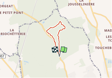
Tour Wandern von 4 km verfügbar auf Zentrum-Loiretal, Loir-et-Cher, Vendôme. Diese Tour wird von guydu41 vorgeschlagen.
Beschreibung
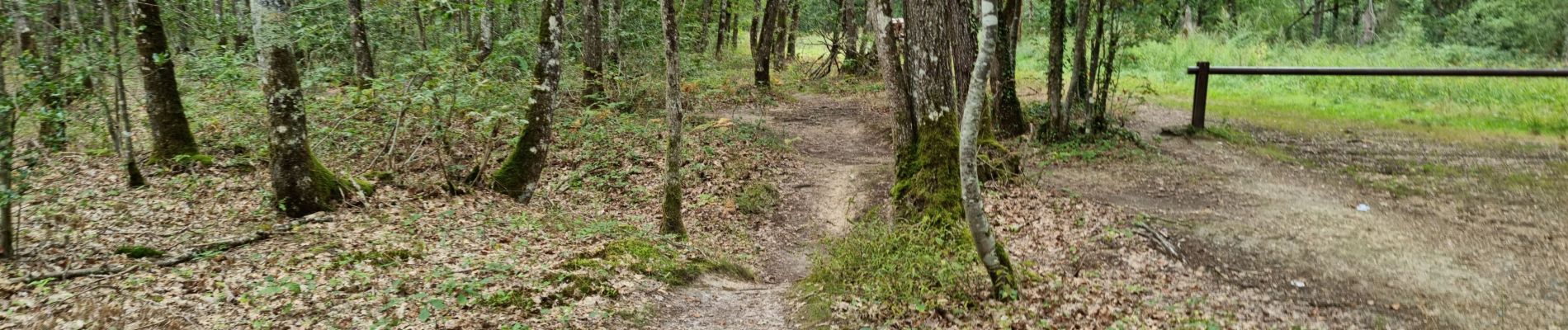
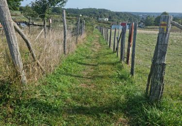
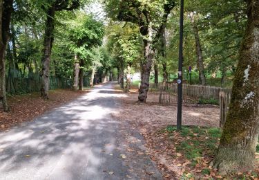
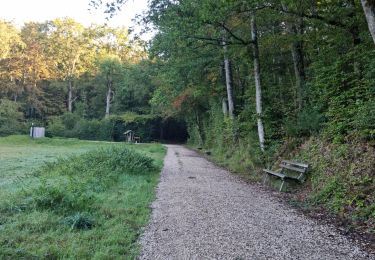
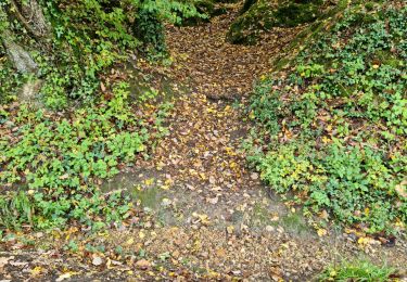
Beau petit parcours sur un circuit pour randonneurs et vététistes dans la forêt de Vendôme.
N'emprunte que des sentiers tortueux au milieu des arbres et bordés de fougères.
Passage à côté d'une mare refuge des grenouilles.
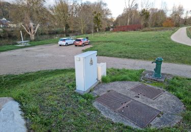
Départ/Arrivée : Parking sur la route d'Azé au Nord de Vendôme.
Remarque : En période de chasse des panneaux placés sur la route préviennent les randonneurs et vététistes du risque encouru.
Ort
Kommentare
Touren in der Umgebung
![Tour Zu Fuß Villiers-sur-Loir - Circuit des Côteaux - Photo](https://media.geolcdn.com/t/375/260/25cb373c-e85b-47b3-b4c8-0c4c4213b15c.jpeg&format=jpg&maxdim=2)
![Zu Fuß Zu Fuß](https://static1.geolcdn.com/sitytour/trail-icons/100.png)
Zu Fuß
![](/images/other/stat-length.png)
![](https://static1.geolcdn.com/siteimages/upload/files/16400158638029165_repeat_loop_refresh_sync_direction_icon.png)
![Tour Wandern Vendôme - Voie de Tours - Poiriers - Vendôme - Prunay Cassereau - Photo](https://media.geolcdn.com/t/375/260/e1f85ff8-5dc9-4860-aac3-2c0f20ccd4d1.jpg&format=jpg&maxdim=2)
![Wandern Wandern](https://static1.geolcdn.com/sitytour/trail-icons/101.png)
Wandern
![](/images/other/stat-length.png)
![](https://static1.geolcdn.com/siteimages/upload/files/16400158638029165_repeat_loop_refresh_sync_direction_icon.png)
![Tour Wandern Saint-Firmin-des-Prés - Saint-Firmin-des-Prés - Photo](https://media.geolcdn.com/t/375/260/a5813cc0-d151-48d6-b693-f67e132742f6.jpg&format=jpg&maxdim=2)
![Wandern Wandern](https://static1.geolcdn.com/sitytour/trail-icons/101.png)
Wandern
![](/images/other/stat-length.png)
![](https://static1.geolcdn.com/siteimages/upload/files/16400158638029165_repeat_loop_refresh_sync_direction_icon.png)
![Tour Wandern Naveil - Naveil - Photo](https://media.geolcdn.com/t/375/260/37d67a4f-f628-4e03-8093-029fa7b56966.jpg&format=jpg&maxdim=2)
![Wandern Wandern](https://static1.geolcdn.com/sitytour/trail-icons/101.png)
Wandern
![](/images/other/stat-length.png)
![](https://static1.geolcdn.com/siteimages/upload/files/16400158638029165_repeat_loop_refresh_sync_direction_icon.png)
![Tour Wandern Vendôme - Vendôme - Villiers-sur-Loir - Photo](https://media.geolcdn.com/t/375/260/e66027b3-088b-4b5f-b5f5-ac0b8671fb02.jpg&format=jpg&maxdim=2)
![Wandern Wandern](https://static1.geolcdn.com/sitytour/trail-icons/101.png)
Wandern
![](/images/other/stat-length.png)
![](https://static1.geolcdn.com/siteimages/upload/files/16400158638029165_repeat_loop_refresh_sync_direction_icon.png)
![Tour Wandern Vendôme - Vendôme Sud - Photo](https://media.geolcdn.com/t/375/260/824e66f3-05ad-4135-a662-4e0a98e9afaa.jpg&format=jpg&maxdim=2)
![Wandern Wandern](https://static1.geolcdn.com/sitytour/trail-icons/101.png)
Wandern
![](/images/other/stat-length.png)
![](https://static1.geolcdn.com/siteimages/upload/files/16400158638029165_repeat_loop_refresh_sync_direction_icon.png)
![Tour Wandern Vendôme - Vendôme Nord - Photo](https://media.geolcdn.com/t/375/260/8467046a-0d6b-4c3c-968e-b82cf7fdf11f.jpg&format=jpg&maxdim=2)
![Wandern Wandern](https://static1.geolcdn.com/sitytour/trail-icons/101.png)
Wandern
![](/images/other/stat-length.png)
![](https://static1.geolcdn.com/siteimages/upload/files/16400158638029165_repeat_loop_refresh_sync_direction_icon.png)
![Tour Wandern Azé - Azé - Bois et Champs - Photo](https://media.geolcdn.com/t/375/260/44a3f911-e175-4e0d-800f-03edf6856465.jpg&format=jpg&maxdim=2)
![Wandern Wandern](https://static1.geolcdn.com/sitytour/trail-icons/101.png)
Wandern
![](/images/other/stat-length.png)
![](https://static1.geolcdn.com/siteimages/upload/files/16400158638029165_repeat_loop_refresh_sync_direction_icon.png)
![Tour Wandern Vendôme - Petit parcours dans la partie Sud-est du Bois de l'Oratoire - Photo](https://media.geolcdn.com/t/375/260/d2231777-d069-4086-bb9e-9c65df795eb8.jpg&format=jpg&maxdim=2)
![Wandern Wandern](https://static1.geolcdn.com/sitytour/trail-icons/101.png)
Wandern
![](/images/other/stat-length.png)
![](https://static1.geolcdn.com/siteimages/upload/files/16400158638029165_repeat_loop_refresh_sync_direction_icon.png)