


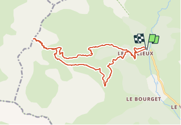

14 km | 25 km-effort


Benutzer


Kostenlosegpshiking-Anwendung
 SityTrail
IGN / Geografische Institute
SityTrail World
Die Welt öffnet sich für Sie
Tour Wandern von 11,1 km verfügbar auf Provence-Alpes-Côte d'Azur, Hochalpen, Réallon. Diese Tour wird von Dervalmarc vorgeschlagen.
Longue randonnée. 13 kilomètres.
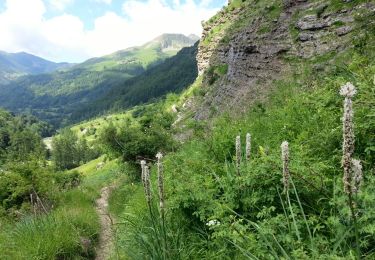
La montée au col est très raide.
Nombreux Vautours sous les Barres de la Coupa.

Wandern

Wandern

Wandern

Wandern

Schneeschuhwandern

Wandern

Wandern

Wandern
Wandern