![](/images/other/stat-length.png)
![Tour Zu Fuß Les Rouges-Eaux - circuit poussettes du col du Haut Jacques - Photo](https://media.geolcdn.com/t/1900/400/50495f91-be0a-442b-8613-da9bb725a04c.jpg&format=pjpeg&maxdim=2)
circuit poussettes du col du Haut Jacques
salomé
Benutzer
![Länge](/images/other/stat-length.png)
![Maximale Höhe](https://static1.geolcdn.com/siteimages/upload/files/1508320355ic_sort_altitude_max_24dp.png)
![Positive Höhendifferenz](https://static1.geolcdn.com/siteimages/upload/files/1508320355ic_sort_den_pos_24dp.png)
![Km-Effort](/images/other/stat-length.png)
![Min. Höhe](https://static1.geolcdn.com/siteimages/upload/files/1508320355ic_sort_altitude_min_24dp.png)
![Negative Höhendifferenz](https://static1.geolcdn.com/siteimages/upload/files/1508320355ic_sort_den_neg_24dp.png)
![Boucle](https://static1.geolcdn.com/siteimages/upload/files/16400158638029165_repeat_loop_refresh_sync_direction_icon.png)
![Zu Fuß](https://static1.geolcdn.com/sitytour/trail-icons/100.png)
21m
Schwierigkeit : Einfach
![Scannen Sie diesen QR-Code, um die Tour in der SityTrail-Anwendung zu öffnen](https://capi.geolives.com/qq0zvz2zws4bq2lad0pu/sitytour/trails/2927781/qr.png?size=200)
Kostenlosegpshiking-Anwendung
Über SityTrail
Tour Zu Fuß von 1,4 km verfügbar auf Großer Osten, Vogesen, Les Rouges-Eaux. Diese Tour wird von salomé vorgeschlagen.
Beschreibung
Poussettes tout terrain.
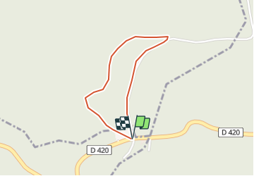
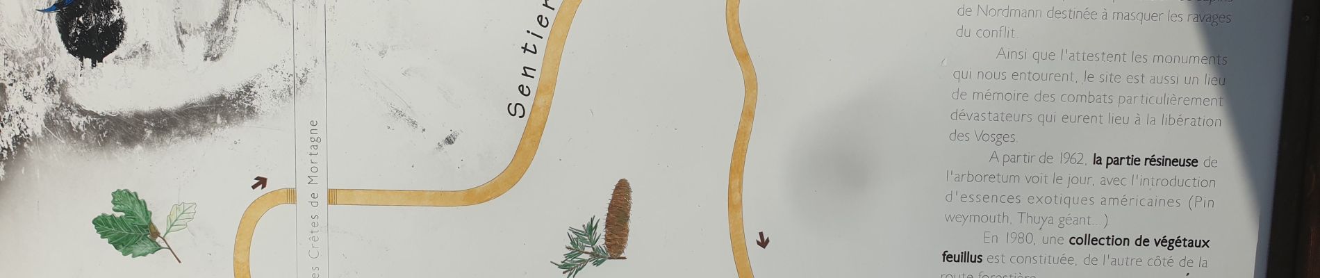
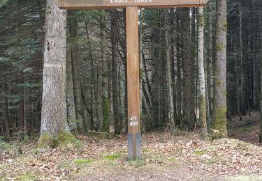
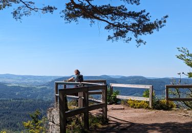
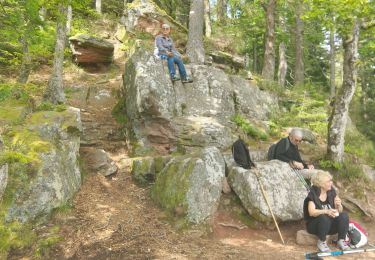
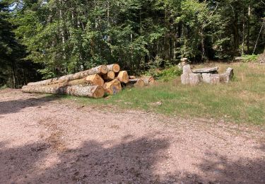
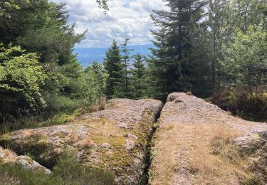
Petit parcours très agréable où se trouve également un arboretum, le parcours se situe en haut du col du Haut Jacques, un très grand parking permet de se garer sans difficulté.Prendre la chemin goudronné se trouvant à gauche du monument aux morts et continuer sur cette route pendant environ 10 minutes, puis vous verrez à votre gauche une intersection sur un chemin de forêt, prendre ce sentier et continuer tout droit.Bercé par le champ des oiseaux vous serez au coeur de la nature, idéal pour se rafraichir et pour un goûter grâce à la table de pic-nique en début de parcours
Ort
Kommentare
Touren in der Umgebung
![Tour Reiten Nompatelize - suuntoapp-HorsebackRiding-2024-04-13T07-02-45Z - Photo](https://media.geolcdn.com/t/375/260/bc3ec0b4-7edc-4377-a165-4a023afd6e02.jpg&format=jpg&maxdim=2)
![Reiten Reiten](https://static1.geolcdn.com/sitytour/trail-icons/301.png)
Reiten
![](/images/other/stat-length.png)
![](https://static1.geolcdn.com/siteimages/upload/files/16400158638029165_repeat_loop_refresh_sync_direction_icon.png)
![Tour Wandern Saint-Michel-sur-Meurthe - massif de la madeleine - Photo](https://media.geolcdn.com/t/375/260/ext.jpg?maxdim=2&url=https%3A%2F%2Fservices.sitytrail.com%2FGeolivesWS%2FDownloadMedia.ashx%3FTrailID%3D1148232%26Media%3D20190421153638.jpg)
![Wandern Wandern](https://static1.geolcdn.com/sitytour/trail-icons/101.png)
Wandern
![](/images/other/stat-length.png)
![](https://static1.geolcdn.com/siteimages/upload/files/16400158638029165_repeat_loop_refresh_sync_direction_icon.png)
![Tour Zu Fuß Taintrux - GR de Pays de Déodatie - Photo](https://media.geolcdn.com/t/375/260/8c9d86c2-6a8a-421f-b627-7552051e9313.jpeg&format=jpg&maxdim=2)
![Zu Fuß Zu Fuß](https://static1.geolcdn.com/sitytour/trail-icons/100.png)
Zu Fuß
![](/images/other/stat-length.png)
![](https://static1.geolcdn.com/siteimages/upload/files/16400158638029165_repeat_loop_refresh_sync_direction_icon.png)
![Tour Mountainbike La Bourgonce - sortie vtt du 07042019 la bourgonce - Photo](https://media.geolcdn.com/t/375/260/1e3c6291-7f2d-4769-b0f9-f4ce43c07b4c.jpg&format=jpg&maxdim=2)
![Mountainbike Mountainbike](https://static1.geolcdn.com/sitytour/trail-icons/202.png)
Mountainbike
![](/images/other/stat-length.png)
![](https://static1.geolcdn.com/siteimages/upload/files/16400158638029165_repeat_loop_refresh_sync_direction_icon.png)
![Tour Wandern Taintrux - suuntoapp-Hiking-2024-05-10T08-54-36Z - Photo](https://media.geolcdn.com/t/375/260/9fe93acc-f8ea-40c3-b435-6f108f3a2d6d.jpg&format=jpg&maxdim=2)
![Wandern Wandern](https://static1.geolcdn.com/sitytour/trail-icons/101.png)
Wandern
![](/images/other/stat-length.png)
![](https://static1.geolcdn.com/siteimages/upload/files/16400158638029165_repeat_loop_refresh_sync_direction_icon.png)
![Tour Wandern Saulcy-sur-Meurthe - Massif du KEMBERG - Photo](https://media.geolcdn.com/t/375/260/a0e83b61-8364-418a-96af-6be211e18cd3.jpg&format=jpg&maxdim=2)
![Wandern Wandern](https://static1.geolcdn.com/sitytour/trail-icons/101.png)
Wandern
![](/images/other/stat-length.png)
![](https://static1.geolcdn.com/siteimages/upload/files/16400158638029165_repeat_loop_refresh_sync_direction_icon.png)
![Tour Wandern Taintrux - Marche 09-07-22 18Km - Photo](https://media.geolcdn.com/t/375/260/dffd94f9-cf6a-45ad-8857-0cc31d7aeb13.jpg&format=jpg&maxdim=2)
![Wandern Wandern](https://static1.geolcdn.com/sitytour/trail-icons/101.png)
Wandern
![](/images/other/stat-length.png)
![](https://static1.geolcdn.com/siteimages/upload/files/16400158638029165_repeat_loop_refresh_sync_direction_icon.png)
![Tour Wandern Taintrux - Marche 06-06-22 24km - Photo](https://media.geolcdn.com/t/375/260/0cc2cfac-96ee-423b-8767-12701e4ef6de.jpg&format=jpg&maxdim=2)
![Wandern Wandern](https://static1.geolcdn.com/sitytour/trail-icons/101.png)
Wandern
![](/images/other/stat-length.png)
![](https://static1.geolcdn.com/siteimages/upload/files/16400158638029165_repeat_loop_refresh_sync_direction_icon.png)
![Tour Wandern Taintrux - Marche 25-05-22 18Km Climont - Photo](https://media.geolcdn.com/t/375/260/3f6a4b19-ce20-42f2-b08d-3fcf1fa7acba.jpg&format=jpg&maxdim=2)
![Wandern Wandern](https://static1.geolcdn.com/sitytour/trail-icons/101.png)
Wandern
![](/images/other/stat-length.png)
![](https://static1.geolcdn.com/siteimages/upload/files/16400158638029165_repeat_loop_refresh_sync_direction_icon.png)