![](/images/other/stat-length.png)
![Tour Wandern Hermigua - Canaries - La Gomera - El Cedro - jour 7 - Photo](https://media.geolcdn.com/t/1900/400/7697a606-f099-4be7-9c1b-9518519b3af3.jpg&format=pjpeg&maxdim=2)
Canaries - La Gomera - El Cedro - jour 7
fhascoet
Benutzer
![Länge](/images/other/stat-length.png)
Länge
9,4 km
![Maximale Höhe](https://static1.geolcdn.com/siteimages/upload/files/1508320355ic_sort_altitude_max_24dp.png)
Maximale Höhe
999 m
![Positive Höhendifferenz](https://static1.geolcdn.com/siteimages/upload/files/1508320355ic_sort_den_pos_24dp.png)
Positive Höhendifferenz
584 m
![Km-Effort](/images/other/stat-length.png)
Km-Effort
17,2 km
![Min. Höhe](https://static1.geolcdn.com/siteimages/upload/files/1508320355ic_sort_altitude_min_24dp.png)
Min. Höhe
489 m
![Negative Höhendifferenz](https://static1.geolcdn.com/siteimages/upload/files/1508320355ic_sort_den_neg_24dp.png)
Negative Höhendifferenz
584 m
![Boucle](https://static1.geolcdn.com/siteimages/upload/files/16400158638029165_repeat_loop_refresh_sync_direction_icon.png)
Boucle
Ja
Erstellungsdatum :
2021-08-28 09:17:01.082
Letzte Änderung :
2021-09-06 17:31:42.976
![Wandern](https://static1.geolcdn.com/sitytour/trail-icons/101.png)
5h30
Schwierigkeit : Medium
![Scannen Sie diesen QR-Code, um die Tour in der SityTrail-Anwendung zu öffnen](https://capi.geolives.com/qq0zvz2zws4bq2lad0pu/sitytour/trails/2915988/qr.png?size=200)
Kostenlosegpshiking-Anwendung
Über SityTrail
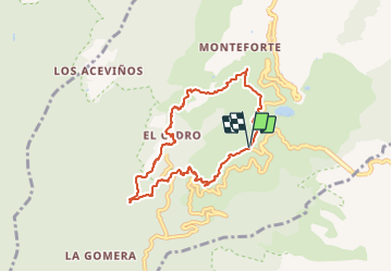
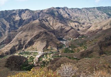
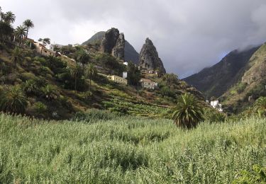
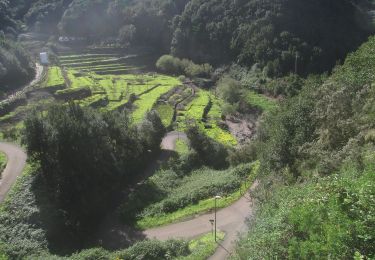
Tour Wandern von 9,4 km verfügbar auf Kanarische Inseln, Santa Cruz de Tenerife, Hermigua. Diese Tour wird von fhascoet vorgeschlagen.
Beschreibung
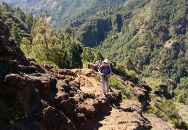
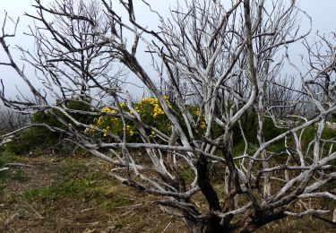
Randonnée très agréable dans la foret de lauriers et de bruyères arborescentes
Jolie cascade après la retenue d'eau.
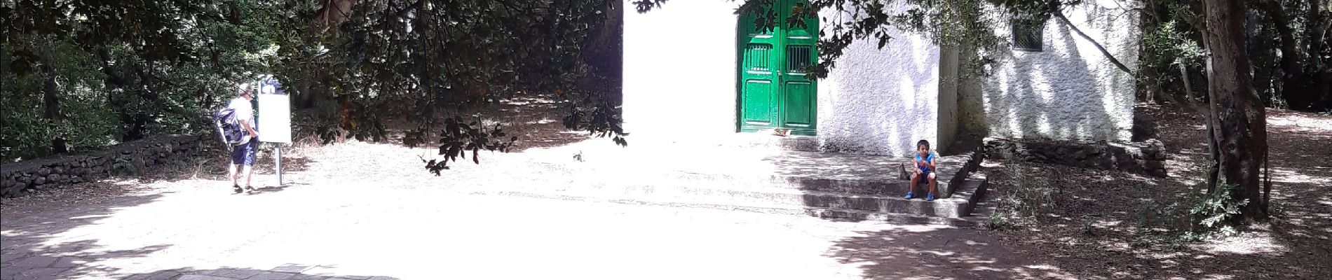
L'ermitage de Lourdes au sud est un endroit joli et très fréquenté avec des tables pour dejeuner.
Ort
Land:
Spain
Region :
Kanarische Inseln
Abteilung/Provinz :
Santa Cruz de Tenerife
Kommune :
Hermigua
Standort:
Unknown
Gehen Sie:(Dec)
Gehen Sie:(UTM)
283727 ; 3114051 (28R) N.
Kommentare
Touren in der Umgebung
![Tour Wandern Hermigua - Ibo Alvaro - Vallehermoso - Photo](https://media.geolcdn.com/t/375/260/dde858dd-4e70-43e2-9f8b-6a43896be5d6.jpg&format=jpg&maxdim=2)
![Wandern Wandern](https://static1.geolcdn.com/sitytour/trail-icons/101.png)
Ibo Alvaro - Vallehermoso
Wandern
Schwierig
Hermigua,
Kanarische Inseln,
Santa Cruz de Tenerife,
Spain
![](/images/other/stat-length.png)
16,9 km | 31 km-effort
6h 25min
![](https://static1.geolcdn.com/siteimages/upload/files/16400158638029165_repeat_loop_refresh_sync_direction_icon.png)
Nein
![Tour Wandern San Sebastián de la Gomera - La Gomera - La Zarcita la Laja el Bailadero 7/5/2019 - Photo](https://media.geolcdn.com/t/375/260/f8d4614d-4c66-4ecc-89c4-7f24d5cd179e.jpg&format=jpg&maxdim=2)
![Wandern Wandern](https://static1.geolcdn.com/sitytour/trail-icons/101.png)
La Gomera - La Zarcita la Laja el Bailadero 7/5/2019
Wandern
Medium
San Sebastián de la Gomera,
Kanarische Inseln,
Santa Cruz de Tenerife,
Spain
![](/images/other/stat-length.png)
8,7 km | 17,8 km-effort
3h 39min
![](https://static1.geolcdn.com/siteimages/upload/files/16400158638029165_repeat_loop_refresh_sync_direction_icon.png)
Ja
![Tour Zu Fuß San Sebastián de la Gomera - Ruta 31 - Photo](https://media.geolcdn.com/t/375/260/a2ad51f1-33e3-4b11-a53c-eb0fc685fb27.jpeg&format=jpg&maxdim=2)
![Zu Fuß Zu Fuß](https://static1.geolcdn.com/sitytour/trail-icons/100.png)
Ruta 31
Zu Fuß
Einfach
San Sebastián de la Gomera,
Kanarische Inseln,
Santa Cruz de Tenerife,
Spain
![](/images/other/stat-length.png)
5,1 km | 9,4 km-effort
2h 7min
![](https://static1.geolcdn.com/siteimages/upload/files/16400158638029165_repeat_loop_refresh_sync_direction_icon.png)
Nein
![Tour Zu Fuß Hermigua - Ruta 37 - Photo](https://media.geolcdn.com/t/375/260/86efd7c3-9675-4951-afc6-abaa1b072042.jpeg&format=jpg&maxdim=2)
![Zu Fuß Zu Fuß](https://static1.geolcdn.com/sitytour/trail-icons/100.png)
Ruta 37
Zu Fuß
Einfach
Hermigua,
Kanarische Inseln,
Santa Cruz de Tenerife,
Spain
![](/images/other/stat-length.png)
3,2 km | 8,5 km-effort
1h 56min
![](https://static1.geolcdn.com/siteimages/upload/files/16400158638029165_repeat_loop_refresh_sync_direction_icon.png)
Nein
![Tour Zu Fuß Agulo - PR LG 3 - Photo](https://media.geolcdn.com/t/375/260/afef9a1d-8886-4d58-be0c-78363cbd237a.jpeg&format=jpg&maxdim=2)
![Zu Fuß Zu Fuß](https://static1.geolcdn.com/sitytour/trail-icons/100.png)
PR LG 3
Zu Fuß
Einfach
Agulo,
Kanarische Inseln,
Santa Cruz de Tenerife,
Spain
![](/images/other/stat-length.png)
5,2 km | 7 km-effort
1h 35min
![](https://static1.geolcdn.com/siteimages/upload/files/16400158638029165_repeat_loop_refresh_sync_direction_icon.png)
Nein
![Tour Zu Fuß Hermigua - Ruta 32 - Photo](https://media.geolcdn.com/t/375/260/91c0beb8-ab87-4461-86a4-75e9d6c23f39.jpeg&format=jpg&maxdim=2)
![Zu Fuß Zu Fuß](https://static1.geolcdn.com/sitytour/trail-icons/100.png)
Ruta 32
Zu Fuß
Einfach
Hermigua,
Kanarische Inseln,
Santa Cruz de Tenerife,
Spain
![](/images/other/stat-length.png)
4,4 km | 6,4 km-effort
1h 26min
![](https://static1.geolcdn.com/siteimages/upload/files/16400158638029165_repeat_loop_refresh_sync_direction_icon.png)
Nein
![Tour Zu Fuß Hermigua - Ruta 33 - Photo](https://media.geolcdn.com/t/375/260/cf4876e3-19d3-4520-8999-19226e345e35.jpeg&format=jpg&maxdim=2)
![Zu Fuß Zu Fuß](https://static1.geolcdn.com/sitytour/trail-icons/100.png)
Ruta 33
Zu Fuß
Einfach
Hermigua,
Kanarische Inseln,
Santa Cruz de Tenerife,
Spain
![](/images/other/stat-length.png)
5,1 km | 8,5 km-effort
1h 56min
![](https://static1.geolcdn.com/siteimages/upload/files/16400158638029165_repeat_loop_refresh_sync_direction_icon.png)
Nein
![Tour Zu Fuß Hermigua - Reventón Oscuro - El Cedro - Photo](https://media.geolcdn.com/t/375/260/894e2729-5fef-471c-801f-1eaa4ed76d4c.jpeg&format=jpg&maxdim=2)
![Zu Fuß Zu Fuß](https://static1.geolcdn.com/sitytour/trail-icons/100.png)
Reventón Oscuro - El Cedro
Zu Fuß
Einfach
Hermigua,
Kanarische Inseln,
Santa Cruz de Tenerife,
Spain
![](/images/other/stat-length.png)
3,2 km | 6,3 km-effort
1h 25min
![](https://static1.geolcdn.com/siteimages/upload/files/16400158638029165_repeat_loop_refresh_sync_direction_icon.png)
Nein
![Tour Zu Fuß Hermigua - Ruta 9: El Contadero - Chorro del Cedro - Photo](https://media.geolcdn.com/t/375/260/170a792b-f466-4df4-95eb-754e8c2f554c.jpeg&format=jpg&maxdim=2)
![Zu Fuß Zu Fuß](https://static1.geolcdn.com/sitytour/trail-icons/100.png)
Ruta 9: El Contadero - Chorro del Cedro
Zu Fuß
Einfach
Hermigua,
Kanarische Inseln,
Santa Cruz de Tenerife,
Spain
![](/images/other/stat-length.png)
5,8 km | 11,4 km-effort
2h 35min
![](https://static1.geolcdn.com/siteimages/upload/files/16400158638029165_repeat_loop_refresh_sync_direction_icon.png)
Nein