![](/images/other/stat-length.png)
![Tour Wandern Cornille - Boucle de l étang Cornille par Pognac et Lafayardie - Photo](https://media.geolcdn.com/t/1900/400/9db332a4-5555-47bf-93a5-6e867e2bdf1f.jpg&format=pjpeg&maxdim=2)
Boucle de l étang Cornille par Pognac et Lafayardie
Marc 24
Benutzer
![Länge](/images/other/stat-length.png)
![Maximale Höhe](https://static1.geolcdn.com/siteimages/upload/files/1508320355ic_sort_altitude_max_24dp.png)
![Positive Höhendifferenz](https://static1.geolcdn.com/siteimages/upload/files/1508320355ic_sort_den_pos_24dp.png)
![Km-Effort](/images/other/stat-length.png)
![Min. Höhe](https://static1.geolcdn.com/siteimages/upload/files/1508320355ic_sort_altitude_min_24dp.png)
![Negative Höhendifferenz](https://static1.geolcdn.com/siteimages/upload/files/1508320355ic_sort_den_neg_24dp.png)
![Boucle](https://static1.geolcdn.com/siteimages/upload/files/16400158638029165_repeat_loop_refresh_sync_direction_icon.png)
![Wandern](https://static1.geolcdn.com/sitytour/trail-icons/101.png)
2h43
Schwierigkeit : Einfach
![Scannen Sie diesen QR-Code, um die Tour in der SityTrail-Anwendung zu öffnen](https://capi.geolives.com/qq0zvz2zws4bq2lad0pu/sitytour/trails/2910150/qr.png?size=200)
Kostenlosegpshiking-Anwendung
Über SityTrail
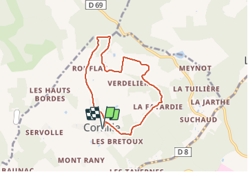
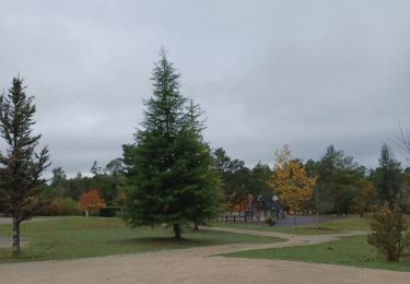
Tour Wandern von 7 km verfügbar auf Neu-Aquitanien, Dordogne, Cornille. Diese Tour wird von Marc 24 vorgeschlagen.
Beschreibung
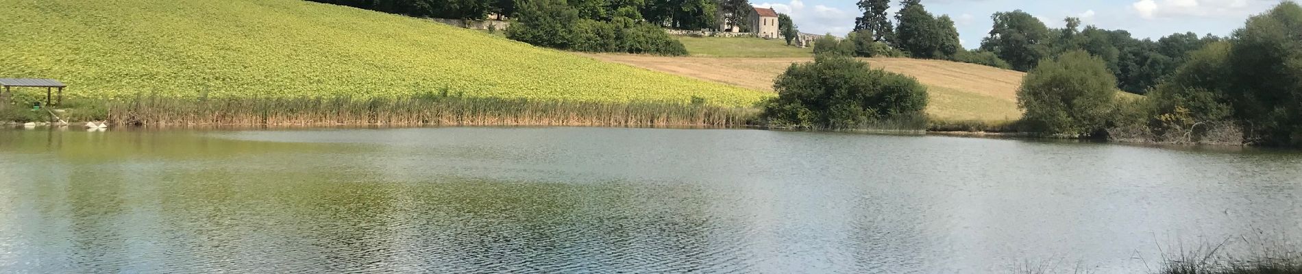
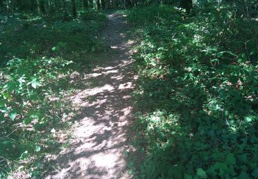
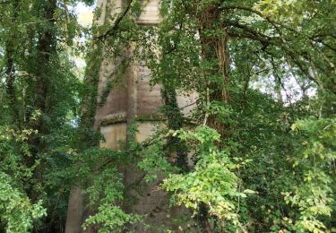
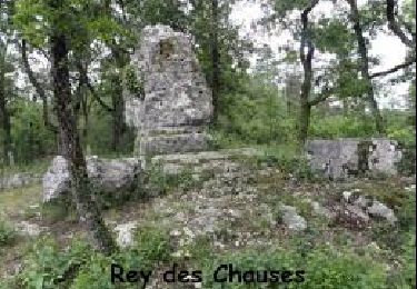
Départ Cornille , route goudronnée direction liaison Agonac. Après environ 500 m sur route, bifurquer à gauche ( balise verte liaison Agonac). Après environ 500 m sur le chemin , à la bifurcation, ne pas tourner à gauche vers « la Haute Garde » , continuer tout droit sur un bon chemin, contourner une vigne , rejoindre un chemin qui vient de la gauche et le suivre vers la droite. Environ 600 m plus loin , au carrefour des chemins, prendre à droite toujours sur des chemins coupe-feu. Rejoindre un route goudronnée, tourner à droite , puis encore à droite vers le hameau « Savertier » , le traverser sur un chemin blanc puis herbeux. A la lisière d un champ , tourner 90 degrés à gauche ( Nord Nord Est) en montant entre deux parcelles puis en haut, tourner à droite vers Pognac. Après avoir passé une maison individuelle à Pognac, tourner à droite avant une route goudronnée, un chemin herbeux vous mène à l étang que vous longez pour retrouver le balisage de la boucle des étangs de Cornille ( balisage jaune) en passant par le gîte « la Fayardie » . Balade facile et agréable . Un peu de route au début. Pause agréable à l étang ( tables et chaises ) , belle vue sur la maison bourgeoise de « Boreau » ( chemin privé) .
Ort
Kommentare
Touren in der Umgebung
![Tour Wandern Antonne-et-Trigonant - Lanmary variente 1 - Photo](https://media.geolcdn.com/t/375/260/401f1b0e-efaf-4088-b5dc-ed2841cc4d88.jpg&format=jpg&maxdim=2)
![Wandern Wandern](https://static1.geolcdn.com/sitytour/trail-icons/101.png)
Wandern
![](/images/other/stat-length.png)
![](https://static1.geolcdn.com/siteimages/upload/files/16400158638029165_repeat_loop_refresh_sync_direction_icon.png)
![Tour Nordic Walking Antonne-et-Trigonant - Lanmary Sibaudie à l'envers - Photo](https://media.geolcdn.com/t/375/260/ext.jpg?maxdim=2&url=https%3A%2F%2Fstatic1.geolcdn.com%2Fsiteimages%2Fupload%2Ffiles%2F1545311037marcheuse_200dpi.jpg)
![Nordic Walking Nordic Walking](https://static1.geolcdn.com/sitytour/trail-icons/102.png)
Nordic Walking
![](/images/other/stat-length.png)
![](https://static1.geolcdn.com/siteimages/upload/files/16400158638029165_repeat_loop_refresh_sync_direction_icon.png)
![Tour Nordic Walking Antonne-et-Trigonant - Lanmary 8,7 km - Photo](https://media.geolcdn.com/t/375/260/ext.jpg?maxdim=2&url=https%3A%2F%2Fstatic1.geolcdn.com%2Fsiteimages%2Fupload%2Ffiles%2F1545311037marcheuse_200dpi.jpg)
![Nordic Walking Nordic Walking](https://static1.geolcdn.com/sitytour/trail-icons/102.png)
Nordic Walking
![](/images/other/stat-length.png)
![](https://static1.geolcdn.com/siteimages/upload/files/16400158638029165_repeat_loop_refresh_sync_direction_icon.png)
![Tour Nordic Walking Antonne-et-Trigonant - lanmary 9.7 - Photo](https://media.geolcdn.com/t/375/260/ext.jpg?maxdim=2&url=https%3A%2F%2Fstatic1.geolcdn.com%2Fsiteimages%2Fupload%2Ffiles%2F1545311037marcheuse_200dpi.jpg)
![Nordic Walking Nordic Walking](https://static1.geolcdn.com/sitytour/trail-icons/102.png)
Nordic Walking
![](/images/other/stat-length.png)
![](https://static1.geolcdn.com/siteimages/upload/files/16400158638029165_repeat_loop_refresh_sync_direction_icon.png)
![Tour Nordic Walking Antonne-et-Trigonant - lanmary 11 km - Photo](https://media.geolcdn.com/t/375/260/ext.jpg?maxdim=2&url=https%3A%2F%2Fstatic1.geolcdn.com%2Fsiteimages%2Fupload%2Ffiles%2F1545311037marcheuse_200dpi.jpg)
![Nordic Walking Nordic Walking](https://static1.geolcdn.com/sitytour/trail-icons/102.png)
Nordic Walking
![](/images/other/stat-length.png)
![](https://static1.geolcdn.com/siteimages/upload/files/16400158638029165_repeat_loop_refresh_sync_direction_icon.png)
![Tour Nordic Walking Antonne-et-Trigonant - Croix du Rat - Photo](https://media.geolcdn.com/t/375/260/ext.jpg?maxdim=2&url=https%3A%2F%2Fstatic1.geolcdn.com%2Fsiteimages%2Fupload%2Ffiles%2F1545311037marcheuse_200dpi.jpg)
![Nordic Walking Nordic Walking](https://static1.geolcdn.com/sitytour/trail-icons/102.png)
Nordic Walking
![](/images/other/stat-length.png)
![](https://static1.geolcdn.com/siteimages/upload/files/16400158638029165_repeat_loop_refresh_sync_direction_icon.png)
![Tour Wandern Sorges et Ligueux en Périgord - lanemary patrice - Photo](https://media.geolcdn.com/t/375/260/b0b970d6-99f6-466a-ae54-e4cff74be56e.jpg&format=jpg&maxdim=2)
![Wandern Wandern](https://static1.geolcdn.com/sitytour/trail-icons/101.png)
Wandern
![](/images/other/stat-length.png)
![](https://static1.geolcdn.com/siteimages/upload/files/16400158638029165_repeat_loop_refresh_sync_direction_icon.png)
![Tour Wandern Sorges et Ligueux en Périgord - Sorges et Ligueux en Périgord - Photo](https://media.geolcdn.com/t/375/260/9d9cbeb0-19ad-4023-981e-3a56196224ce.jpg&format=jpg&maxdim=2)
![Wandern Wandern](https://static1.geolcdn.com/sitytour/trail-icons/101.png)
Wandern
![](/images/other/stat-length.png)
![](https://static1.geolcdn.com/siteimages/upload/files/16400158638029165_repeat_loop_refresh_sync_direction_icon.png)
![Tour Wandern Antonne-et-Trigonant - Boucle du Roi des Chauzes - Photo](https://media.geolcdn.com/t/375/260/fbc60e71-a24a-45dc-91d1-d88bdfb2c928.jpg&format=jpg&maxdim=2)
![Wandern Wandern](https://static1.geolcdn.com/sitytour/trail-icons/101.png)
Wandern
![](/images/other/stat-length.png)
![](https://static1.geolcdn.com/siteimages/upload/files/16400158638029165_repeat_loop_refresh_sync_direction_icon.png)