![](/images/other/stat-length.png)
![Tour Wandern Portovenere - Porte Venere to Riomaggiore - Photo](https://media.geolcdn.com/t/1900/400/6e0cac46-b1bd-4703-90c2-57a8cf4ba20d.jpg&format=pjpeg&maxdim=2)
Porte Venere to Riomaggiore
zazie
Benutzer
![Länge](/images/other/stat-length.png)
Länge
13,8 km
![Maximale Höhe](https://static1.geolcdn.com/siteimages/upload/files/1508320355ic_sort_altitude_max_24dp.png)
Maximale Höhe
531 m
![Positive Höhendifferenz](https://static1.geolcdn.com/siteimages/upload/files/1508320355ic_sort_den_pos_24dp.png)
Positive Höhendifferenz
746 m
![Km-Effort](/images/other/stat-length.png)
Km-Effort
24 km
![Min. Höhe](https://static1.geolcdn.com/siteimages/upload/files/1508320355ic_sort_altitude_min_24dp.png)
Min. Höhe
11 m
![Negative Höhendifferenz](https://static1.geolcdn.com/siteimages/upload/files/1508320355ic_sort_den_neg_24dp.png)
Negative Höhendifferenz
722 m
![Boucle](https://static1.geolcdn.com/siteimages/upload/files/16400158638029165_repeat_loop_refresh_sync_direction_icon.png)
Boucle
Nein
Erstellungsdatum :
2021-08-13 07:34:24.839
Letzte Änderung :
2021-08-13 19:17:06.969
![Wandern](https://static1.geolcdn.com/sitytour/trail-icons/101.png)
4h48
Schwierigkeit : Schwierig
![Scannen Sie diesen QR-Code, um die Tour in der SityTrail-Anwendung zu öffnen](https://capi.geolives.com/qq0zvz2zws4bq2lad0pu/sitytour/trails/2897033/qr.png?size=200)
Kostenlosegpshiking-Anwendung
Über SityTrail
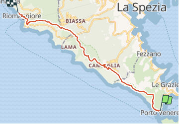
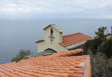
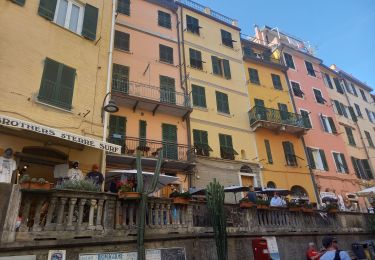
Tour Wandern von 13,8 km verfügbar auf Ligurien, La Spezia, Portovenere. Diese Tour wird von zazie vorgeschlagen.
Beschreibung
Aller simple avec passage à Campiglia et San Antonio
Prévoir beaucoup d'eau même si des bars existent.
Durée de la randonnée sans les arrêts pause.
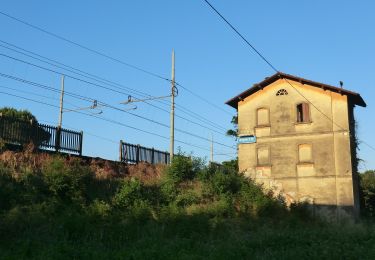
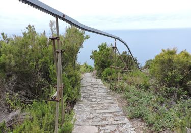
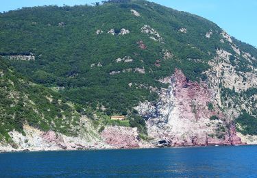
Ort
Land:
Italy
Region :
Ligurien
Abteilung/Provinz :
La Spezia
Kommune :
Portovenere
Standort:
Unknown
Gehen Sie:(Dec)
Gehen Sie:(UTM)
566852 ; 4877961 (32T) N.
Kommentare
Touren in der Umgebung
![Tour Zu Fuß Lerici - San Terenzo - Pozzuolo – sella Pin Bon – Trebiano - Photo](https://media.geolcdn.com/t/375/260/6310cab5-08ac-4700-bbde-70d1c057af88.jpeg&format=jpg&maxdim=2)
![Zu Fuß Zu Fuß](https://static1.geolcdn.com/sitytour/trail-icons/100.png)
San Terenzo - Pozzuolo – sella Pin Bon – Trebiano
Zu Fuß
Einfach
Lerici,
Ligurien,
La Spezia,
Italy
![](/images/other/stat-length.png)
5,9 km | 9,6 km-effort
2h 11min
![](https://static1.geolcdn.com/siteimages/upload/files/16400158638029165_repeat_loop_refresh_sync_direction_icon.png)
Nein
![Tour Zu Fuß Portovenere - Isola Palmaria (giro dell'isola) - Photo](https://media.geolcdn.com/t/375/260/1c69b59e-f408-4789-9002-54b9defc08e9.jpeg&format=jpg&maxdim=2)
![Zu Fuß Zu Fuß](https://static1.geolcdn.com/sitytour/trail-icons/100.png)
Isola Palmaria (giro dell'isola)
Zu Fuß
Einfach
Portovenere,
Ligurien,
La Spezia,
Italy
![](/images/other/stat-length.png)
6 km | 9,7 km-effort
2h 12min
![](https://static1.geolcdn.com/siteimages/upload/files/16400158638029165_repeat_loop_refresh_sync_direction_icon.png)
Ja
![Tour Zu Fuß La Spezia - Fabiano – Mad.na dell'Olmo – Cà Pilloa – Sella Gesuela - Photo](https://media.geolcdn.com/t/375/260/64ba72ec-148f-4d90-a788-50975718b31b.jpeg&format=jpg&maxdim=2)
![Zu Fuß Zu Fuß](https://static1.geolcdn.com/sitytour/trail-icons/100.png)
Fabiano – Mad.na dell'Olmo – Cà Pilloa – Sella Gesuela
Zu Fuß
Einfach
La Spezia,
Ligurien,
La Spezia,
Italy
![](/images/other/stat-length.png)
3,3 km | 5,1 km-effort
1h 10min
![](https://static1.geolcdn.com/siteimages/upload/files/16400158638029165_repeat_loop_refresh_sync_direction_icon.png)
Nein
![Tour Zu Fuß La Spezia - Acquasanta – Campiglia – P.ta Persico - Photo](https://media.geolcdn.com/t/375/260/f16ddc74-e4df-42e2-90d6-74322ced9089.jpeg&format=jpg&maxdim=2)
![Zu Fuß Zu Fuß](https://static1.geolcdn.com/sitytour/trail-icons/100.png)
Acquasanta – Campiglia – P.ta Persico
Zu Fuß
Einfach
La Spezia,
Ligurien,
La Spezia,
Italy
![](/images/other/stat-length.png)
4,2 km | 9,3 km-effort
2h 6min
![](https://static1.geolcdn.com/siteimages/upload/files/16400158638029165_repeat_loop_refresh_sync_direction_icon.png)
Nein
![Tour Zu Fuß La Spezia - Pegazzano – Biassa – S.Antonio – Schiara - Photo](https://media.geolcdn.com/t/375/260/f5823fa0-46d8-488d-83ac-e0137eda51cf.jpeg&format=jpg&maxdim=2)
![Zu Fuß Zu Fuß](https://static1.geolcdn.com/sitytour/trail-icons/100.png)
Pegazzano – Biassa – S.Antonio – Schiara
Zu Fuß
Einfach
La Spezia,
Ligurien,
La Spezia,
Italy
![](/images/other/stat-length.png)
6 km | 11,2 km-effort
2h 33min
![](https://static1.geolcdn.com/siteimages/upload/files/16400158638029165_repeat_loop_refresh_sync_direction_icon.png)
Nein
![Tour Wandern Portovenere - Porto Venere - Riomaggiore 5.5.23 - Photo](https://media.geolcdn.com/t/375/260/2ed1d12f-7711-4a06-8c7a-0148588c10f4.jpg&format=jpg&maxdim=2)
![Wandern Wandern](https://static1.geolcdn.com/sitytour/trail-icons/101.png)
Porto Venere - Riomaggiore 5.5.23
Wandern
Schwierig
Portovenere,
Ligurien,
La Spezia,
Italy
![](/images/other/stat-length.png)
13,2 km | 23 km-effort
4h 30min
![](https://static1.geolcdn.com/siteimages/upload/files/16400158638029165_repeat_loop_refresh_sync_direction_icon.png)
Nein
![Tour Wandern - Cinque Terre Italie - Photo](https://media.geolcdn.com/t/375/260/ext.jpg?maxdim=2&url=https%3A%2F%2Fstatic1.geolcdn.com%2Fsiteimages%2Fupload%2Ffiles%2F1553511878bg_sport_marche.png)
![Wandern Wandern](https://static1.geolcdn.com/sitytour/trail-icons/101.png)
![Tour Zu Fuß Portovenere - Cinque Terre jour 1: Porto Venere à Riomaggiore - Photo](https://media.geolcdn.com/t/375/260/ext.jpg?maxdim=2&url=https%3A%2F%2Fstatic1.geolcdn.com%2Fsiteimages%2Fupload%2Ffiles%2F1545311037marcheuse_200dpi.jpg)
![Zu Fuß Zu Fuß](https://static1.geolcdn.com/sitytour/trail-icons/100.png)
Cinque Terre jour 1: Porto Venere à Riomaggiore
Zu Fuß
Einfach
Portovenere,
Ligurien,
La Spezia,
Italy
![](/images/other/stat-length.png)
19,1 km | 38 km-effort
1h 11min
![](https://static1.geolcdn.com/siteimages/upload/files/16400158638029165_repeat_loop_refresh_sync_direction_icon.png)
Nein
![Tour Zu Fuß Portovenere - SityTrail - Cinqueterres 1a - Photo](https://media.geolcdn.com/t/375/260/ext.jpg?maxdim=2&url=https%3A%2F%2Fstatic1.geolcdn.com%2Fsiteimages%2Fupload%2Ffiles%2F1545311037marcheuse_200dpi.jpg)
![Zu Fuß Zu Fuß](https://static1.geolcdn.com/sitytour/trail-icons/100.png)
SityTrail - Cinqueterres 1a
Zu Fuß
Medium
Portovenere,
Ligurien,
La Spezia,
Italy
![](/images/other/stat-length.png)
17,2 km | 29 km-effort
Unbekannt
![](https://static1.geolcdn.com/siteimages/upload/files/16400158638029165_repeat_loop_refresh_sync_direction_icon.png)
Nein