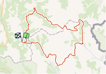
![](/images/other/stat-length.png)
![Tour Wandern Valloire - tour du mont thabor en bivouac 4jours - Photo](https://media.geolcdn.com/t/1900/400/56f83e66-84f4-4d75-b21f-3341978b4eb6.jpg&format=pjpeg&maxdim=2)
tour du mont thabor en bivouac 4jours
Camille Lecoutre
Benutzer
![Länge](/images/other/stat-length.png)
![Maximale Höhe](https://static1.geolcdn.com/siteimages/upload/files/1508320355ic_sort_altitude_max_24dp.png)
![Positive Höhendifferenz](https://static1.geolcdn.com/siteimages/upload/files/1508320355ic_sort_den_pos_24dp.png)
![Km-Effort](/images/other/stat-length.png)
![Min. Höhe](https://static1.geolcdn.com/siteimages/upload/files/1508320355ic_sort_altitude_min_24dp.png)
![Negative Höhendifferenz](https://static1.geolcdn.com/siteimages/upload/files/1508320355ic_sort_den_neg_24dp.png)
![Boucle](https://static1.geolcdn.com/siteimages/upload/files/16400158638029165_repeat_loop_refresh_sync_direction_icon.png)
![Wandern](https://static1.geolcdn.com/sitytour/trail-icons/101.png)
--
Schwierigkeit : Sehr schwierig
![Scannen Sie diesen QR-Code, um die Tour in der SityTrail-Anwendung zu öffnen](https://capi.geolives.com/qq0zvz2zws4bq2lad0pu/sitytour/trails/2867877/qr.png?size=200)
Kostenlosegpshiking-Anwendung
Über SityTrail
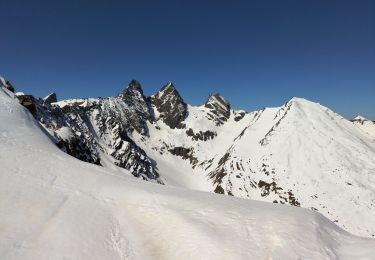
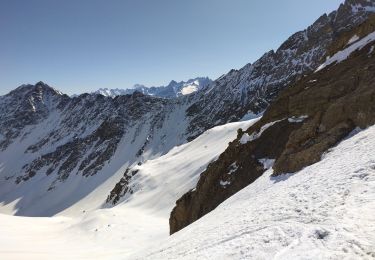
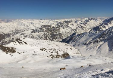
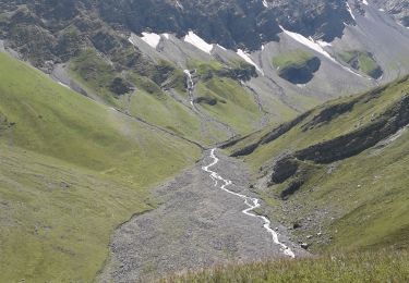
Tour Wandern von 55 km verfügbar auf Auvergne-Rhone-Alpen, Savoyen, Valloire. Diese Tour wird von Camille Lecoutre vorgeschlagen.
Beschreibung
Tour du mont Thabor au départ du camp des rochilles avec ascension du mont et ravitaillement dans les refuge et passage par le lac blanc
(6h/jours en moyennes, bivouac avant le refuge de terre rouge, refuge de thabor, lac blanc ou laramon)
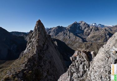
Premier jour : passage pic de l’aigle et on récupère le tracé jaune du 2 eme jour jusqu’au refuge de terre rouge : mardi 10 aout / bivouac
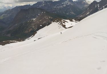
Second jour : terre rouge – ascension mont thabor – refuge de thabor (zone de bivouac) (refuge complet j’ai l’impression)
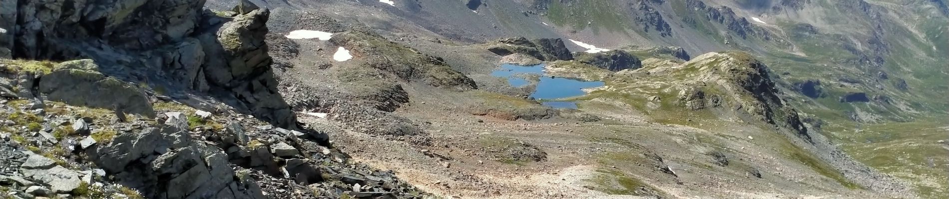
Troisième jour : refuge de thabor – lac blanc ( bivouac) ou lac de laramont / refuge ricou pas libre / laval : libre
Quatrième jour : lac blanc/refuge – voiture
Variante
Premier jour : camp des rochilles - refuge de terre rouge : mardi 10 aout / bivouac
Second jour : terre rouge – ascension mont thabor – refuge de tre alpini libre
Troisième jour : refuge de tre alpini – lac blanc ( bivouac) ou lac de laramont / refuge ricou pas libre / laval : libre
Quatrième jour : lac blanc/refuge – voiture
Ort
Kommentare
Touren in der Umgebung
![Tour Wandern Valloire - Le Pic de l'Aigle (ou presque), 2776m - Photo](https://media.geolcdn.com/t/375/260/ext.jpg?maxdim=2&url=https%3A%2F%2Fservices.sitytrail.com%2FGeolivesWS%2FDownloadMedia.ashx%3FTrailID%3D107289%26Media%3D12175_1.jpg)
![Wandern Wandern](https://static1.geolcdn.com/sitytour/trail-icons/101.png)
Wandern
![](/images/other/stat-length.png)
![](https://static1.geolcdn.com/siteimages/upload/files/16400158638029165_repeat_loop_refresh_sync_direction_icon.png)
![Tour Wandern Valloire - GPX Download: Boucle Vue sur le lac de Cerces – Lac des Cerces au départ de Moulin Benjamin - Photo](https://media.geolcdn.com/t/375/260/ext.jpg?maxdim=2&url=https%3A%2F%2Fstatic1.geolcdn.com%2Fsiteimages%2Fupload%2Ffiles%2F1553511878bg_sport_marche.png)
![Wandern Wandern](https://static1.geolcdn.com/sitytour/trail-icons/101.png)
Wandern
![](/images/other/stat-length.png)
![](https://static1.geolcdn.com/siteimages/upload/files/16400158638029165_repeat_loop_refresh_sync_direction_icon.png)
![Tour Skiwanderen Valloire - Tricotage pic blanc du Galibier, petit Galibier ouest.. - Photo](https://media.geolcdn.com/t/375/260/5fb80036-d061-47ea-be50-06ae2f510eef.jpg&format=jpg&maxdim=2)
![Skiwanderen Skiwanderen](https://static1.geolcdn.com/sitytour/trail-icons/503.png)
Skiwanderen
![](/images/other/stat-length.png)
![](https://static1.geolcdn.com/siteimages/upload/files/16400158638029165_repeat_loop_refresh_sync_direction_icon.png)
![Tour Wandern Le Monêtier-les-Bains - Pic Blanc du Galibier - Photo](https://media.geolcdn.com/t/375/260/50ed979f-f708-4034-9dd2-18865bd9cea5.jpg&format=jpg&maxdim=2)
![Wandern Wandern](https://static1.geolcdn.com/sitytour/trail-icons/101.png)
Wandern
![](/images/other/stat-length.png)
![](https://static1.geolcdn.com/siteimages/upload/files/16400158638029165_repeat_loop_refresh_sync_direction_icon.png)
![Tour Wandern Valloire - le grand Galibier par le plan lachat - Photo](https://media.geolcdn.com/t/375/260/ext.jpg?maxdim=2&url=https%3A%2F%2Fservices.sitytrail.com%2FGeolivesWS%2FDownloadMedia.ashx%3FTrailID%3D464698%26Media%3D82d2ca84-ebcc-4d20-9f14-0e6afb40d51f.JPG)
![Wandern Wandern](https://static1.geolcdn.com/sitytour/trail-icons/101.png)
Wandern
![](/images/other/stat-length.png)
![](https://static1.geolcdn.com/siteimages/upload/files/16400158638029165_repeat_loop_refresh_sync_direction_icon.png)
![Tour Skiwanderen Valloire - PT 2973 sur la crête d'argentière - Photo](https://media.geolcdn.com/t/375/260/9dd54d7b-14b1-43db-b5e7-f165732d35b0.jpg&format=jpg&maxdim=2)
![Skiwanderen Skiwanderen](https://static1.geolcdn.com/sitytour/trail-icons/503.png)
Skiwanderen
![](/images/other/stat-length.png)
![](https://static1.geolcdn.com/siteimages/upload/files/16400158638029165_repeat_loop_refresh_sync_direction_icon.png)
![Tour Skiwanderen Valloire - Col de petit Jean - Photo](https://media.geolcdn.com/t/375/260/e1f50793-9675-4ea6-9a1c-3ba4e20102bf.jpg&format=jpg&maxdim=2)
![Skiwanderen Skiwanderen](https://static1.geolcdn.com/sitytour/trail-icons/503.png)
Skiwanderen
![](/images/other/stat-length.png)
![](https://static1.geolcdn.com/siteimages/upload/files/16400158638029165_repeat_loop_refresh_sync_direction_icon.png)
![Tour Skiwanderen Valloire - Aiguille de l'épaisseur - Photo](https://media.geolcdn.com/t/375/260/77d61587-180b-4205-b36d-a83a35e6850c.jpg&format=jpg&maxdim=2)
![Skiwanderen Skiwanderen](https://static1.geolcdn.com/sitytour/trail-icons/503.png)
Skiwanderen
![](/images/other/stat-length.png)
![](https://static1.geolcdn.com/siteimages/upload/files/16400158638029165_repeat_loop_refresh_sync_direction_icon.png)
![Tour Wandern Valloire - Bonne nuit- refuge - combe des Aiguilles - Photo](https://media.geolcdn.com/t/375/260/324355e1-ed1e-44dd-bc99-5afcf7d1c974.jpg&format=jpg&maxdim=2)
![Wandern Wandern](https://static1.geolcdn.com/sitytour/trail-icons/101.png)
Wandern
![](/images/other/stat-length.png)
![](https://static1.geolcdn.com/siteimages/upload/files/16400158638029165_repeat_loop_refresh_sync_direction_icon.png)