![](/images/other/stat-length.png)
![Tour Wandern Vielsalm - Vielsalm - Photo](https://media.geolcdn.com/t/1900/400/44378ef5-866e-438f-b180-d9b97ade4067.jpg&format=pjpeg&maxdim=2)
Vielsalm
mumu.larandonneuse
Benutzer GUIDE
![Länge](/images/other/stat-length.png)
Länge
17,7 km
![Maximale Höhe](https://static1.geolcdn.com/siteimages/upload/files/1508320355ic_sort_altitude_max_24dp.png)
Maximale Höhe
536 m
![Positive Höhendifferenz](https://static1.geolcdn.com/siteimages/upload/files/1508320355ic_sort_den_pos_24dp.png)
Positive Höhendifferenz
490 m
![Km-Effort](/images/other/stat-length.png)
Km-Effort
24 km
![Min. Höhe](https://static1.geolcdn.com/siteimages/upload/files/1508320355ic_sort_altitude_min_24dp.png)
Min. Höhe
359 m
![Negative Höhendifferenz](https://static1.geolcdn.com/siteimages/upload/files/1508320355ic_sort_den_neg_24dp.png)
Negative Höhendifferenz
489 m
![Boucle](https://static1.geolcdn.com/siteimages/upload/files/16400158638029165_repeat_loop_refresh_sync_direction_icon.png)
Boucle
Ja
Erstellungsdatum :
2021-07-07 07:19:45.215
Letzte Änderung :
2021-07-07 12:33:00.813
![Wandern](https://static1.geolcdn.com/sitytour/trail-icons/101.png)
4h00
Schwierigkeit : Medium
![Scannen Sie diesen QR-Code, um die Tour in der SityTrail-Anwendung zu öffnen](https://capi.geolives.com/qq0zvz2zws4bq2lad0pu/sitytour/trails/2852789/qr.png?size=200)
Kostenlosegpshiking-Anwendung
Über SityTrail
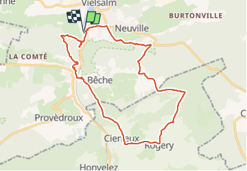
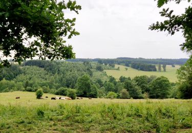
Tour Wandern von 17,7 km verfügbar auf Wallonien, Luxemburg, Vielsalm. Diese Tour wird von mumu.larandonneuse vorgeschlagen.
Beschreibung
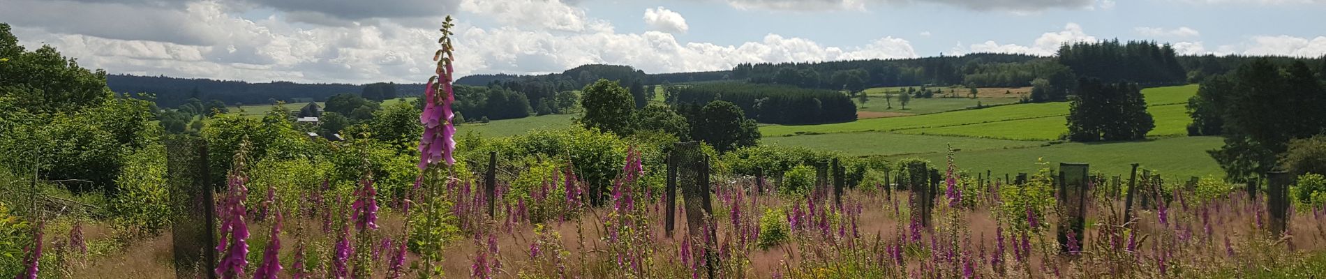
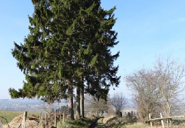
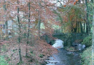
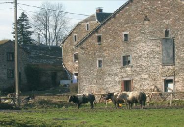
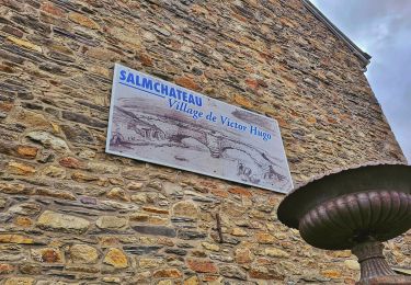
Une belle boucle dans l'Ardenne belge, de Vielsalm en passant par Salmchâteau, Cierreux, Rogery, Grand Bois de Bovigny, la réserve naturelle des Quatre-Vents et Thier des Carrières, la Carrière du renard.
📌 Gare de Vielsalm, rue de la Station.
Ort
Land:
Belgium
Region :
Wallonien
Abteilung/Provinz :
Luxemburg
Kommune :
Vielsalm
Standort:
Unknown
Gehen Sie:(Dec)
Gehen Sie:(UTM)
707314 ; 5573642 (31U) N.
Kommentare
Touren in der Umgebung
![Tour Wandern Vielsalm - 2023-04-02_15h38m24_Cirkwi-Vielsalm___Pays_du_bois,_de_la_pierre_de_l_eau - Photo](https://media.geolcdn.com/t/375/260/0c677089-4c6a-401e-ab95-09fc62ad11cf.jpg&format=jpg&maxdim=2)
![Wandern Wandern](https://static1.geolcdn.com/sitytour/trail-icons/101.png)
2023-04-02_15h38m24_Cirkwi-Vielsalm___Pays_du_bois,_de_la_pierre_de_l_eau
Wandern
Medium
(2)
Vielsalm,
Wallonien,
Luxemburg,
Belgium
![](/images/other/stat-length.png)
11,6 km | 15,6 km-effort
3h 32min
![](https://static1.geolcdn.com/siteimages/upload/files/16400158638029165_repeat_loop_refresh_sync_direction_icon.png)
Ja
![Tour Wandern Vielsalm - GG-Lu-16_Vielsalm - Gouvy - Photo](https://media.geolcdn.com/t/375/260/8dcabdae-2ff1-4908-b3bb-b5309e97313c.jpg&format=jpg&maxdim=2)
![Wandern Wandern](https://static1.geolcdn.com/sitytour/trail-icons/101.png)
GG-Lu-16_Vielsalm - Gouvy
Wandern
Sehr schwierig
(3)
Vielsalm,
Wallonien,
Luxemburg,
Belgium
![](/images/other/stat-length.png)
16 km | 22 km-effort
4h 48min
![](https://static1.geolcdn.com/siteimages/upload/files/16400158638029165_repeat_loop_refresh_sync_direction_icon.png)
Nein
![Tour Wandern Lierneux - RB-Lg-25_Arbrefontaine_via-racc-2 - Photo](https://media.geolcdn.com/t/375/260/ext.jpg?maxdim=2&url=https%3A%2F%2Fservices.sitytrail.com%2FGeolivesWS%2FDownloadMedia.ashx%3FTrailID%3D400946%26Media%3Dfe3505cb-bdd0-409b-9697-390f9300195f.jpg)
![Wandern Wandern](https://static1.geolcdn.com/sitytour/trail-icons/101.png)
RB-Lg-25_Arbrefontaine_via-racc-2
Wandern
(3)
Lierneux,
Wallonien,
Lüttich,
Belgium
![](/images/other/stat-length.png)
17,7 km | 23 km-effort
5h 12min
![](https://static1.geolcdn.com/siteimages/upload/files/16400158638029165_repeat_loop_refresh_sync_direction_icon.png)
Ja
![Tour Wandern Lierneux - RB-Lg-25_Arbrefontaine - Photo](https://media.geolcdn.com/t/375/260/ext.jpg?maxdim=2&url=https%3A%2F%2Fservices.sitytrail.com%2FGeolivesWS%2FDownloadMedia.ashx%3FTrailID%3D400945%26Media%3Dfe3505cb-bdd0-409b-9697-390f9300195f.jpg)
![Wandern Wandern](https://static1.geolcdn.com/sitytour/trail-icons/101.png)
RB-Lg-25_Arbrefontaine
Wandern
(4)
Lierneux,
Wallonien,
Lüttich,
Belgium
![](/images/other/stat-length.png)
25 km | 33 km-effort
7h 25min
![](https://static1.geolcdn.com/siteimages/upload/files/16400158638029165_repeat_loop_refresh_sync_direction_icon.png)
Ja
![Tour Wandern Vielsalm - RB-LUX-03 - Raccourci - Dans les vallées de la Salm et du Glain - Photo](https://media.geolcdn.com/t/375/260/ext.jpg?maxdim=2&url=https%3A%2F%2Fservices.sitytrail.com%2FGeolivesWS%2FDownloadMedia.ashx%3FTrailID%3D216051%26Media%3D51a8d94d-ce85-4f46-8793-517bb65c5b20.jpg)
![Wandern Wandern](https://static1.geolcdn.com/sitytour/trail-icons/101.png)
RB-LUX-03 - Raccourci - Dans les vallées de la Salm et du Glain
Wandern
Einfach
(4)
Vielsalm,
Wallonien,
Luxemburg,
Belgium
![](/images/other/stat-length.png)
16,8 km | 23 km-effort
3h 36min
![](https://static1.geolcdn.com/siteimages/upload/files/16400158638029165_repeat_loop_refresh_sync_direction_icon.png)
Ja
![Tour Wandern Vielsalm - RB-LUX-03 - Dans les vallées de la Salm et du Glain - Photo](https://media.geolcdn.com/t/375/260/ext.jpg?maxdim=2&url=https%3A%2F%2Fservices.sitytrail.com%2FGeolivesWS%2FDownloadMedia.ashx%3FTrailID%3D179612%26Media%3Db9c1cda3-4257-4d22-9a9f-65f69e9d8092.jpg)
![Wandern Wandern](https://static1.geolcdn.com/sitytour/trail-icons/101.png)
RB-LUX-03 - Dans les vallées de la Salm et du Glain
Wandern
Medium
(4)
Vielsalm,
Wallonien,
Luxemburg,
Belgium
![](/images/other/stat-length.png)
22 km | 30 km-effort
6h 10min
![](https://static1.geolcdn.com/siteimages/upload/files/16400158638029165_repeat_loop_refresh_sync_direction_icon.png)
Ja
![Tour Mountainbike Lierneux - O2bikers_151_petit_sart - Photo](https://media.geolcdn.com/t/375/260/ext.jpg?maxdim=2&url=https%3A%2F%2Fstatic1.geolcdn.com%2Fsiteimages%2Fupload%2Ffiles%2F1524743154velo.jpg)
![Mountainbike Mountainbike](https://static1.geolcdn.com/sitytour/trail-icons/202.png)
O2bikers_151_petit_sart
Mountainbike
Sehr leicht
(1)
Lierneux,
Wallonien,
Lüttich,
Belgium
![](/images/other/stat-length.png)
38 km | 50 km-effort
6h 44min
![](https://static1.geolcdn.com/siteimages/upload/files/16400158638029165_repeat_loop_refresh_sync_direction_icon.png)
Ja
![Tour Wandern Vielsalm - Balade à Salmchateau - Photo](https://media.geolcdn.com/t/375/260/3de6bc27-49c3-4a0d-9844-4130c8ac5c83.jpeg&format=jpg&maxdim=2)
![Wandern Wandern](https://static1.geolcdn.com/sitytour/trail-icons/101.png)
Balade à Salmchateau
Wandern
Schwierig
Vielsalm,
Wallonien,
Luxemburg,
Belgium
![](/images/other/stat-length.png)
9,8 km | 13,4 km-effort
3h 2min
![](https://static1.geolcdn.com/siteimages/upload/files/16400158638029165_repeat_loop_refresh_sync_direction_icon.png)
Ja
![Tour Wandern Vielsalm - La nature en questions - Photo](https://media.geolcdn.com/t/375/260/c82c6954-3937-4349-a2df-80b6eaa40ce3.jpg&format=jpg&maxdim=2)
![Wandern Wandern](https://static1.geolcdn.com/sitytour/trail-icons/101.png)
La nature en questions
Wandern
Medium
Vielsalm,
Wallonien,
Luxemburg,
Belgium
![](/images/other/stat-length.png)
7 km | 9,8 km-effort
2h 13min
![](https://static1.geolcdn.com/siteimages/upload/files/16400158638029165_repeat_loop_refresh_sync_direction_icon.png)
Ja