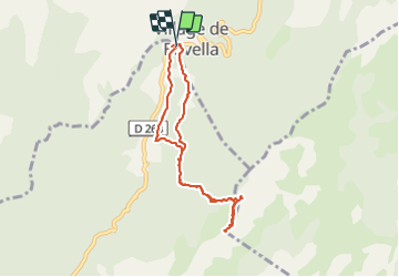
![](/images/other/stat-length.png)
![Tour Wandern Zonza - punta velaco 2021 - Photo](https://media.geolcdn.com/t/1900/400/ext.pjpeg?maxdim=2&url=https%3A%2F%2Fstatic1.geolcdn.com%2Fsiteimages%2Fupload%2Ffiles%2F1553511878bg_sport_marche.png)
punta velaco 2021
philippenl
Benutzer
![Länge](/images/other/stat-length.png)
Länge
7,9 km
![Maximale Höhe](https://static1.geolcdn.com/siteimages/upload/files/1508320355ic_sort_altitude_max_24dp.png)
Maximale Höhe
1446 m
![Positive Höhendifferenz](https://static1.geolcdn.com/siteimages/upload/files/1508320355ic_sort_den_pos_24dp.png)
Positive Höhendifferenz
333 m
![Km-Effort](/images/other/stat-length.png)
Km-Effort
12,4 km
![Min. Höhe](https://static1.geolcdn.com/siteimages/upload/files/1508320355ic_sort_altitude_min_24dp.png)
Min. Höhe
1212 m
![Negative Höhendifferenz](https://static1.geolcdn.com/siteimages/upload/files/1508320355ic_sort_den_neg_24dp.png)
Negative Höhendifferenz
334 m
![Boucle](https://static1.geolcdn.com/siteimages/upload/files/16400158638029165_repeat_loop_refresh_sync_direction_icon.png)
Boucle
Ja
Erstellungsdatum :
2021-07-04 09:30:15.204
Letzte Änderung :
2021-07-30 14:55:08.603
![Wandern](https://static1.geolcdn.com/sitytour/trail-icons/101.png)
3h55
Schwierigkeit : Sehr schwierig
![Scannen Sie diesen QR-Code, um die Tour in der SityTrail-Anwendung zu öffnen](https://capi.geolives.com/qq0zvz2zws4bq2lad0pu/sitytour/trails/2849660/qr.png?size=200)
Kostenlosegpshiking-Anwendung
Über SityTrail
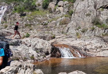
Tour Wandern von 7,9 km verfügbar auf Korsika, Südkorsika, Zonza. Diese Tour wird von philippenl vorgeschlagen.
Beschreibung
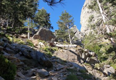
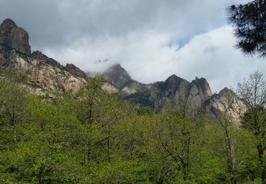
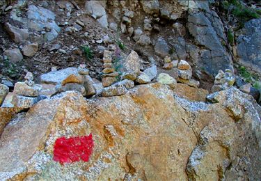
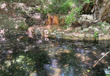
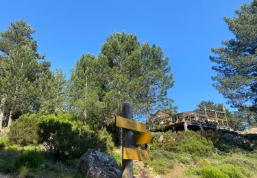
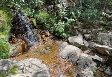
Très beau panorama sur le massif de Bavella, le Haut Cavu et le chaînon de Paliri de Punta Quercitella à Punta Paliri. Vers le sommet, deux passages un peu aériens sans difficulté que l'on passe sans équipement. La vue vaut l'effort.
Ort
Land:
France
Region :
Korsika
Abteilung/Provinz :
Südkorsika
Kommune :
Zonza
Standort:
Unknown
Gehen Sie:(Dec)
Gehen Sie:(UTM)
518619 ; 4627114 (32T) N.
Kommentare
Touren in der Umgebung
![Tour Wandern Zonza - Boucle du trou de la bombe - Bavella - Photo](https://media.geolcdn.com/t/375/260/ext.jpg?maxdim=2&url=https%3A%2F%2Fmedia.geolcdn.com%2Ff%2F57ec4c61-a922-4825-a53b-adb705edbd02.jpg)
![Wandern Wandern](https://static1.geolcdn.com/sitytour/trail-icons/101.png)
Boucle du trou de la bombe - Bavella
Wandern
Einfach
(1)
Zonza,
Korsika,
Südkorsika,
France
![](/images/other/stat-length.png)
6,5 km | 9 km-effort
1h 53min
![](https://static1.geolcdn.com/siteimages/upload/files/16400158638029165_repeat_loop_refresh_sync_direction_icon.png)
Ja
![Tour Wandern Zonza - Bavella_trou de la bombe - Photo](https://media.geolcdn.com/t/375/260/ext.jpg?maxdim=2&url=https%3A%2F%2Fservices.sitytrail.com%2FGeolivesWS%2FDownloadMedia.ashx%3FTrailID%3D198331%26Media%3D1886eeb5-9e06-40d9-ad21-e8df8d175266.jpg)
![Wandern Wandern](https://static1.geolcdn.com/sitytour/trail-icons/101.png)
Bavella_trou de la bombe
Wandern
Medium
(1)
Zonza,
Korsika,
Südkorsika,
France
![](/images/other/stat-length.png)
7,7 km | 11,4 km-effort
3h 9min
![](https://static1.geolcdn.com/siteimages/upload/files/16400158638029165_repeat_loop_refresh_sync_direction_icon.png)
Ja
![Tour Wandern Quenza - Les aiguilles de Bavella - Photo](https://media.geolcdn.com/t/375/260/ext.jpg?maxdim=2&url=https%3A%2F%2Fstatic1.geolcdn.com%2Fsiteimages%2Fupload%2Ffiles%2F1553511878bg_sport_marche.png)
![Wandern Wandern](https://static1.geolcdn.com/sitytour/trail-icons/101.png)
Les aiguilles de Bavella
Wandern
Schwierig
(2)
Quenza,
Korsika,
Südkorsika,
France
![](/images/other/stat-length.png)
14,1 km | 26 km-effort
4h 30min
![](https://static1.geolcdn.com/siteimages/upload/files/16400158638029165_repeat_loop_refresh_sync_direction_icon.png)
Ja
![Tour Wandern Conca - Paliri Conca - Photo](https://media.geolcdn.com/t/375/260/ext.jpg?maxdim=2&url=https%3A%2F%2Fmedia.geolcdn.com%2Ff%2F8129a798-c8a0-4a1d-9b4b-9f49d3407a5a.jpg)
![Wandern Wandern](https://static1.geolcdn.com/sitytour/trail-icons/101.png)
Paliri Conca
Wandern
Sehr schwierig
Conca,
Korsika,
Südkorsika,
France
![](/images/other/stat-length.png)
13,5 km | 21 km-effort
4h 29min
![](https://static1.geolcdn.com/siteimages/upload/files/16400158638029165_repeat_loop_refresh_sync_direction_icon.png)
Nein
![Tour Wandern Quenza - Refuge Aline Paliri - Photo](https://media.geolcdn.com/t/375/260/ext.jpg?maxdim=2&url=https%3A%2F%2Fmedia.geolcdn.com%2Ff%2F64e98614-54d0-47ee-aa13-b132cf042059.jpg)
![Wandern Wandern](https://static1.geolcdn.com/sitytour/trail-icons/101.png)
Refuge Aline Paliri
Wandern
Sehr schwierig
Quenza,
Korsika,
Südkorsika,
France
![](/images/other/stat-length.png)
11,3 km | 24 km-effort
3h 53min
![](https://static1.geolcdn.com/siteimages/upload/files/16400158638029165_repeat_loop_refresh_sync_direction_icon.png)
Nein
![Tour Wandern Conca - eta 2 - Photo](https://media.geolcdn.com/t/375/260/ext.jpg?maxdim=2&url=https%3A%2F%2Fmedia.geolcdn.com%2Ff%2F2e5824f5-cee9-4ee9-b75e-599680df0276.jpg)
![Wandern Wandern](https://static1.geolcdn.com/sitytour/trail-icons/101.png)
![Tour Wandern Conca - Corse - GR20 Paliri à Conca - Photo](https://media.geolcdn.com/t/375/260/ext.jpg?maxdim=2&url=https%3A%2F%2Fmedia.geolcdn.com%2Ff%2F374a964b-6d4e-4e78-8a0e-bd563fc5fe7d.jpg)
![Wandern Wandern](https://static1.geolcdn.com/sitytour/trail-icons/101.png)
Corse - GR20 Paliri à Conca
Wandern
Medium
Conca,
Korsika,
Südkorsika,
France
![](/images/other/stat-length.png)
13,5 km | 21 km-effort
4h 30min
![](https://static1.geolcdn.com/siteimages/upload/files/16400158638029165_repeat_loop_refresh_sync_direction_icon.png)
Nein
![Tour Wandern Zonza - Trou de la bombe et Punta Velacu - Photo](https://media.geolcdn.com/t/375/260/ext.jpg?maxdim=2&url=https%3A%2F%2Fmedia.geolcdn.com%2Ff%2Fd5bb3da4-e374-49ec-b561-b8a65b36615c.jpg)
![Wandern Wandern](https://static1.geolcdn.com/sitytour/trail-icons/101.png)
Trou de la bombe et Punta Velacu
Wandern
Einfach
Zonza,
Korsika,
Südkorsika,
France
![](/images/other/stat-length.png)
9,4 km | 14,8 km-effort
4h 43min
![](https://static1.geolcdn.com/siteimages/upload/files/16400158638029165_repeat_loop_refresh_sync_direction_icon.png)
Ja
![Tour Wandern Conca - GR20 Etape 15 Paliri Conca - Photo](https://media.geolcdn.com/t/375/260/ext.jpg?maxdim=2&url=https%3A%2F%2Fmedia.geolcdn.com%2Ff%2F6eca872c-e9ba-41e5-a4c7-e7ea694aaee8.jpg)
![Wandern Wandern](https://static1.geolcdn.com/sitytour/trail-icons/101.png)
GR20 Etape 15 Paliri Conca
Wandern
Schwierig
Conca,
Korsika,
Südkorsika,
France
![](/images/other/stat-length.png)
14 km | 21 km-effort
4h 53min
![](https://static1.geolcdn.com/siteimages/upload/files/16400158638029165_repeat_loop_refresh_sync_direction_icon.png)
Nein