![](/images/other/stat-length.png)
![Tour Elektrofahrrad Ostwald - Château - Photo](https://media.geolcdn.com/t/1900/400/e767c6a9-afc1-4286-93bc-286332bee116.jpg&format=pjpeg&maxdim=2)
Château
26051010
Benutzer
![Länge](/images/other/stat-length.png)
Länge
71 km
![Maximale Höhe](https://static1.geolcdn.com/siteimages/upload/files/1508320355ic_sort_altitude_max_24dp.png)
Maximale Höhe
493 m
![Positive Höhendifferenz](https://static1.geolcdn.com/siteimages/upload/files/1508320355ic_sort_den_pos_24dp.png)
Positive Höhendifferenz
701 m
![Km-Effort](/images/other/stat-length.png)
Km-Effort
80 km
![Min. Höhe](https://static1.geolcdn.com/siteimages/upload/files/1508320355ic_sort_altitude_min_24dp.png)
Min. Höhe
138 m
![Negative Höhendifferenz](https://static1.geolcdn.com/siteimages/upload/files/1508320355ic_sort_den_neg_24dp.png)
Negative Höhendifferenz
701 m
![Boucle](https://static1.geolcdn.com/siteimages/upload/files/16400158638029165_repeat_loop_refresh_sync_direction_icon.png)
Boucle
Ja
Erstellungsdatum :
2021-07-03 08:27:44.0
Letzte Änderung :
2021-07-03 13:24:24.028
![Elektrofahrrad](https://static1.geolcdn.com/sitytour/trail-icons/205.png)
3h53
Schwierigkeit : Medium
![Scannen Sie diesen QR-Code, um die Tour in der SityTrail-Anwendung zu öffnen](https://capi.geolives.com/qq0zvz2zws4bq2lad0pu/sitytour/trails/2848041/qr.png?size=200)
Kostenlosegpshiking-Anwendung
Über SityTrail
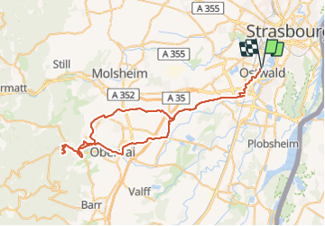
Tour Elektrofahrrad von 71 km verfügbar auf Großer Osten, Unterelsass, Ostwald. Diese Tour wird von 26051010 vorgeschlagen.
Beschreibung
Ostwald châteaux d’Ottrott
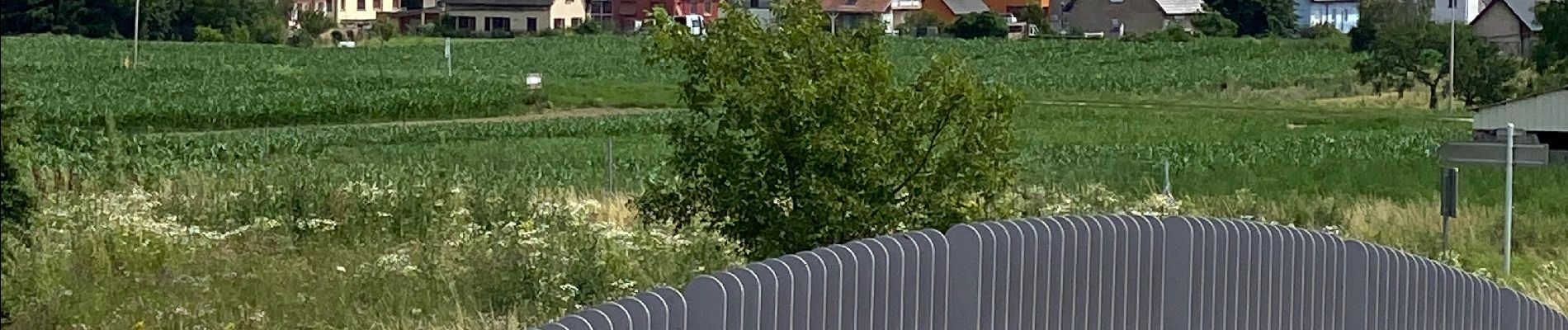
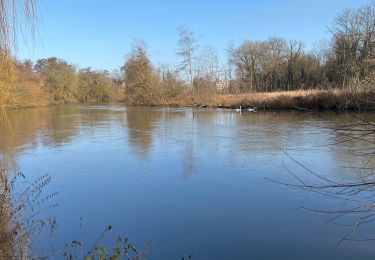
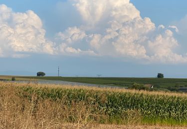
Ort
Land:
France
Region :
Großer Osten
Abteilung/Provinz :
Unterelsass
Kommune :
Ostwald
Standort:
Unknown
Gehen Sie:(Dec)
Gehen Sie:(UTM)
404782 ; 5377830 (32U) N.
Kommentare
Touren in der Umgebung
![Tour Wandern Straßburg - Strasbourg - Centre historique - Photo](https://media.geolcdn.com/t/375/260/ext.jpg?maxdim=2&url=https%3A%2F%2Fservices.sitytrail.com%2FGeolivesWS%2FDownloadMedia.ashx%3FTrailID%3D714530%26Media%3Dfix__20170315162311.jpg)
![Wandern Wandern](https://static1.geolcdn.com/sitytour/trail-icons/101.png)
Strasbourg - Centre historique
Wandern
Einfach
(3)
Straßburg,
Großer Osten,
Unterelsass,
France
![](/images/other/stat-length.png)
8 km | 9,2 km-effort
2h 11min
![](https://static1.geolcdn.com/siteimages/upload/files/16400158638029165_repeat_loop_refresh_sync_direction_icon.png)
Nein
![Tour Wandern Straßburg - Untitled - Photo](https://media.geolcdn.com/t/375/260/ext.jpg?maxdim=2&url=https%3A%2F%2Fservices.sitytrail.com%2FGeolivesWS%2FDownloadMedia.ashx%3FTrailID%3D378325%26Media%3D20150118104613.jpg)
![Wandern Wandern](https://static1.geolcdn.com/sitytour/trail-icons/101.png)
Untitled
Wandern
Sehr leicht
(1)
Straßburg,
Großer Osten,
Unterelsass,
France
![](/images/other/stat-length.png)
6,1 km | 7 km-effort
1h 42min
![](https://static1.geolcdn.com/siteimages/upload/files/16400158638029165_repeat_loop_refresh_sync_direction_icon.png)
Ja
![Tour Wandern Straßburg - Strasbourg Krutenau Université - Photo](https://media.geolcdn.com/t/375/260/8cbb56df-c20b-4a21-8b38-d84143e8ba5e.jpg&format=jpg&maxdim=2)
![Wandern Wandern](https://static1.geolcdn.com/sitytour/trail-icons/101.png)
Strasbourg Krutenau Université
Wandern
Medium
(1)
Straßburg,
Großer Osten,
Unterelsass,
France
![](/images/other/stat-length.png)
5,3 km | 6,1 km-effort
1h 23min
![](https://static1.geolcdn.com/siteimages/upload/files/16400158638029165_repeat_loop_refresh_sync_direction_icon.png)
Ja
![Tour sport Wolfisheim - 20241213 Wolfisheim - Photo](https://media.geolcdn.com/t/375/260/b82d77db-7d71-4ee9-aaab-c2a4d356d4d1.jpg&format=jpg&maxdim=2)
20241213 Wolfisheim
sport
Sehr leicht
Wolfisheim,
Großer Osten,
Unterelsass,
France
![](/images/other/stat-length.png)
7,5 km | 8,1 km-effort
Unbekannt
![](https://static1.geolcdn.com/siteimages/upload/files/16400158638029165_repeat_loop_refresh_sync_direction_icon.png)
Ja
![Tour Wandern Ostwald - Tayla - Photo](https://media.geolcdn.com/t/375/260/236e4d72-747b-45d2-ae4f-84e3c8bc8c57.jpg&format=jpg&maxdim=2)
![Wandern Wandern](https://static1.geolcdn.com/sitytour/trail-icons/101.png)
![Tour Wandern Ostwald - Lundi - Photo](https://media.geolcdn.com/t/375/260/7f259d80-50fa-422a-96ef-cd2ae8fbda1c.jpg&format=jpg&maxdim=2)
![Wandern Wandern](https://static1.geolcdn.com/sitytour/trail-icons/101.png)
Lundi
Wandern
Sehr leicht
Ostwald,
Großer Osten,
Unterelsass,
France
![](/images/other/stat-length.png)
8,4 km | 9,2 km-effort
1h 45min
![](https://static1.geolcdn.com/siteimages/upload/files/16400158638029165_repeat_loop_refresh_sync_direction_icon.png)
Ja
![Tour Elektrofahrrad Ostwald - Promenade Vosges - Photo](https://media.geolcdn.com/t/375/260/f9c256ef-dfcd-431d-8977-ca099c8aa398.jpg&format=jpg&maxdim=2)
![Elektrofahrrad Elektrofahrrad](https://static1.geolcdn.com/sitytour/trail-icons/205.png)
Promenade Vosges
Elektrofahrrad
Sehr leicht
Ostwald,
Großer Osten,
Unterelsass,
France
![](/images/other/stat-length.png)
82 km | 94 km-effort
4h 33min
![](https://static1.geolcdn.com/siteimages/upload/files/16400158638029165_repeat_loop_refresh_sync_direction_icon.png)
Ja
![Tour Elektrofahrrad Ostwald - Nideck carrefour des Pandours - Photo](https://media.geolcdn.com/t/375/260/e2ea2c89-1b62-4f65-a986-fc596c752bcf.jpg&format=jpg&maxdim=2)
![Elektrofahrrad Elektrofahrrad](https://static1.geolcdn.com/sitytour/trail-icons/205.png)
Nideck carrefour des Pandours
Elektrofahrrad
Medium
Ostwald,
Großer Osten,
Unterelsass,
France
![](/images/other/stat-length.png)
86 km | 102 km-effort
5h 10min
![](https://static1.geolcdn.com/siteimages/upload/files/16400158638029165_repeat_loop_refresh_sync_direction_icon.png)
Ja
![Tour Mountainbike Ostwald - Ostwald Etang du loup - Photo](https://media.geolcdn.com/t/375/260/b25b355f-15e8-48e3-8757-005d4424f736.jpg&format=jpg&maxdim=2)
![Mountainbike Mountainbike](https://static1.geolcdn.com/sitytour/trail-icons/202.png)
Ostwald Etang du loup
Mountainbike
Medium
Ostwald,
Großer Osten,
Unterelsass,
France
![](/images/other/stat-length.png)
78 km | 91 km-effort
4h 27min
![](https://static1.geolcdn.com/siteimages/upload/files/16400158638029165_repeat_loop_refresh_sync_direction_icon.png)
Ja