![](/images/other/stat-length.png)
![Tour Wandern Auris - 2021-06-12_07h54m40_6693230 - Photo](https://media.geolcdn.com/t/1900/400/ext.pjpeg?maxdim=2&url=https%3A%2F%2Fstatic1.geolcdn.com%2Fsiteimages%2Fupload%2Ffiles%2F1553511878bg_sport_marche.png)
2021-06-12_07h54m40_6693230
jpb83
Benutzer
![Länge](/images/other/stat-length.png)
![Maximale Höhe](https://static1.geolcdn.com/siteimages/upload/files/1508320355ic_sort_altitude_max_24dp.png)
![Positive Höhendifferenz](https://static1.geolcdn.com/siteimages/upload/files/1508320355ic_sort_den_pos_24dp.png)
![Km-Effort](/images/other/stat-length.png)
![Min. Höhe](https://static1.geolcdn.com/siteimages/upload/files/1508320355ic_sort_altitude_min_24dp.png)
![Negative Höhendifferenz](https://static1.geolcdn.com/siteimages/upload/files/1508320355ic_sort_den_neg_24dp.png)
![Boucle](https://static1.geolcdn.com/siteimages/upload/files/16400158638029165_repeat_loop_refresh_sync_direction_icon.png)
![Wandern](https://static1.geolcdn.com/sitytour/trail-icons/101.png)
3h08
Schwierigkeit : Schwierig
![Pfad](https://static1.geolcdn.com/sitytour/trail-icons/104.png)
--
Schwierigkeit : Medium
![Scannen Sie diesen QR-Code, um die Tour in der SityTrail-Anwendung zu öffnen](https://capi.geolives.com/qq0zvz2zws4bq2lad0pu/sitytour/trails/2823479/qr.png?size=200)
Kostenlosegpshiking-Anwendung
Über SityTrail
Tour Wandern von 9,4 km verfügbar auf Auvergne-Rhone-Alpen, Isère, Auris. Diese Tour wird von jpb83 vorgeschlagen.
Beschreibung
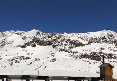
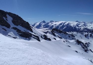
Balade / Randonnée avec des vues magnifiques sur la Meije, les Écrins, le massif des Grandes Rousses.
TINÉRAIRE
Au départ de Auris Station, commencer direction Col de Cluy via le sentier 312. Au Col de Cluy, longer le tour du Signal de L'homme sur le sentier 253 vers Col de Maronne.
Au Col de Maronne, retour Auris Station sur le sentier 301.
A VOIR SUR LE PARCOURS
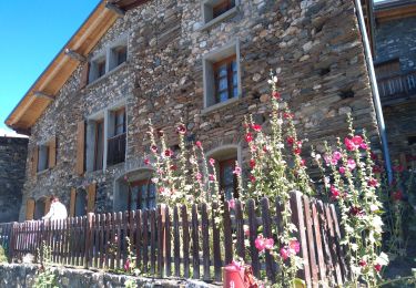
Vous croiserez sur le chemin, la chapelle St Géraud et la chapelle St Ilpice.
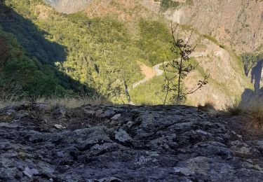
Le point de vue sur le parc national des Écrins et les glaciers de la Meije
A VOIR, A FAIRE À PROXIMITÉ
Partez à la découverte des alpages, saison tissée de moments rares et précieux, qui invitent le voyageur à s'immerger dans la culture montagnarde, à s'émerveiller des paysages et à appréhender la vie en alpages avec les bergers, les éleveurs et leurs troupeaux.
A SAVOIR
La chapelle St Géraud, se trouve sur le début de la balade (312). L'histoire raconte que le compte Géraud d'Aurillac serait passé par Auris, lors d'un de ses nombreux pèlerinages à Rome.
Cette chapelle (qui date de l'an 890) aurait été édifiée à l'endroit même, où il aurait trouvé la mort.
Les chiens doivent être obligatoirement tenus en laisse en raison de la présence des chiens de troupeaux à certaines périodes de l'année.
Ort
Kommentare
Touren in der Umgebung
![Tour Skiwanderen Huez - Pic de la Pyramide. - Photo](https://media.geolcdn.com/t/375/260/d8f02114-cc43-41f4-8fcf-228e99c4af6c.jpg&format=jpg&maxdim=2)
![Skiwanderen Skiwanderen](https://static1.geolcdn.com/sitytour/trail-icons/503.png)
Skiwanderen
![](/images/other/stat-length.png)
![](https://static1.geolcdn.com/siteimages/upload/files/16400158638029165_repeat_loop_refresh_sync_direction_icon.png)
![Tour Skiwanderen Huez - Pic blanc par le tunnel - Photo](https://media.geolcdn.com/t/375/260/79c86d8d-1a1a-42e0-965d-518affa465c7.jpg&format=jpg&maxdim=2)
![Skiwanderen Skiwanderen](https://static1.geolcdn.com/sitytour/trail-icons/503.png)
Skiwanderen
![](/images/other/stat-length.png)
![](https://static1.geolcdn.com/siteimages/upload/files/16400158638029165_repeat_loop_refresh_sync_direction_icon.png)
![Tour Wandern Le Bourg-d'Oisans - 38 BG d Oisans cascade pisse - Photo](https://media.geolcdn.com/t/375/260/2e81579a-11c0-4302-b399-8bc55cc0dd5f.jpg&format=jpg&maxdim=2)
![Wandern Wandern](https://static1.geolcdn.com/sitytour/trail-icons/101.png)
Wandern
![](/images/other/stat-length.png)
![](https://static1.geolcdn.com/siteimages/upload/files/16400158638029165_repeat_loop_refresh_sync_direction_icon.png)
![Tour Skiwanderen Le Freney-d'Oisans - pic blanc - Photo](https://media.geolcdn.com/t/375/260/4389279f-2a15-49e6-bc1c-70bf2118c5f4.jpg&format=jpg&maxdim=2)
![Skiwanderen Skiwanderen](https://static1.geolcdn.com/sitytour/trail-icons/503.png)
Skiwanderen
![](/images/other/stat-length.png)
![](https://static1.geolcdn.com/siteimages/upload/files/16400158638029165_repeat_loop_refresh_sync_direction_icon.png)
![Tour Wandern Le Bourg-d'Oisans - Lac de Buclet et cascade de la Pisse - Photo](https://media.geolcdn.com/t/375/260/7920e5ce-d45f-4ce3-8489-7c3261ef3795.jpg&format=jpg&maxdim=2)
![Wandern Wandern](https://static1.geolcdn.com/sitytour/trail-icons/101.png)
Wandern
![](/images/other/stat-length.png)
![](https://static1.geolcdn.com/siteimages/upload/files/16400158638029165_repeat_loop_refresh_sync_direction_icon.png)
![Tour Elektrofahrrad Les Deux Alpes - plateau d'Emparis - Photo](https://media.geolcdn.com/t/375/260/e0e5c364-faf9-450f-8107-1f1f65fd8d5d.jpg&format=jpg&maxdim=2)
![Elektrofahrrad Elektrofahrrad](https://static1.geolcdn.com/sitytour/trail-icons/205.png)
Elektrofahrrad
![](/images/other/stat-length.png)
![](https://static1.geolcdn.com/siteimages/upload/files/16400158638029165_repeat_loop_refresh_sync_direction_icon.png)
![Tour Wandern Les Deux Alpes - Bons porte romaine - Photo](https://media.geolcdn.com/t/375/260/e953dd9b-92c2-4085-b1ca-d9ed03ffa9de.jpg&format=jpg&maxdim=2)
![Wandern Wandern](https://static1.geolcdn.com/sitytour/trail-icons/101.png)
Wandern
![](/images/other/stat-length.png)
![](https://static1.geolcdn.com/siteimages/upload/files/16400158638029165_repeat_loop_refresh_sync_direction_icon.png)
![Tour Skiwanderen Auris - 220123 les Buffes - Photo](https://media.geolcdn.com/t/375/260/1f219626-40f4-4df5-bc13-28244765ba6f.jpg&format=jpg&maxdim=2)
![Skiwanderen Skiwanderen](https://static1.geolcdn.com/sitytour/trail-icons/503.png)
Skiwanderen
![](/images/other/stat-length.png)
![](https://static1.geolcdn.com/siteimages/upload/files/16400158638029165_repeat_loop_refresh_sync_direction_icon.png)
![Tour Skiwanderen Les Deux Alpes - 220122 Fioc. 2 alpes - Photo](https://media.geolcdn.com/t/375/260/dd038ef8-b25c-40e5-a3b6-422f02e40feb.jpg&format=jpg&maxdim=2)
![Skiwanderen Skiwanderen](https://static1.geolcdn.com/sitytour/trail-icons/503.png)
Skiwanderen
![](/images/other/stat-length.png)
![](https://static1.geolcdn.com/siteimages/upload/files/16400158638029165_repeat_loop_refresh_sync_direction_icon.png)