![](/images/other/stat-length.png)
![Tour Wandern Allemond - Les Chalanches - Allemont - Photo](https://media.geolcdn.com/t/1900/400/544271fc-ea3c-4bf1-b1da-fbe1b1456b85.jpg&format=pjpeg&maxdim=2)
Les Chalanches - Allemont
patjobou
Benutzer
![Länge](/images/other/stat-length.png)
![Maximale Höhe](https://static1.geolcdn.com/siteimages/upload/files/1508320355ic_sort_altitude_max_24dp.png)
![Positive Höhendifferenz](https://static1.geolcdn.com/siteimages/upload/files/1508320355ic_sort_den_pos_24dp.png)
![Km-Effort](/images/other/stat-length.png)
![Min. Höhe](https://static1.geolcdn.com/siteimages/upload/files/1508320355ic_sort_altitude_min_24dp.png)
![Negative Höhendifferenz](https://static1.geolcdn.com/siteimages/upload/files/1508320355ic_sort_den_neg_24dp.png)
![Boucle](https://static1.geolcdn.com/siteimages/upload/files/16400158638029165_repeat_loop_refresh_sync_direction_icon.png)
![Wandern](https://static1.geolcdn.com/sitytour/trail-icons/101.png)
5h25
Schwierigkeit : Medium
![Scannen Sie diesen QR-Code, um die Tour in der SityTrail-Anwendung zu öffnen](https://capi.geolives.com/qq0zvz2zws4bq2lad0pu/sitytour/trails/2821836/qr.png?size=200)
Kostenlosegpshiking-Anwendung
Über SityTrail
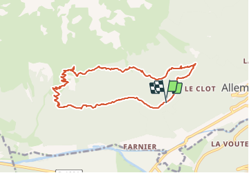
Tour Wandern von 10,1 km verfügbar auf Auvergne-Rhone-Alpen, Isère, Allemond. Diese Tour wird von patjobou vorgeschlagen.
Beschreibung
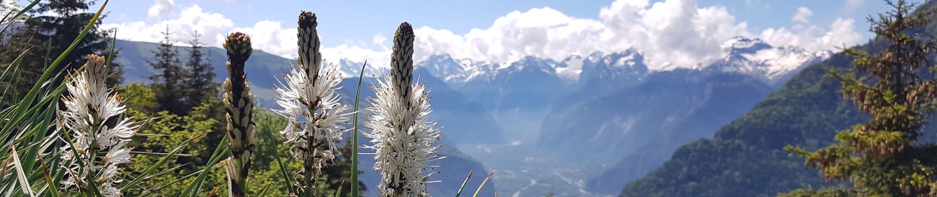
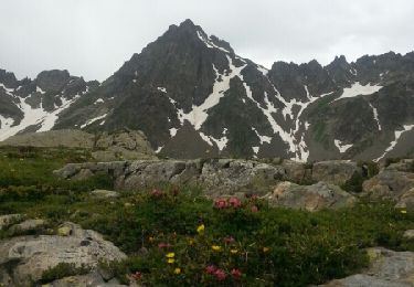
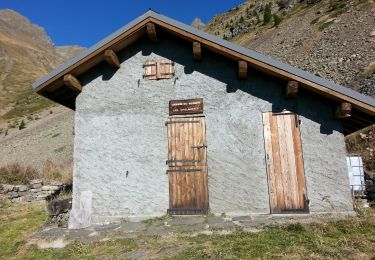
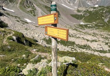
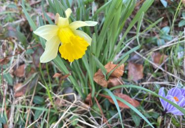
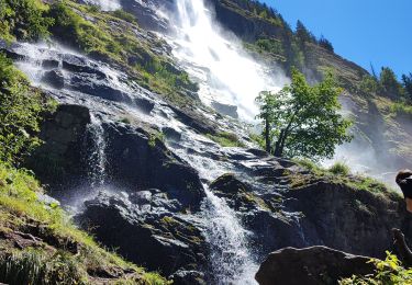
Une belle boucle avec des paysages variés. Montée dans une belle foret de feuillus puis parmi les asphodèles en fleurs! Repas à la cabane des Chalanches, avec de très belles vue sur la vallée de La Romanche, l'Oisans, et les Grandes Rousses. Un petit détour au dessus de la cabane permet de trouver l'entrée d'une ancienne mine. Belle descente en balcon, avec quelques traversées de ravins qui engagent à la prudence. Le sentier est toujours bien tracé.
Ort
Kommentare
Touren in der Umgebung
![Tour Wandern Allemond - Lac de Belledonne - Photo](https://media.geolcdn.com/t/375/260/ext.jpg?maxdim=2&url=https%3A%2F%2Fservices.sitytrail.com%2FGeolivesWS%2FDownloadMedia.ashx%3FTrailID%3D325958%26Media%3Dfix__20140719114309.jpg)
![Wandern Wandern](https://static1.geolcdn.com/sitytour/trail-icons/101.png)
Wandern
![](/images/other/stat-length.png)
![](https://static1.geolcdn.com/siteimages/upload/files/16400158638029165_repeat_loop_refresh_sync_direction_icon.png)
![Tour Wandern Allemond - allemond-les chalanches - Photo](https://media.geolcdn.com/t/375/260/ext.jpg?maxdim=2&url=https%3A%2F%2Fservices.sitytrail.com%2FGeolivesWS%2FDownloadMedia.ashx%3FTrailID%3D359050%26Media%3Dfix__20141101111257.jpg)
![Wandern Wandern](https://static1.geolcdn.com/sitytour/trail-icons/101.png)
Wandern
![](/images/other/stat-length.png)
![](https://static1.geolcdn.com/siteimages/upload/files/16400158638029165_repeat_loop_refresh_sync_direction_icon.png)
![Tour Skiwanderen Huez - Pic de la Pyramide. - Photo](https://media.geolcdn.com/t/375/260/d8f02114-cc43-41f4-8fcf-228e99c4af6c.jpg&format=jpg&maxdim=2)
![Skiwanderen Skiwanderen](https://static1.geolcdn.com/sitytour/trail-icons/503.png)
Skiwanderen
![](/images/other/stat-length.png)
![](https://static1.geolcdn.com/siteimages/upload/files/16400158638029165_repeat_loop_refresh_sync_direction_icon.png)
![Tour Skiwanderen Huez - Pic blanc par le tunnel - Photo](https://media.geolcdn.com/t/375/260/79c86d8d-1a1a-42e0-965d-518affa465c7.jpg&format=jpg&maxdim=2)
![Skiwanderen Skiwanderen](https://static1.geolcdn.com/sitytour/trail-icons/503.png)
Skiwanderen
![](/images/other/stat-length.png)
![](https://static1.geolcdn.com/siteimages/upload/files/16400158638029165_repeat_loop_refresh_sync_direction_icon.png)
![Tour Skiwanderen Allemond - col PT 2459m près de la gde Lance d'Allemond - Photo](https://media.geolcdn.com/t/375/260/9c8ab575-4333-48a0-9046-13f36910fc12.jpg&format=jpg&maxdim=2)
![Skiwanderen Skiwanderen](https://static1.geolcdn.com/sitytour/trail-icons/503.png)
Skiwanderen
![](/images/other/stat-length.png)
![](https://static1.geolcdn.com/siteimages/upload/files/16400158638029165_repeat_loop_refresh_sync_direction_icon.png)
![Tour sport Vaujany - Randonnée - Photo](https://media.geolcdn.com/t/375/260/031a3bee-458a-4b9a-b2e3-d9cf5829f63e.jpg&format=jpg&maxdim=2)
sport
![](/images/other/stat-length.png)
![](https://static1.geolcdn.com/siteimages/upload/files/16400158638029165_repeat_loop_refresh_sync_direction_icon.png)
![Tour Wandern Allemond - Lac de Belledonne trace réelle - Photo](https://media.geolcdn.com/t/375/260/3c006e55-5416-422b-8475-727a88b53584.jpg&format=jpg&maxdim=2)
![Wandern Wandern](https://static1.geolcdn.com/sitytour/trail-icons/101.png)
Wandern
![](/images/other/stat-length.png)
![](https://static1.geolcdn.com/siteimages/upload/files/16400158638029165_repeat_loop_refresh_sync_direction_icon.png)
![Tour sport Allemond - Allemond et les hameaux - Photo](https://media.geolcdn.com/t/375/260/9ef2955e-597c-4a93-b262-e89ce8d66961.jpg&format=jpg&maxdim=2)
sport
![](/images/other/stat-length.png)
![](https://static1.geolcdn.com/siteimages/upload/files/16400158638029165_repeat_loop_refresh_sync_direction_icon.png)
![Tour Wandern Oz - Oz en Oisans Cascade de La Fare - Photo](https://media.geolcdn.com/t/375/260/cedc7fb5-b126-433c-84a3-6190c51b3527.jpg&format=jpg&maxdim=2)
![Wandern Wandern](https://static1.geolcdn.com/sitytour/trail-icons/101.png)
Wandern
![](/images/other/stat-length.png)
![](https://static1.geolcdn.com/siteimages/upload/files/16400158638029165_repeat_loop_refresh_sync_direction_icon.png)