![](/images/other/stat-length.png)
![Tour Laufen Kolmar - Boucle Dachsbulh Colmar Course - Photo](https://media.geolcdn.com/t/1900/400/ext.pjpeg?maxdim=2&url=https%3A%2F%2Fmedia.geolcdn.com%2Ff%2F6aa33e0b-f76d-4fe7-bcd9-22d6766b2e29.jpg)
Boucle Dachsbulh Colmar Course
zazie
Benutzer
![Länge](/images/other/stat-length.png)
Länge
11 km
![Maximale Höhe](https://static1.geolcdn.com/siteimages/upload/files/1508320355ic_sort_altitude_max_24dp.png)
Maximale Höhe
201 m
![Positive Höhendifferenz](https://static1.geolcdn.com/siteimages/upload/files/1508320355ic_sort_den_pos_24dp.png)
Positive Höhendifferenz
87 m
![Km-Effort](/images/other/stat-length.png)
Km-Effort
12,1 km
![Min. Höhe](https://static1.geolcdn.com/siteimages/upload/files/1508320355ic_sort_altitude_min_24dp.png)
Min. Höhe
183 m
![Negative Höhendifferenz](https://static1.geolcdn.com/siteimages/upload/files/1508320355ic_sort_den_neg_24dp.png)
Negative Höhendifferenz
90 m
![Boucle](https://static1.geolcdn.com/siteimages/upload/files/16400158638029165_repeat_loop_refresh_sync_direction_icon.png)
Boucle
Ja
Erstellungsdatum :
2021-05-02 07:17:38.977
Letzte Änderung :
2021-05-02 08:29:01.235
![Laufen](https://static1.geolcdn.com/sitytour/trail-icons/103.png)
1h01
Schwierigkeit : Sehr leicht
![Scannen Sie diesen QR-Code, um die Tour in der SityTrail-Anwendung zu öffnen](https://capi.geolives.com/qq0zvz2zws4bq2lad0pu/sitytour/trails/2769705/qr.png?size=200)
Kostenlosegpshiking-Anwendung
Über SityTrail
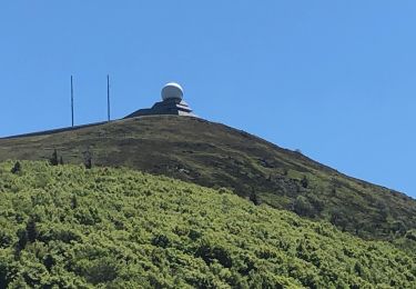
Tour Laufen von 11 km verfügbar auf Großer Osten, Oberelsass, Kolmar. Diese Tour wird von zazie vorgeschlagen.
Beschreibung
Circuit pour course, traversée de routes et le long de l'autoroute, donc avec des 🎧, c'est supportable.
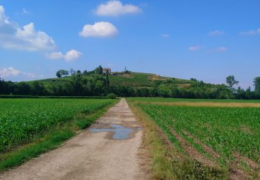
Parcours varié en sous nous lignes droites petites pentes.
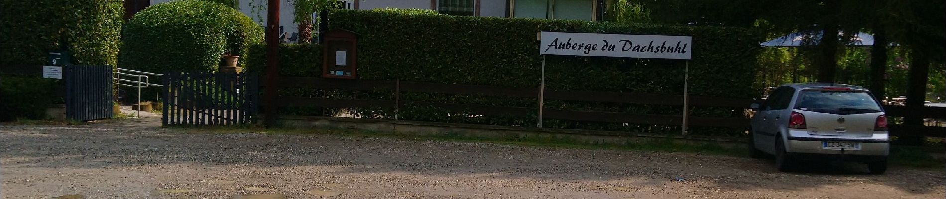
Ne pas hésiter à réserver à l'auberge, cuisine très bonne et terrasse agréable.
Ort
Land:
France
Region :
Großer Osten
Abteilung/Provinz :
Oberelsass
Kommune :
Kolmar
Standort:
Unknown
Gehen Sie:(Dec)
Gehen Sie:(UTM)
379299 ; 5324183 (32U) N.
Kommentare
Touren in der Umgebung
![Tour Laufen Kolmar - Covid-19 - A la recherche du cercle parfait - Photo](https://media.geolcdn.com/t/375/260/ext.jpg?maxdim=2&url=https%3A%2F%2Fstatic1.geolcdn.com%2Fsiteimages%2Fupload%2Ffiles%2F1524743154running.jpg)
![Laufen Laufen](https://static1.geolcdn.com/sitytour/trail-icons/103.png)
Covid-19 - A la recherche du cercle parfait
Laufen
Sehr leicht
(1)
Kolmar,
Großer Osten,
Oberelsass,
France
![](/images/other/stat-length.png)
11,2 km | 11,9 km-effort
1h 0min
![](https://static1.geolcdn.com/siteimages/upload/files/16400158638029165_repeat_loop_refresh_sync_direction_icon.png)
Ja
![Tour Wandern Kolmar - grand tour de Colmar - Photo](https://media.geolcdn.com/t/375/260/ext.jpg?maxdim=2&url=https%3A%2F%2Fstatic1.geolcdn.com%2Fsiteimages%2Fupload%2Ffiles%2F1553511878bg_sport_marche.png)
![Wandern Wandern](https://static1.geolcdn.com/sitytour/trail-icons/101.png)
grand tour de Colmar
Wandern
Sehr leicht
(1)
Kolmar,
Großer Osten,
Oberelsass,
France
![](/images/other/stat-length.png)
4,7 km | 5,1 km-effort
1h 22min
![](https://static1.geolcdn.com/siteimages/upload/files/16400158638029165_repeat_loop_refresh_sync_direction_icon.png)
Ja
![Tour Wandern Kolmar - Colmar petite Venise - Photo](https://media.geolcdn.com/t/375/260/ext.jpg?maxdim=2&url=https%3A%2F%2Fmedia.geolcdn.com%2Ff%2Fcb1a55ed-d7ca-476a-8a88-d48c10da04cb.jpg)
![Wandern Wandern](https://static1.geolcdn.com/sitytour/trail-icons/101.png)
Colmar petite Venise
Wandern
Kolmar,
Großer Osten,
Oberelsass,
France
![](/images/other/stat-length.png)
9,3 km | 10,1 km-effort
3h 16min
![](https://static1.geolcdn.com/siteimages/upload/files/16400158638029165_repeat_loop_refresh_sync_direction_icon.png)
Ja
![Tour Wandern Kolmar - balade découverte de Colmar - Photo](https://media.geolcdn.com/t/375/260/ext.jpg?maxdim=2&url=https%3A%2F%2Fmedia.geolcdn.com%2Ff%2Fa090b411-e5c3-4f8a-96a5-5454a29ca881.jpg)
![Wandern Wandern](https://static1.geolcdn.com/sitytour/trail-icons/101.png)
balade découverte de Colmar
Wandern
Sehr leicht
Kolmar,
Großer Osten,
Oberelsass,
France
![](/images/other/stat-length.png)
6,4 km | 7 km-effort
2h 50min
![](https://static1.geolcdn.com/siteimages/upload/files/16400158638029165_repeat_loop_refresh_sync_direction_icon.png)
Ja
![Tour Mountainbike Andolsheim - VTT 15/11/22 effectuée - Photo](https://media.geolcdn.com/t/375/260/ext.jpg?maxdim=2&url=https%3A%2F%2Fstatic1.geolcdn.com%2Fsiteimages%2Fupload%2Ffiles%2F1524743154velo.jpg)
![Mountainbike Mountainbike](https://static1.geolcdn.com/sitytour/trail-icons/202.png)
VTT 15/11/22 effectuée
Mountainbike
Einfach
(1)
Andolsheim,
Großer Osten,
Oberelsass,
France
![](/images/other/stat-length.png)
11,6 km | 12,5 km-effort
1h 26min
![](https://static1.geolcdn.com/siteimages/upload/files/16400158638029165_repeat_loop_refresh_sync_direction_icon.png)
Nein
![Tour Wandern Kolmar - Sur un parcours d'une course d'orientation - Photo](https://media.geolcdn.com/t/375/260/ext.jpg?maxdim=2&url=https%3A%2F%2Fmedia.geolcdn.com%2Ff%2Fc8a73b1e-1924-4d74-bfc8-611dd53e5910.jpg)
![Wandern Wandern](https://static1.geolcdn.com/sitytour/trail-icons/101.png)
Sur un parcours d'une course d'orientation
Wandern
Sehr leicht
Kolmar,
Großer Osten,
Oberelsass,
France
![](/images/other/stat-length.png)
4,6 km | 5 km-effort
51min
![](https://static1.geolcdn.com/siteimages/upload/files/16400158638029165_repeat_loop_refresh_sync_direction_icon.png)
Nein
![Tour Hybrid-Bike Kolmar - Vélo randonnée Colmar Guebwiller - Photo](https://media.geolcdn.com/t/375/260/ext.jpg?maxdim=2&url=https%3A%2F%2Fmedia.geolcdn.com%2Ff%2F6cf00bf4-257c-4f82-9b53-86096a3e95e9.jpg)
![Hybrid-Bike Hybrid-Bike](https://static1.geolcdn.com/sitytour/trail-icons/203.png)
Vélo randonnée Colmar Guebwiller
Hybrid-Bike
Einfach
Kolmar,
Großer Osten,
Oberelsass,
France
![](/images/other/stat-length.png)
59 km | 64 km-effort
3h 29min
![](https://static1.geolcdn.com/siteimages/upload/files/16400158638029165_repeat_loop_refresh_sync_direction_icon.png)
Ja
![Tour Zu Fuß Kolmar - Colmar centre Enseignes - Photo](https://media.geolcdn.com/t/375/260/ext.jpg?maxdim=2&url=https%3A%2F%2Fmedia.geolcdn.com%2Ff%2F0d055925-366a-4988-8b7d-8363ed26e27b.JPG)
![Zu Fuß Zu Fuß](https://static1.geolcdn.com/sitytour/trail-icons/100.png)
Colmar centre Enseignes
Zu Fuß
Einfach
Kolmar,
Großer Osten,
Oberelsass,
France
![](/images/other/stat-length.png)
4,8 km | 5,2 km-effort
Unbekannt
![](https://static1.geolcdn.com/siteimages/upload/files/16400158638029165_repeat_loop_refresh_sync_direction_icon.png)
Ja
![Tour Wandern Kolmar - Willer sur Thur - Grand Ballon- Willer sur Thur - Photo](https://media.geolcdn.com/t/375/260/ext.jpg?maxdim=2&url=https%3A%2F%2Fmedia.geolcdn.com%2Ff%2Fc1b49f34-58de-40fa-a641-c3caa279b53a.jpg)
![Wandern Wandern](https://static1.geolcdn.com/sitytour/trail-icons/101.png)
Willer sur Thur - Grand Ballon- Willer sur Thur
Wandern
Schwierig
Kolmar,
Großer Osten,
Oberelsass,
France
![](/images/other/stat-length.png)
51 km | 0 m-effort
5h 34min
![](https://static1.geolcdn.com/siteimages/upload/files/16400158638029165_repeat_loop_refresh_sync_direction_icon.png)
Nein