19,5 km | 22 km-effort
montnoel echelle 12km
coglais
Benutzer
Länge
12,4 km
Maximale Höhe
168 m
Positive Höhendifferenz
159 m
Km-Effort
14,5 km
Min. Höhe
118 m
Negative Höhendifferenz
163 m
Boucle
Ja
Erstellungsdatum :
2019-06-04 07:17:47.881
Letzte Änderung :
2021-04-28 10:41:20.657
2h26
Schwierigkeit : Einfach
Kostenlosegpshiking-Anwendung
Über SityTrail
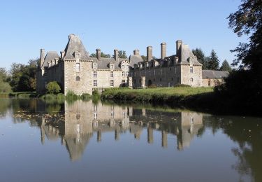
Tour Nordic Walking von 12,4 km verfügbar auf Bretagne, Ille-et-Vilaine, Les Portes du Coglais. Diese Tour wird von coglais vorgeschlagen.
Ort
Land:
France
Region :
Bretagne
Abteilung/Provinz :
Ille-et-Vilaine
Kommune :
Les Portes du Coglais
Standort:
Unknown
Gehen Sie:(Dec)
Gehen Sie:(UTM)
625174 ; 5367039 (30U) N.
Kommentare
Touren in der Umgebung
A l'Orée de Gâtines
Zu Fuß
Medium
Les Portes du Coglais,
Bretagne,
Ille-et-Vilaine,
France
5h 2min
Ja
Le Chatellier - le cirque du Diable
Zu Fuß
Einfach
Le Châtellier,
Bretagne,
Ille-et-Vilaine,
France
5,9 km | 7,1 km-effort
1h 37min
Ja
Saint-Brice-en-Coglès / la marche des châteax
Wandern
Einfach
(1)
Maen-Roch,
Bretagne,
Ille-et-Vilaine,
France
10,8 km | 12,3 km-effort
2h 41min
Ja
GR_37_AE_19_Chatellier_Fougeres_20210618
Wandern
Einfach
Le Châtellier,
Bretagne,
Ille-et-Vilaine,
France
19 km | 23 km-effort
4h 58min
Nein
GR_37_AD_18_Maen-Roch_Chatellier_20210617
Wandern
Einfach
Maen-Roch,
Bretagne,
Ille-et-Vilaine,
France
17,8 km | 21 km-effort
4h 31min
Nein
montours pontbesnard chênesec11km
Nordic Walking
Medium
(1)
Les Portes du Coglais,
Bretagne,
Ille-et-Vilaine,
France
11,3 km | 13,1 km-effort
2h 30min
Ja
Montours talvassais 7,5km
Nordic Walking
Medium
(1)
Les Portes du Coglais,
Bretagne,
Ille-et-Vilaine,
France
7,6 km | 8,8 km-effort
2h 0min
Ja
Le Châtellier Péroussel
Nordic Walking
Einfach
Le Châtellier,
Bretagne,
Ille-et-Vilaine,
France
11,4 km | 14 km-effort
2h 17min
Ja
Coglais 2015 Boucle 1b
Nordic Walking
Einfach
Le Châtellier,
Bretagne,
Ille-et-Vilaine,
France
13,7 km | 17,1 km-effort
2h 44min
Ja