![](/images/other/stat-length.png)
![Tour Wandern Rogéville - ROGEVILLE - LA PETITE SUISSE PAR MAMEY ET GEZONCOURT - Photo](https://media.geolcdn.com/t/1900/400/9da3ecdf-5552-45ce-a8e5-2bd94b8442b6.jpg&format=pjpeg&maxdim=2)
ROGEVILLE - LA PETITE SUISSE PAR MAMEY ET GEZONCOURT
jean-marie.parachini
Benutzer
![Länge](/images/other/stat-length.png)
Länge
23 km
![Maximale Höhe](https://static1.geolcdn.com/siteimages/upload/files/1508320355ic_sort_altitude_max_24dp.png)
Maximale Höhe
342 m
![Positive Höhendifferenz](https://static1.geolcdn.com/siteimages/upload/files/1508320355ic_sort_den_pos_24dp.png)
Positive Höhendifferenz
464 m
![Km-Effort](/images/other/stat-length.png)
Km-Effort
29 km
![Min. Höhe](https://static1.geolcdn.com/siteimages/upload/files/1508320355ic_sort_altitude_min_24dp.png)
Min. Höhe
206 m
![Negative Höhendifferenz](https://static1.geolcdn.com/siteimages/upload/files/1508320355ic_sort_den_neg_24dp.png)
Negative Höhendifferenz
463 m
![Boucle](https://static1.geolcdn.com/siteimages/upload/files/16400158638029165_repeat_loop_refresh_sync_direction_icon.png)
Boucle
Ja
Erstellungsdatum :
2021-04-22 06:38:12.213
Letzte Änderung :
2021-04-22 15:35:37.38
![Wandern](https://static1.geolcdn.com/sitytour/trail-icons/101.png)
7h53
Schwierigkeit : Medium
![Scannen Sie diesen QR-Code, um die Tour in der SityTrail-Anwendung zu öffnen](https://capi.geolives.com/qq0zvz2zws4bq2lad0pu/sitytour/trails/2757728/qr.png?size=200)
Kostenlosegpshiking-Anwendung
Über SityTrail
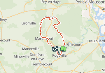
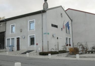
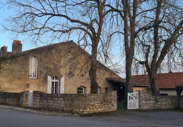
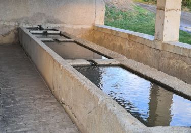
Tour Wandern von 23 km verfügbar auf Großer Osten, Mörthe und Mosel, Rogéville. Diese Tour wird von jean-marie.parachini vorgeschlagen.
Beschreibung
randonnée à travers la Petite Suisse par les forêts de Rogeville Mamey et Gezoncourt.
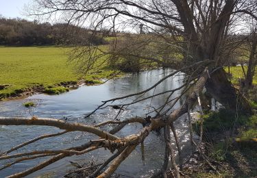
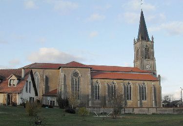
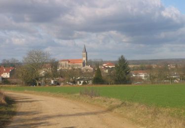
Ort
Land:
France
Region :
Großer Osten
Abteilung/Provinz :
Mörthe und Mosel
Kommune :
Rogéville
Standort:
Unknown
Gehen Sie:(Dec)
Gehen Sie:(UTM)
718802 ; 5411697 (31U) N.
Kommentare
Touren in der Umgebung
![Tour Wandern Gézoncourt - GEZONCOURT - PETITE SUISSE LORRAINE - Photo](https://media.geolcdn.com/t/375/260/0c868cf4-7521-4b69-b2f6-03625391f5f0.jpg&format=jpg&maxdim=2)
![Wandern Wandern](https://static1.geolcdn.com/sitytour/trail-icons/101.png)
GEZONCOURT - PETITE SUISSE LORRAINE
Wandern
Sehr leicht
Gézoncourt,
Großer Osten,
Mörthe und Mosel,
France
![](/images/other/stat-length.png)
8,5 km | 10,3 km-effort
5h 9min
![](https://static1.geolcdn.com/siteimages/upload/files/16400158638029165_repeat_loop_refresh_sync_direction_icon.png)
Ja
![Tour Pferd Saizerais - Le Bois St Ignon - Saizerais - Photo](https://media.geolcdn.com/t/375/260/ext.jpg?maxdim=2&url=https%3A%2F%2Fservices.sitytrail.com%2FGeolivesWS%2FDownloadMedia.ashx%3FTrailID%3D317068%26Media%3D16213_6.jpg)
![Pferd Pferd](https://static1.geolcdn.com/sitytour/trail-icons/300.png)
Le Bois St Ignon - Saizerais
Pferd
Einfach
Saizerais,
Großer Osten,
Mörthe und Mosel,
France
![](/images/other/stat-length.png)
6,9 km | 8 km-effort
1h 15min
![](https://static1.geolcdn.com/siteimages/upload/files/16400158638029165_repeat_loop_refresh_sync_direction_icon.png)
Ja
![Tour Mountainbike Saizerais - Le Bois St Ignon - Saizerais - Photo](https://media.geolcdn.com/t/375/260/ext.jpg?maxdim=2&url=https%3A%2F%2Fservices.sitytrail.com%2FGeolivesWS%2FDownloadMedia.ashx%3FTrailID%3D317067%26Media%3D16213_6.jpg)
![Mountainbike Mountainbike](https://static1.geolcdn.com/sitytour/trail-icons/202.png)
Le Bois St Ignon - Saizerais
Mountainbike
Einfach
Saizerais,
Großer Osten,
Mörthe und Mosel,
France
![](/images/other/stat-length.png)
6,9 km | 8 km-effort
45min
![](https://static1.geolcdn.com/siteimages/upload/files/16400158638029165_repeat_loop_refresh_sync_direction_icon.png)
Ja
![Tour Wandern Saizerais - Le Bois St Ignon - Saizerais - Photo](https://media.geolcdn.com/t/375/260/ext.jpg?maxdim=2&url=https%3A%2F%2Fservices.sitytrail.com%2FGeolivesWS%2FDownloadMedia.ashx%3FTrailID%3D317066%26Media%3D16213_6.jpg)
![Wandern Wandern](https://static1.geolcdn.com/sitytour/trail-icons/101.png)
Le Bois St Ignon - Saizerais
Wandern
Einfach
Saizerais,
Großer Osten,
Mörthe und Mosel,
France
![](/images/other/stat-length.png)
6,9 km | 8 km-effort
1h 45min
![](https://static1.geolcdn.com/siteimages/upload/files/16400158638029165_repeat_loop_refresh_sync_direction_icon.png)
Ja
![Tour Pferd Saizerais - La Cense St Paul - Saizerais - Photo](https://media.geolcdn.com/t/375/260/ext.jpg?maxdim=2&url=https%3A%2F%2Fservices.sitytrail.com%2FGeolivesWS%2FDownloadMedia.ashx%3FTrailID%3D317065%26Media%3D16212_6.jpg)
![Pferd Pferd](https://static1.geolcdn.com/sitytour/trail-icons/300.png)
La Cense St Paul - Saizerais
Pferd
Einfach
Saizerais,
Großer Osten,
Mörthe und Mosel,
France
![](/images/other/stat-length.png)
6,2 km | 7,1 km-effort
1h 0min
![](https://static1.geolcdn.com/siteimages/upload/files/16400158638029165_repeat_loop_refresh_sync_direction_icon.png)
Ja
![Tour Mountainbike Saizerais - La Cense St Paul - Saizerais - Photo](https://media.geolcdn.com/t/375/260/ext.jpg?maxdim=2&url=https%3A%2F%2Fservices.sitytrail.com%2FGeolivesWS%2FDownloadMedia.ashx%3FTrailID%3D317064%26Media%3D16212_6.jpg)
![Mountainbike Mountainbike](https://static1.geolcdn.com/sitytour/trail-icons/202.png)
La Cense St Paul - Saizerais
Mountainbike
Einfach
Saizerais,
Großer Osten,
Mörthe und Mosel,
France
![](/images/other/stat-length.png)
6,2 km | 7,1 km-effort
30min
![](https://static1.geolcdn.com/siteimages/upload/files/16400158638029165_repeat_loop_refresh_sync_direction_icon.png)
Ja
![Tour Wandern Saizerais - La Cense St Paul - Saizerais - Photo](https://media.geolcdn.com/t/375/260/ext.jpg?maxdim=2&url=https%3A%2F%2Fservices.sitytrail.com%2FGeolivesWS%2FDownloadMedia.ashx%3FTrailID%3D317063%26Media%3D16212_1.jpg)
![Wandern Wandern](https://static1.geolcdn.com/sitytour/trail-icons/101.png)
La Cense St Paul - Saizerais
Wandern
Einfach
Saizerais,
Großer Osten,
Mörthe und Mosel,
France
![](/images/other/stat-length.png)
6,2 km | 7,1 km-effort
1h 30min
![](https://static1.geolcdn.com/siteimages/upload/files/16400158638029165_repeat_loop_refresh_sync_direction_icon.png)
Ja
![Tour Wandern Gézoncourt - gezoncourt - bois du haut pargé - Photo](https://media.geolcdn.com/t/375/260/5c10a1ac-f841-42cc-aef0-e6d6a7dc1474.jpg&format=jpg&maxdim=2)
![Wandern Wandern](https://static1.geolcdn.com/sitytour/trail-icons/101.png)
gezoncourt - bois du haut pargé
Wandern
Medium
Gézoncourt,
Großer Osten,
Mörthe und Mosel,
France
![](/images/other/stat-length.png)
11,7 km | 14,9 km-effort
3h 40min
![](https://static1.geolcdn.com/siteimages/upload/files/16400158638029165_repeat_loop_refresh_sync_direction_icon.png)
Ja
![Tour Wandern Gézoncourt - Gézoncourt - Photo](https://media.geolcdn.com/t/375/260/8bab5907-38c0-4975-9abe-ded1bb760e99.jpg&format=jpg&maxdim=2)
![Wandern Wandern](https://static1.geolcdn.com/sitytour/trail-icons/101.png)
Gézoncourt
Wandern
Einfach
Gézoncourt,
Großer Osten,
Mörthe und Mosel,
France
![](/images/other/stat-length.png)
10,2 km | 12,6 km-effort
2h 50min
![](https://static1.geolcdn.com/siteimages/upload/files/16400158638029165_repeat_loop_refresh_sync_direction_icon.png)
Ja