![](/images/other/stat-length.png)
![Tour Wandern Lepuix - la vallée de Beucinère et l'étang des belles filles - Photo](https://media.geolcdn.com/t/1900/400/720044ba-12ff-43be-a133-c229edae5b48.jpg&format=pjpeg&maxdim=2)
la vallée de Beucinère et l'étang des belles filles
margotte
Benutzer
![Länge](/images/other/stat-length.png)
![Maximale Höhe](https://static1.geolcdn.com/siteimages/upload/files/1508320355ic_sort_altitude_max_24dp.png)
![Positive Höhendifferenz](https://static1.geolcdn.com/siteimages/upload/files/1508320355ic_sort_den_pos_24dp.png)
![Km-Effort](/images/other/stat-length.png)
![Min. Höhe](https://static1.geolcdn.com/siteimages/upload/files/1508320355ic_sort_altitude_min_24dp.png)
![Negative Höhendifferenz](https://static1.geolcdn.com/siteimages/upload/files/1508320355ic_sort_den_neg_24dp.png)
![Boucle](https://static1.geolcdn.com/siteimages/upload/files/16400158638029165_repeat_loop_refresh_sync_direction_icon.png)
![Wandern](https://static1.geolcdn.com/sitytour/trail-icons/101.png)
2h52
Schwierigkeit : Medium
![Scannen Sie diesen QR-Code, um die Tour in der SityTrail-Anwendung zu öffnen](https://capi.geolives.com/qq0zvz2zws4bq2lad0pu/sitytour/trails/2757228/qr.png?size=200)
Kostenlosegpshiking-Anwendung
Über SityTrail
Tour Wandern von 12,4 km verfügbar auf Burgund und Freigrafschaft, Territoire-de-Belfort, Lepuix. Diese Tour wird von margotte vorgeschlagen.
Beschreibung
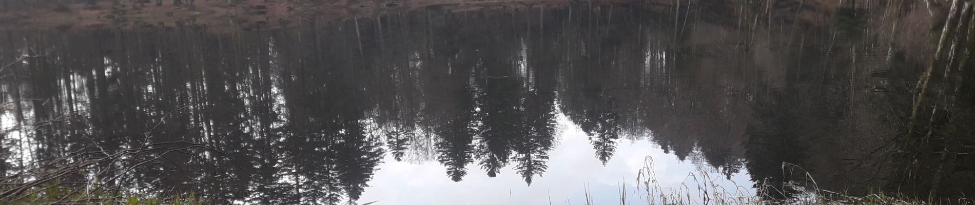
belle vallée à remonter. le haut du parcours n'etait pas très intéressant, vu les interditions de certains chemins pour la quiétude de la faune. On est obligé de faire des détours pas très agréable sur des gros chemins. Évitez la période 15 décembre au 14 juillet. L'absence de soleil arrivé à l'étang des belles filles n'a pas permis au lac de révéler ces couleurs.
Ort
Kommentare
Touren in der Umgebung
![Tour Wandern Oberassel - planche belles filles par auxelle haut - Photo](https://media.geolcdn.com/t/375/260/ext.jpg?maxdim=2&url=https%3A%2F%2Fservices.sitytrail.com%2FGeolivesWS%2FDownloadMedia.ashx%3FTrailID%3D305224%26Media%3D10d34718-818e-4b54-8a0e-bb1d508617db.JPG)
![Wandern Wandern](https://static1.geolcdn.com/sitytour/trail-icons/101.png)
Wandern
![](/images/other/stat-length.png)
![](https://static1.geolcdn.com/siteimages/upload/files/16400158638029165_repeat_loop_refresh_sync_direction_icon.png)
![Tour Wandern Lepuix - Le Tremontkopf - Photo](https://media.geolcdn.com/t/375/260/ext.jpg?maxdim=2&url=https%3A%2F%2Fservices.sitytrail.com%2FGeolivesWS%2FDownloadMedia.ashx%3FTrailID%3D109649%26Media%3D4290_1.jpg)
![Wandern Wandern](https://static1.geolcdn.com/sitytour/trail-icons/101.png)
Wandern
![](/images/other/stat-length.png)
![](https://static1.geolcdn.com/siteimages/upload/files/16400158638029165_repeat_loop_refresh_sync_direction_icon.png)
![Tour Wandern Plancher-les-Mines - Le Ballon de Servance - Photo](https://media.geolcdn.com/t/375/260/ext.jpg?maxdim=2&url=https%3A%2F%2Fservices.sitytrail.com%2FGeolivesWS%2FDownloadMedia.ashx%3FTrailID%3D109643%26Media%3D4284_1.jpg)
![Wandern Wandern](https://static1.geolcdn.com/sitytour/trail-icons/101.png)
Wandern
![](/images/other/stat-length.png)
![](https://static1.geolcdn.com/siteimages/upload/files/16400158638029165_repeat_loop_refresh_sync_direction_icon.png)
![Tour Wandern Plancher-les-Mines - 2025-01-04 Rando Polaire Dolleren Ballon Alsace Etape 3 - Photo](https://media.geolcdn.com/t/375/260/2540e417-a017-45ca-bf10-302bab8725fa.jpg&format=jpg&maxdim=2)
![Wandern Wandern](https://static1.geolcdn.com/sitytour/trail-icons/101.png)
Wandern
![](/images/other/stat-length.png)
![](https://static1.geolcdn.com/siteimages/upload/files/16400158638029165_repeat_loop_refresh_sync_direction_icon.png)
![Tour Wandern Plancher-les-Mines - 2019-08-07 Balade Plancher des belles filles - Photo](https://media.geolcdn.com/t/375/260/66a371f6-1837-4f48-9b52-0abd1c8fe413.jpg&format=jpg&maxdim=2)
![Wandern Wandern](https://static1.geolcdn.com/sitytour/trail-icons/101.png)
Wandern
![](/images/other/stat-length.png)
![](https://static1.geolcdn.com/siteimages/upload/files/16400158638029165_repeat_loop_refresh_sync_direction_icon.png)
![Tour Wandern Lepuix - ballon alsace saut de la truite - Photo](https://media.geolcdn.com/t/375/260/ext.jpg?maxdim=2&url=https%3A%2F%2Fservices.sitytrail.com%2FGeolivesWS%2FDownloadMedia.ashx%3FTrailID%3D40878%26Media%3Dimage6.jpg)
![Wandern Wandern](https://static1.geolcdn.com/sitytour/trail-icons/101.png)
Wandern
![](/images/other/stat-length.png)
![](https://static1.geolcdn.com/siteimages/upload/files/16400158638029165_repeat_loop_refresh_sync_direction_icon.png)
![Tour Wandern Lepuix - Malvaux - Ballon d'Alsace - La Gentiane - Photo](https://media.geolcdn.com/t/375/260/79578682-d0f3-4956-a014-9b78edebdf9a.jpg&format=jpg&maxdim=2)
![Wandern Wandern](https://static1.geolcdn.com/sitytour/trail-icons/101.png)
Wandern
![](/images/other/stat-length.png)
![](https://static1.geolcdn.com/siteimages/upload/files/16400158638029165_repeat_loop_refresh_sync_direction_icon.png)
![Tour Wandern Lepuix - Malvaux - Ballon d'Alsace (15/12 au 15/7) - Photo](https://media.geolcdn.com/t/375/260/8b5b8e46-b065-4d76-880f-ae90ac7502e3.jpg&format=jpg&maxdim=2)
![Wandern Wandern](https://static1.geolcdn.com/sitytour/trail-icons/101.png)
Wandern
![](/images/other/stat-length.png)
![](https://static1.geolcdn.com/siteimages/upload/files/16400158638029165_repeat_loop_refresh_sync_direction_icon.png)
![Tour Wandern Plancher-les-Mines - Plancher les mines - sentier des mines - croix du choléra - Planche des Belles Filles - sentier FFI - Mont Menard - Plancher les Mines - Photo](https://media.geolcdn.com/t/375/260/f7fa7cdf-da22-406f-8d96-8f9f07e4fd3d.jpg&format=jpg&maxdim=2)
![Wandern Wandern](https://static1.geolcdn.com/sitytour/trail-icons/101.png)
Wandern
![](/images/other/stat-length.png)
![](https://static1.geolcdn.com/siteimages/upload/files/16400158638029165_repeat_loop_refresh_sync_direction_icon.png)