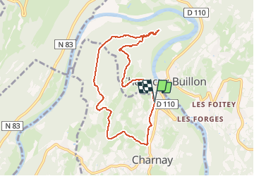
![](/images/other/stat-length.png)
![Tour Wandern Charnay - charnay - Photo](https://media.geolcdn.com/t/1900/400/3a0b88c5-1d96-4f44-a545-03b03b7ef47c.jpg&format=pjpeg&maxdim=2)
charnay
eltonnermou
Benutzer
![Länge](/images/other/stat-length.png)
![Maximale Höhe](https://static1.geolcdn.com/siteimages/upload/files/1508320355ic_sort_altitude_max_24dp.png)
![Positive Höhendifferenz](https://static1.geolcdn.com/siteimages/upload/files/1508320355ic_sort_den_pos_24dp.png)
![Km-Effort](/images/other/stat-length.png)
![Min. Höhe](https://static1.geolcdn.com/siteimages/upload/files/1508320355ic_sort_altitude_min_24dp.png)
![Negative Höhendifferenz](https://static1.geolcdn.com/siteimages/upload/files/1508320355ic_sort_den_neg_24dp.png)
![Boucle](https://static1.geolcdn.com/siteimages/upload/files/16400158638029165_repeat_loop_refresh_sync_direction_icon.png)
![Wandern](https://static1.geolcdn.com/sitytour/trail-icons/101.png)
2h29
Schwierigkeit : Sehr leicht
![Scannen Sie diesen QR-Code, um die Tour in der SityTrail-Anwendung zu öffnen](https://capi.geolives.com/qq0zvz2zws4bq2lad0pu/sitytour/trails/2753967/qr.png?size=200)
Kostenlosegpshiking-Anwendung
Über SityTrail
Tour Wandern von 8,1 km verfügbar auf Burgund und Freigrafschaft, Doubs, Charnay. Diese Tour wird von eltonnermou vorgeschlagen.
Beschreibung
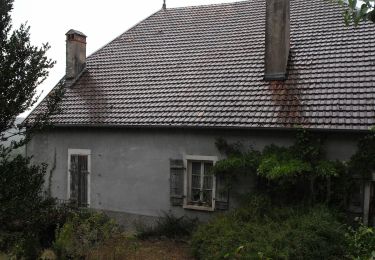
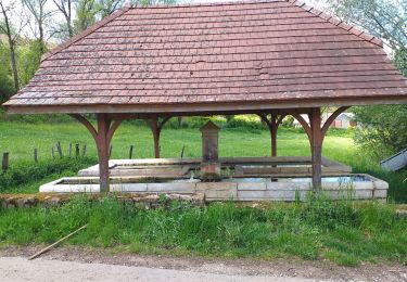
parking sur le bas côté de la rue ; randonnée en groupe
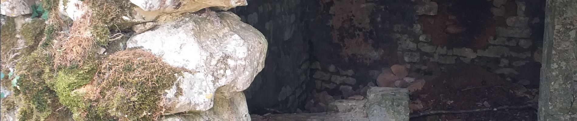
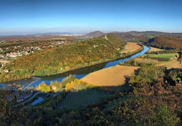
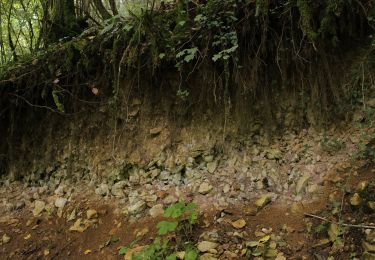
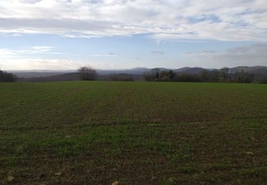
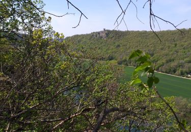
randonnée agréable à travers prairies et forêts qui à cette saison nous fait profiter de ses éclats de couleur. 2 petits raidillons à gravir mais rien de bien extraordinaire, pour une arrivée aux ruine du château de Charencey (au dessus de Chenecey Buillon).
Laissez vous surprendre par le passage d’un ou plusieurs chevreuils et dans les parties escarpées de voir des chamois.
Ort
Kommentare
Touren in der Umgebung
![Tour Zu Fuß Busy - Sentier de la Pierre de Vorges - Photo](https://media.geolcdn.com/t/375/260/6f249824-322a-4d94-8931-19d5b1d90e88.jpeg&format=jpg&maxdim=2)
![Zu Fuß Zu Fuß](https://static1.geolcdn.com/sitytour/trail-icons/100.png)
Zu Fuß
![](/images/other/stat-length.png)
![](https://static1.geolcdn.com/siteimages/upload/files/16400158638029165_repeat_loop_refresh_sync_direction_icon.png)
![Tour Zu Fuß Vorges-les-Pins - Sentier des Crêtes - Photo](https://media.geolcdn.com/t/375/260/11000138-aa02-48df-818f-23d3321a98ed.jpeg&format=jpg&maxdim=2)
![Zu Fuß Zu Fuß](https://static1.geolcdn.com/sitytour/trail-icons/100.png)
Zu Fuß
![](/images/other/stat-length.png)
![](https://static1.geolcdn.com/siteimages/upload/files/16400158638029165_repeat_loop_refresh_sync_direction_icon.png)
![Tour Zu Fuß Boussières - Sentier du Ruisseau - Photo](https://media.geolcdn.com/t/375/260/4b9f6489-2cea-48c8-a931-7d2d0fad9445.jpeg&format=jpg&maxdim=2)
![Zu Fuß Zu Fuß](https://static1.geolcdn.com/sitytour/trail-icons/100.png)
Zu Fuß
![](/images/other/stat-length.png)
![](https://static1.geolcdn.com/siteimages/upload/files/16400158638029165_repeat_loop_refresh_sync_direction_icon.png)
![Tour Zu Fuß Montferrand-le-Château - Sentier de Crête et Bois Rapin - Photo](https://media.geolcdn.com/t/375/260/c8b25516-529e-4f5c-85cb-5313429ddb47.jpeg&format=jpg&maxdim=2)
![Zu Fuß Zu Fuß](https://static1.geolcdn.com/sitytour/trail-icons/100.png)
Zu Fuß
![](/images/other/stat-length.png)
![](https://static1.geolcdn.com/siteimages/upload/files/16400158638029165_repeat_loop_refresh_sync_direction_icon.png)
![Tour Zu Fuß Thoraise - Sentier de Notre Dame du Mont - Photo](https://media.geolcdn.com/t/375/260/e4c78328-7a72-4c70-b054-e885f49e43ee.jpeg&format=jpg&maxdim=2)
![Zu Fuß Zu Fuß](https://static1.geolcdn.com/sitytour/trail-icons/100.png)
Zu Fuß
![](/images/other/stat-length.png)
![](https://static1.geolcdn.com/siteimages/upload/files/16400158638029165_repeat_loop_refresh_sync_direction_icon.png)
![Tour Wandern Pugey - pugey vierge comice arguel - Photo](https://media.geolcdn.com/t/375/260/210ae8a7-1f70-4f24-86c2-2d030290ac2e.jpg&format=jpg&maxdim=2)
![Wandern Wandern](https://static1.geolcdn.com/sitytour/trail-icons/101.png)
Wandern
![](/images/other/stat-length.png)
![](https://static1.geolcdn.com/siteimages/upload/files/16400158638029165_repeat_loop_refresh_sync_direction_icon.png)
![Tour Wandern Boussières - Boussières crête - Photo](https://media.geolcdn.com/t/375/260/59815f49-0266-454c-acab-aa8c73607952.jpg&format=jpg&maxdim=2)
![Wandern Wandern](https://static1.geolcdn.com/sitytour/trail-icons/101.png)
Wandern
![](/images/other/stat-length.png)
![](https://static1.geolcdn.com/siteimages/upload/files/16400158638029165_repeat_loop_refresh_sync_direction_icon.png)
![Tour Wandern Busy - Busy Vierge du mont - Photo](https://media.geolcdn.com/t/375/260/a4594e72-5506-4551-90b2-490d3330d43d.jpg&format=jpg&maxdim=2)
![Wandern Wandern](https://static1.geolcdn.com/sitytour/trail-icons/101.png)
Wandern
![](/images/other/stat-length.png)
![](https://static1.geolcdn.com/siteimages/upload/files/16400158638029165_repeat_loop_refresh_sync_direction_icon.png)
![Tour Wandern Cessey - Cessey 2021-01-26 rando CAF - Photo](https://media.geolcdn.com/t/375/260/672450e4-6204-40da-8680-b68dabe30a24.jpg&format=jpg&maxdim=2)
![Wandern Wandern](https://static1.geolcdn.com/sitytour/trail-icons/101.png)
Wandern
![](/images/other/stat-length.png)
![](https://static1.geolcdn.com/siteimages/upload/files/16400158638029165_repeat_loop_refresh_sync_direction_icon.png)