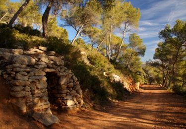
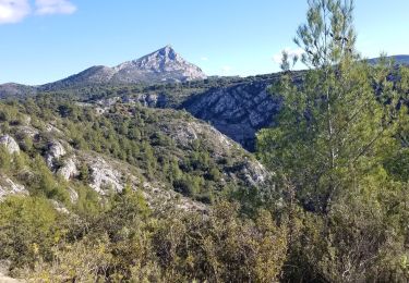
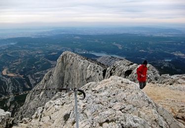
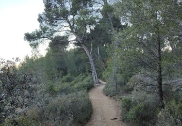
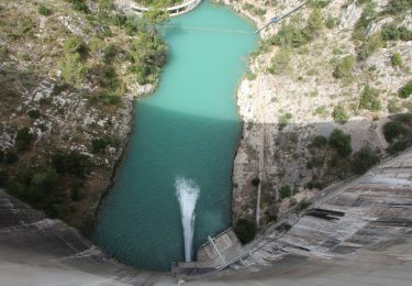
Tour Zu Fuß Le Tholonet - Le tour des Infernets et de la Petite Mer - Photo

Le tour des Infernets et de la Petite Mer

© OpenStreetMap contributors
Länge
Länge
8,9 km
Maximale Höhe
Maximale Höhe
345 m
Positive Höhendifferenz
338 m
Km-Effort
Km-Effort  
13,4 km
Min. Höhe
Min. Höhe
200 m
Negative Höhendifferenz
336 m
Boucle
Boucle
Ja
Erstellungsdatum :
2021-04-03 16:04:02.471
Letzte Änderung :
2021-04-03 16:05:26.935

(0 Nachricht)

Zu Fuß
Zu Fuß
3h02
Schwierigkeit : Einfach

Scannen Sie diesen QR-Code, um die Tour in der SityTrail-Anwendung zu öffnen

Kostenlosegpshiking-Anwendung

Logo SityTrail SityTrail

IGN / Geografische Institute

SityTrail aus dem App Store herunterladen SityTrail von Google Play herunterladen

Logo SityTrail SityTrail World

Die Welt öffnet sich für Sie

SityTrail aus dem App Store herunterladen SityTrail von Google Play herunterladen SityTrail auf Huawei AppGallery herunterladen

Über SityTrail

Tour Zu Fuß von 8,9 km verfügbar auf Provence-Alpes-Côte d'Azur, Bouches-du-Rhône, Le Tholonet. Diese Tour wird von Valentin Lelong vorgeschlagen.

Höhenprofil

POIs

POI Le Tholonet - Parking du cimetière - Photo
Valentin Lelong
POI Le Tholonet - Parking du cimetière - Photo
Valentin Lelong
POI Le Tholonet - Sentier à droite points jaunes - Photo
Valentin Lelong
POI Le Tholonet - À gauche vers les falaises - Photo
Valentin Lelong
POI Le Tholonet - Lacet sentier à gauche - Photo
Valentin Lelong
POI Saint-Marc-Jaumegarde - Lacet sentier à gauche - Photo
Valentin Lelong
SAINT-MARC-JAUMEGARDE 
POI Saint-Marc-Jaumegarde - Belvédères - Photo
Valentin Lelong
SAINT-MARC-JAUMEGARDE 
POI Le Tholonet - Belvédères - Photo
Valentin Lelong
LE THOLONET 
POI Saint-Marc-Jaumegarde - à gauche - Photo
Valentin Lelong
SAINT-MARC-JAUMEGARDE 
POI Saint-Marc-Jaumegarde - À gauche - Photo
Valentin Lelong
SAINT-MARC-JAUMEGARDE 
POI Le Tholonet - à gauche - Photo
Valentin Lelong
LE THOLONET 
POI Le Tholonet - À gauche - Photo
Valentin Lelong
LE THOLONET 
POI Le Tholonet - à gauche - Photo
Valentin Lelong
LE THOLONET 
POI Le Tholonet - À gauche - Photo
Valentin Lelong
LE THOLONET 
POI Le Tholonet - Petit vallon - Photo
Valentin Lelong
LE THOLONET 
POI Le Tholonet - Petit vallon, sentier à droite - Photo
Valentin Lelong
POI Le Tholonet - Petit vallon - Photo
Valentin Lelong
LE THOLONET 
POI Le Tholonet - Petite plateforme - Photo
Valentin Lelong
LE THOLONET 
POI Le Tholonet - Petite plateforme - Photo
Valentin Lelong
LE THOLONET 
POI Le Tholonet - Carrefour de la boucle - Photo
Valentin Lelong
POI Le Tholonet - Carrefour de la boucle - Photo
Valentin Lelong
POI Le Tholonet - Parking du cimetière - Photo
Valentin Lelong

Ort

Land:
France
Region :
Provence-Alpes-Côte d'Azur
Abteilung/Provinz :
Bouches-du-Rhône
Kommune :
Le Tholonet
Standort:
Unknown
Gehen Sie:(Dec)
Gehen Sie:(UTM)
703200 ; 4822070 (31T) N.

Touren in der Umgebung

Tour Wandern Aix-en-Provence - Circuit des lacs Zola et Bimont - Aix-en-Provence - Photo
Wandern
tracegps

Wandern

Medium
(4)
Aix-en-Provence, Provence-Alpes-Côte d'Azur, Bouches-du-Rhône, France
10 km | 13,6 km-effort
2h 30min
Ja
Tour Wandern Saint-Marc-Jaumegarde - Barrages Zola-Bimont - Photo
Wandern
Berpav

Wandern

Medium
(2)
Saint-Marc-Jaumegarde, Provence-Alpes-Côte d'Azur, Bouches-du-Rhône, France
8 km | 11 km-effort
2h 30min
Ja
Tour Wandern Saint-Marc-Jaumegarde - La Croix de Provence depuis le barrage de Bimont - Photo
Wandern
tracegps

Wandern

Schwierig
(1)
Saint-Marc-Jaumegarde, Provence-Alpes-Côte d'Azur, Bouches-du-Rhône, France
13,9 km | 24 km-effort
4h 45min
Ja
Tour Zu Fuß Beaurecueil - Sentier Imoucha - Photo
Zu Fuß
GUIDE+

Zu Fuß

Einfach
Beaurecueil, Provence-Alpes-Côte d'Azur, Bouches-du-Rhône, France
4,4 km | 10,1 km-effort
2h 17min
Nein
Tour Wandern Le Tholonet - Bibemus - Lac Zola 1-1-21 - Photo
Wandern
GUIDE
fredetpascale

Wandern

Medium
(1)
Le Tholonet, Provence-Alpes-Côte d'Azur, Bouches-du-Rhône, France
7,6 km | 10,4 km-effort
2h 21min
Nein
Tour Wandern Aix-en-Provence - Aix - Tour César 8/11/2020 - Photo
Wandern
GUIDE
fredetpascale

Wandern

Einfach
(1)
Aix-en-Provence, Provence-Alpes-Côte d'Azur, Bouches-du-Rhône, France
15,6 km | 19,6 km-effort
3h 26min
Ja
Tour Wandern Saint-Antonin-sur-Bayon - la croix de Provence - Photo
Wandern
GUIDE
nadd73

Wandern

Schwierig
Saint-Antonin-sur-Bayon, Provence-Alpes-Côte d'Azur, Bouches-du-Rhône, France
6,6 km | 14,7 km-effort
5h 11min
Ja
Tour Wandern Aix-en-Provence - Aix En Provence - St Beaume - Photo
Wandern
Geckos

Wandern

Schwierig
(1)
Aix-en-Provence, Provence-Alpes-Côte d'Azur, Bouches-du-Rhône, France
65 km | 94 km-effort
19h 29min
Nein
Tour Wandern Saint-Antonin-sur-Bayon - Sainte Victoire - Bau Cézanne - tracé jaune - Photo
Wandern
GUIDE
amiral13

Wandern

Schwierig
(1)
Saint-Antonin-sur-Bayon, Provence-Alpes-Côte d'Azur, Bouches-du-Rhône, France
5,3 km | 12,2 km-effort
2h 28min
Ja


Schließen
Meine Abonnements