![](/images/other/stat-length.png)
![Tour Mountainbike Meyrargues - De Meyrargues au Jas du Ligourès et au Vallon du Puits - Photo](https://media.geolcdn.com/t/1900/400/ext.pjpeg?maxdim=2&url=https%3A%2F%2Fstatic1.geolcdn.com%2Fsiteimages%2Fupload%2Ffiles%2F1524743154velo.jpg)
De Meyrargues au Jas du Ligourès et au Vallon du Puits
Coqorico
Benutzer
![Länge](/images/other/stat-length.png)
![Maximale Höhe](https://static1.geolcdn.com/siteimages/upload/files/1508320355ic_sort_altitude_max_24dp.png)
![Positive Höhendifferenz](https://static1.geolcdn.com/siteimages/upload/files/1508320355ic_sort_den_pos_24dp.png)
![Km-Effort](/images/other/stat-length.png)
![Min. Höhe](https://static1.geolcdn.com/siteimages/upload/files/1508320355ic_sort_altitude_min_24dp.png)
![Negative Höhendifferenz](https://static1.geolcdn.com/siteimages/upload/files/1508320355ic_sort_den_neg_24dp.png)
![Boucle](https://static1.geolcdn.com/siteimages/upload/files/16400158638029165_repeat_loop_refresh_sync_direction_icon.png)
![Mountainbike](https://static1.geolcdn.com/sitytour/trail-icons/202.png)
1h51
Schwierigkeit : Einfach
![Scannen Sie diesen QR-Code, um die Tour in der SityTrail-Anwendung zu öffnen](https://capi.geolives.com/qq0zvz2zws4bq2lad0pu/sitytour/trails/2715356/qr.png?size=200)
Kostenlosegpshiking-Anwendung
Über SityTrail
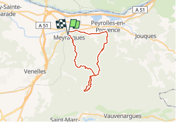
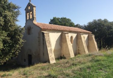
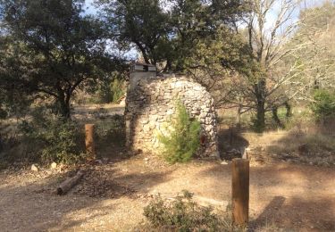
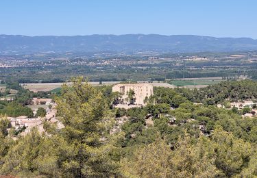
Tour Mountainbike von 25 km verfügbar auf Provence-Alpes-Côte d'Azur, Bouches-du-Rhône, Meyrargues. Diese Tour wird von Coqorico vorgeschlagen.
Beschreibung
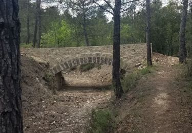
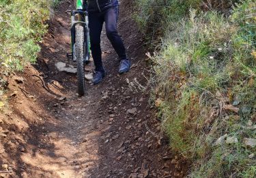
Départ de Meyrargues le long du canal EDF pour emprunter la montée des Lavandes et le chemin du Bès jusqu'au jas de Ligourès. De là descente par le single du Puits et remontée par la piste main droite pour enfin redescendre sur Meyrargues par le pas de l'Étroit.
Il est possible selon l'envie de varier la descente (le Brûlé et le single du Petit, le Lauvas, etc.)
Pas de difficulté particulière en-dehors du single du Puits qui reste facile (VTT semi-rigide).
Ort
Kommentare
Touren in der Umgebung
![Wandern Wandern](https://static1.geolcdn.com/sitytour/trail-icons/101.png)
Wandern
![](/images/other/stat-length.png)
![](https://static1.geolcdn.com/siteimages/upload/files/16400158638029165_repeat_loop_refresh_sync_direction_icon.png)
![Tour Wandern Meyrargues - Meyrargue Camp chinois Vallon du petit - Photo](https://media.geolcdn.com/t/375/260/bdb76f07-312d-4412-8213-94a98c001771.jpg&format=jpg&maxdim=2)
![Wandern Wandern](https://static1.geolcdn.com/sitytour/trail-icons/101.png)
Wandern
![](/images/other/stat-length.png)
![](https://static1.geolcdn.com/siteimages/upload/files/16400158638029165_repeat_loop_refresh_sync_direction_icon.png)
![Tour Wandern Peyrolles-en-Provence - Ancien canal du Verdon 1.5.22 - Photo](https://media.geolcdn.com/t/375/260/62ebffa6-ce90-44d1-8a5a-2da46d971824.jpg&format=jpg&maxdim=2)
![Wandern Wandern](https://static1.geolcdn.com/sitytour/trail-icons/101.png)
Wandern
![](/images/other/stat-length.png)
![](https://static1.geolcdn.com/siteimages/upload/files/16400158638029165_repeat_loop_refresh_sync_direction_icon.png)
![Tour Wandern Peyrolles-en-Provence - loubatas-Camp Chinois-retour par les vallons - Photo](https://media.geolcdn.com/t/375/260/eef47ac4-c641-43d2-bb84-26631de69203.jpg&format=jpg&maxdim=2)
![Wandern Wandern](https://static1.geolcdn.com/sitytour/trail-icons/101.png)
Wandern
![](/images/other/stat-length.png)
![](https://static1.geolcdn.com/siteimages/upload/files/16400158638029165_repeat_loop_refresh_sync_direction_icon.png)
![Tour Wandern Peyrolles-en-Provence - PF-Peyrolles-en-Provence - Notre Dame d'Astors - Photo](https://media.geolcdn.com/t/375/260/da3fa0b3-39ff-44df-8458-8b11162830b1.jpg&format=jpg&maxdim=2)
![Wandern Wandern](https://static1.geolcdn.com/sitytour/trail-icons/101.png)
Wandern
![](/images/other/stat-length.png)
![](https://static1.geolcdn.com/siteimages/upload/files/16400158638029165_repeat_loop_refresh_sync_direction_icon.png)
![Tour Wandern Peyrolles-en-Provence - PF-Peyrolles-Sentier du Loubatas - Photo](https://media.geolcdn.com/t/375/260/ext.jpg?maxdim=2&url=https%3A%2F%2Fservices.sitytrail.com%2FGeolivesWS%2FDownloadMedia.ashx%3FTrailID%3D537957%26Media%3D20160314160329.jpg)
![Wandern Wandern](https://static1.geolcdn.com/sitytour/trail-icons/101.png)
Wandern
![](/images/other/stat-length.png)
![](https://static1.geolcdn.com/siteimages/upload/files/16400158638029165_repeat_loop_refresh_sync_direction_icon.png)
![Tour Mountainbike Venelles - venelles isa jeff - Photo](https://media.geolcdn.com/t/375/260/d4832cbe-4880-482f-ae46-7170caae83c8.jpg&format=jpg&maxdim=2)
![Mountainbike Mountainbike](https://static1.geolcdn.com/sitytour/trail-icons/202.png)
Mountainbike
![](/images/other/stat-length.png)
![](https://static1.geolcdn.com/siteimages/upload/files/16400158638029165_repeat_loop_refresh_sync_direction_icon.png)
![Tour Wandern Meyrargues - alentours de Meyrargues tracé bleu - Photo](https://media.geolcdn.com/t/375/260/8d4af597-6f33-40b4-95e0-5e2b2f11b4b9.jpg&format=jpg&maxdim=2)
![Wandern Wandern](https://static1.geolcdn.com/sitytour/trail-icons/101.png)
Wandern
![](/images/other/stat-length.png)
![](https://static1.geolcdn.com/siteimages/upload/files/16400158638029165_repeat_loop_refresh_sync_direction_icon.png)
![Tour Wandern Meyrargues - Meyrargues - Par vallon de Lazare - Photo](https://media.geolcdn.com/t/375/260/569d1ad8-ad21-4242-9681-6080f9908d1b.jpg&format=jpg&maxdim=2)
![Wandern Wandern](https://static1.geolcdn.com/sitytour/trail-icons/101.png)
Wandern
![](/images/other/stat-length.png)
![](https://static1.geolcdn.com/siteimages/upload/files/16400158638029165_repeat_loop_refresh_sync_direction_icon.png)