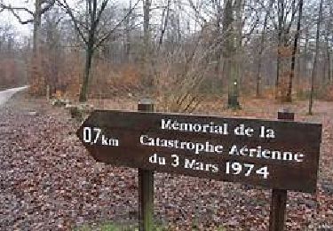
8,7 km | 9,7 km-effort
plailly
MAZE
Benutzer
Länge
15,8 km
Maximale Höhe
205 m
Positive Höhendifferenz
201 m
Km-Effort
18,5 km
Min. Höhe
92 m
Negative Höhendifferenz
201 m
Boucle
Ja
Erstellungsdatum :
2021-03-02 09:52:26.007
Letzte Änderung :
2021-03-02 14:29:22.908
4h35
Schwierigkeit : Sehr leicht
Kostenlosegpshiking-Anwendung
Über SityTrail
Tour Wandern von 15,8 km verfügbar auf Nordfrankreich, Oise, Plailly. Diese Tour wird von MAZE vorgeschlagen.
Ort
Land:
France
Region :
Nordfrankreich
Abteilung/Provinz :
Oise
Kommune :
Plailly
Standort:
Unknown
Gehen Sie:(Dec)
Gehen Sie:(UTM)
469669 ; 5438999 (31U) N.
Kommentare
Touren in der Umgebung
SM_ERMENONVILLE_CROIX-NEUVE_7.9Km
Wandern
Medium
(6)
Fontaine-Chaalis,
Nordfrankreich,
Oise,
France
7,3 km | 8,3 km-effort
1h 58min
Ja
MR_ERMENONVILLE_Croix Neuve_5.6Km
Wandern
Medium
(5)
Fontaine-Chaalis,
Nordfrankreich,
Oise,
France
5,6 km | 6,7 km-effort
1h 27min
Ja
MR_LOISY-Nord_5.2Km
Wandern
Einfach
(1)
Ver-sur-Launette,
Nordfrankreich,
Oise,
France
5,2 km | 5,9 km-effort
1h 19min
Ja
Loisy MN
Nordic Walking
Einfach
(1)
Ver-sur-Launette,
Nordfrankreich,
Oise,
France
10 km | 11,2 km-effort
1h 57min
Ja
MR_ERMENONVILLE_Poteau de la Futaie_5Km
Wandern
Einfach
(4)
Fontaine-Chaalis,
Nordfrankreich,
Oise,
France
5,2 km | 5,9 km-effort
1h 15min
Ja
Loisy MN
Nordic Walking
Medium
(1)
Ver-sur-Launette,
Nordfrankreich,
Oise,
France
11,1 km | 12,8 km-effort
2h 49min
Ja
Loisy MN
Wandern
Medium
(4)
Ver-sur-Launette,
Nordfrankreich,
Oise,
France
11,1 km | 12,9 km-effort
2h 50min
Ja
Fosses - Bellefontaine
Wandern
Schwierig
Fosses,
Île-de-France,
Val-d'Oise,
France
12,3 km | 14,3 km-effort
3h 10min
Ja