![](/images/other/stat-length.png)
![Tour Wandern Mutzig - Les chapelles de Mutzig - Photo](https://media.geolcdn.com/t/1900/400/ext.pjpeg?maxdim=2&url=https%3A%2F%2Fservices.sitytrail.com%2FGeolivesWS%2FDownloadMedia.ashx%3FTrailID%3D268899%26Media%3Dfix__20140421150243.jpg)
Les chapelles de Mutzig
VacheKiri67
Benutzer
![Länge](/images/other/stat-length.png)
Länge
14,8 km
![Maximale Höhe](https://static1.geolcdn.com/siteimages/upload/files/1508320355ic_sort_altitude_max_24dp.png)
Maximale Höhe
377 m
![Positive Höhendifferenz](https://static1.geolcdn.com/siteimages/upload/files/1508320355ic_sort_den_pos_24dp.png)
Positive Höhendifferenz
285 m
![Km-Effort](/images/other/stat-length.png)
Km-Effort
18,6 km
![Min. Höhe](https://static1.geolcdn.com/siteimages/upload/files/1508320355ic_sort_altitude_min_24dp.png)
Min. Höhe
176 m
![Negative Höhendifferenz](https://static1.geolcdn.com/siteimages/upload/files/1508320355ic_sort_den_neg_24dp.png)
Negative Höhendifferenz
285 m
![Boucle](https://static1.geolcdn.com/siteimages/upload/files/16400158638029165_repeat_loop_refresh_sync_direction_icon.png)
Boucle
Ja
Erstellungsdatum :
2014-12-10 00:00:00.0
Letzte Änderung :
2014-12-10 00:00:00.0
![Wandern](https://static1.geolcdn.com/sitytour/trail-icons/101.png)
4h00
Schwierigkeit : Medium
![Scannen Sie diesen QR-Code, um die Tour in der SityTrail-Anwendung zu öffnen](https://capi.geolives.com/qq0zvz2zws4bq2lad0pu/sitytour/trails/268899/qr.png?size=200)
Kostenlosegpshiking-Anwendung
Über SityTrail
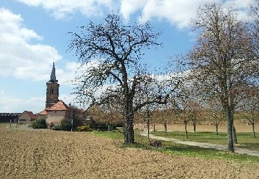
Tour Wandern von 14,8 km verfügbar auf Großer Osten, Unterelsass, Mutzig. Diese Tour wird von VacheKiri67 vorgeschlagen.
Beschreibung
Faite le 21/04/2014 avec notre fils de 9 ans et sa tatie Jennifer, Rémy et son cousin Johan. D'après : Circuit de l'OT de Molsheim-Mutzig - Les chapelles de Mutzig. Plus de détails : http://www.ot-molsheim-mutzig.com/loisirs/randonnees-pedestres.htm
Ort
Land:
France
Region :
Großer Osten
Abteilung/Provinz :
Unterelsass
Kommune :
Mutzig
Standort:
Unknown
Gehen Sie:(Dec)
Gehen Sie:(UTM)
386429 ; 5376783 (32U) N.
Kommentare
Touren in der Umgebung
![Tour Wandern Mutzig - Les sanctuaires autour de Mutzig - Photo](https://media.geolcdn.com/t/375/260/ext.jpg?maxdim=2&url=https%3A%2F%2Fservices.sitytrail.com%2FGeolivesWS%2FDownloadMedia.ashx%3FTrailID%3D757212%26Media%3Dfix__20170521144513.jpg)
![Wandern Wandern](https://static1.geolcdn.com/sitytour/trail-icons/101.png)
Les sanctuaires autour de Mutzig
Wandern
Medium
(1)
Mutzig,
Großer Osten,
Unterelsass,
France
![](/images/other/stat-length.png)
13,6 km | 17,9 km-effort
5h 0min
![](https://static1.geolcdn.com/siteimages/upload/files/16400158638029165_repeat_loop_refresh_sync_direction_icon.png)
Ja
![Tour Wandern Wolxheim - wolxheim, chapelle st-denis. - Photo](https://media.geolcdn.com/t/375/260/ext.jpg?maxdim=2&url=https%3A%2F%2Fservices.sitytrail.com%2FGeolivesWS%2FDownloadMedia.ashx%3FTrailID%3D212187%26Media%3D20130505140350.jpeg)
![Wandern Wandern](https://static1.geolcdn.com/sitytour/trail-icons/101.png)
wolxheim, chapelle st-denis.
Wandern
Medium
(1)
Wolxheim,
Großer Osten,
Unterelsass,
France
![](/images/other/stat-length.png)
6,9 km | 8,3 km-effort
2h 19min
![](https://static1.geolcdn.com/siteimages/upload/files/16400158638029165_repeat_loop_refresh_sync_direction_icon.png)
Ja
![Tour Wandern Mutzig - Les sanctuaires autour de Mutzig - Photo](https://media.geolcdn.com/t/375/260/ext.jpg?maxdim=2&url=https%3A%2F%2Fservices.sitytrail.com%2FGeolivesWS%2FDownloadMedia.ashx%3FTrailID%3D191554%26Media%3D15170_5.jpg)
![Wandern Wandern](https://static1.geolcdn.com/sitytour/trail-icons/101.png)
Les sanctuaires autour de Mutzig
Wandern
Schwierig
(1)
Mutzig,
Großer Osten,
Unterelsass,
France
![](/images/other/stat-length.png)
12,7 km | 16,8 km-effort
4h 0min
![](https://static1.geolcdn.com/siteimages/upload/files/16400158638029165_repeat_loop_refresh_sync_direction_icon.png)
Ja
![Tour Wandern Dorlisheim - Escapade dans le vignoble de Dorlisheim - Photo](https://media.geolcdn.com/t/375/260/ext.jpg?maxdim=2&url=https%3A%2F%2Fservices.sitytrail.com%2FGeolivesWS%2FDownloadMedia.ashx%3FTrailID%3D191544%26Media%3D15156_5.jpg)
![Wandern Wandern](https://static1.geolcdn.com/sitytour/trail-icons/101.png)
Escapade dans le vignoble de Dorlisheim
Wandern
Medium
(1)
Dorlisheim,
Großer Osten,
Unterelsass,
France
![](/images/other/stat-length.png)
9,7 km | 12,6 km-effort
3h 0min
![](https://static1.geolcdn.com/siteimages/upload/files/16400158638029165_repeat_loop_refresh_sync_direction_icon.png)
Ja
![Tour Wandern Mutzig - Autour du Fort de Mutzig - Photo](https://media.geolcdn.com/t/375/260/ext.jpg?maxdim=2&url=https%3A%2F%2Fservices.sitytrail.com%2FGeolivesWS%2FDownloadMedia.ashx%3FTrailID%3D184932%26Media%3D20130414160934.jpeg)
![Wandern Wandern](https://static1.geolcdn.com/sitytour/trail-icons/101.png)
Autour du Fort de Mutzig
Wandern
Schwierig
(2)
Mutzig,
Großer Osten,
Unterelsass,
France
![](/images/other/stat-length.png)
18,7 km | 26 km-effort
6h 30min
![](https://static1.geolcdn.com/siteimages/upload/files/16400158638029165_repeat_loop_refresh_sync_direction_icon.png)
Ja
![Tour Wandern Molsheim - Les Chapelles entre vignoble et canal - Photo](https://media.geolcdn.com/t/375/260/ext.jpg?maxdim=2&url=https%3A%2F%2Fservices.sitytrail.com%2FGeolivesWS%2FDownloadMedia.ashx%3FTrailID%3D183542%26Media%3D2646587c-a01c-401b-8b31-6064124244bc.jpeg)
![Wandern Wandern](https://static1.geolcdn.com/sitytour/trail-icons/101.png)
Les Chapelles entre vignoble et canal
Wandern
Medium
(2)
Molsheim,
Großer Osten,
Unterelsass,
France
![](/images/other/stat-length.png)
14,8 km | 17 km-effort
3h 43min
![](https://static1.geolcdn.com/siteimages/upload/files/16400158638029165_repeat_loop_refresh_sync_direction_icon.png)
Ja
![Tour Mountainbike Dinsheim - Les Grandes Manoeuvres - Photo](https://media.geolcdn.com/t/375/260/ext.jpg?maxdim=2&url=https%3A%2F%2Fservices.sitytrail.com%2FGeolivesWS%2FDownloadMedia.ashx%3FTrailID%3D101149%26Media%3D637_1.jpg)
![Mountainbike Mountainbike](https://static1.geolcdn.com/sitytour/trail-icons/202.png)
Les Grandes Manoeuvres
Mountainbike
Sehr schwierig
(1)
Dinsheim,
Großer Osten,
Unterelsass,
France
![](/images/other/stat-length.png)
45 km | 59 km-effort
4h 0min
![](https://static1.geolcdn.com/siteimages/upload/files/16400158638029165_repeat_loop_refresh_sync_direction_icon.png)
Ja
![Tour Reiten Rosenweiler - suuntoapp-HorsebackRiding-2024-10-13T07-08-28Z - Photo](https://media.geolcdn.com/t/375/260/5e0f037b-8c10-49d5-8e85-7ccefd4ab616.jpg&format=jpg&maxdim=2)
![Reiten Reiten](https://static1.geolcdn.com/sitytour/trail-icons/301.png)
suuntoapp-HorsebackRiding-2024-10-13T07-08-28Z
Reiten
Medium
Rosenweiler,
Großer Osten,
Unterelsass,
France
![](/images/other/stat-length.png)
35 km | 44 km-effort
5h 46min
![](https://static1.geolcdn.com/siteimages/upload/files/16400158638029165_repeat_loop_refresh_sync_direction_icon.png)
Ja
![Tour Wandern Still - 2024-02-07_22h30m09_B3 - Photo](https://media.geolcdn.com/t/375/260/ext.jpg?maxdim=2&url=https%3A%2F%2Fstatic1.geolcdn.com%2Fsiteimages%2Fupload%2Ffiles%2F1553511878bg_sport_marche.png)
![Wandern Wandern](https://static1.geolcdn.com/sitytour/trail-icons/101.png)
2024-02-07_22h30m09_B3
Wandern
Medium
(1)
Still,
Großer Osten,
Unterelsass,
France
![](/images/other/stat-length.png)
16,8 km | 22 km-effort
4h 56min
![](https://static1.geolcdn.com/siteimages/upload/files/16400158638029165_repeat_loop_refresh_sync_direction_icon.png)
Ja
Un bon coin à muguet !