![](/images/other/stat-length.png)
![Tour Wandern Chainaz-les-Frasses - Entre Albanais et Chéran - Photo](https://media.geolcdn.com/t/1900/400/8cc00001-1916-423c-85b5-998ccae22bcf.jpg&format=pjpeg&maxdim=2)
Entre Albanais et Chéran
HERRY
Benutzer GUIDE
![Länge](/images/other/stat-length.png)
![Maximale Höhe](https://static1.geolcdn.com/siteimages/upload/files/1508320355ic_sort_altitude_max_24dp.png)
![Positive Höhendifferenz](https://static1.geolcdn.com/siteimages/upload/files/1508320355ic_sort_den_pos_24dp.png)
![Km-Effort](/images/other/stat-length.png)
![Min. Höhe](https://static1.geolcdn.com/siteimages/upload/files/1508320355ic_sort_altitude_min_24dp.png)
![Negative Höhendifferenz](https://static1.geolcdn.com/siteimages/upload/files/1508320355ic_sort_den_neg_24dp.png)
![Boucle](https://static1.geolcdn.com/siteimages/upload/files/16400158638029165_repeat_loop_refresh_sync_direction_icon.png)
![Wandern](https://static1.geolcdn.com/sitytour/trail-icons/101.png)
1h46
Schwierigkeit : Unbekannt
![Scannen Sie diesen QR-Code, um die Tour in der SityTrail-Anwendung zu öffnen](https://capi.geolives.com/qq0zvz2zws4bq2lad0pu/sitytour/trails/2679641/qr.png?size=200)
Kostenlosegpshiking-Anwendung
Über SityTrail
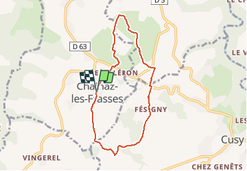
Tour Wandern von 7,1 km verfügbar auf Auvergne-Rhone-Alpen, Hochsavoyen, Chainaz-les-Frasses. Diese Tour wird von HERRY vorgeschlagen.
Beschreibung
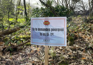
Se garer à l'église de Chainaz. Un panneau affiche la randonnée. Suivre le tracé ( flèches jaunes sur fond vert). Le chemin mène vers "chez les Rey".
A ce niveau prendre à gauche et suivre d'abord sur la route puis par un sentier à travers bois la direction du château de Fésigny.
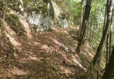
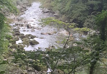
Après le château descente vers la route de Cusy. Prendre à gauche sur la route, puis 100 m plus loin à droite pour traverser un peu plus loin un ruisseau pour arriver au lieu dit "Bocquerat". Ensuite continuer sur un sentier assez humide en hiver et qui monte vers "les Daufes Dessus".
Continuer vers "Les monts" et tourner à gauche vers "Les Platets".
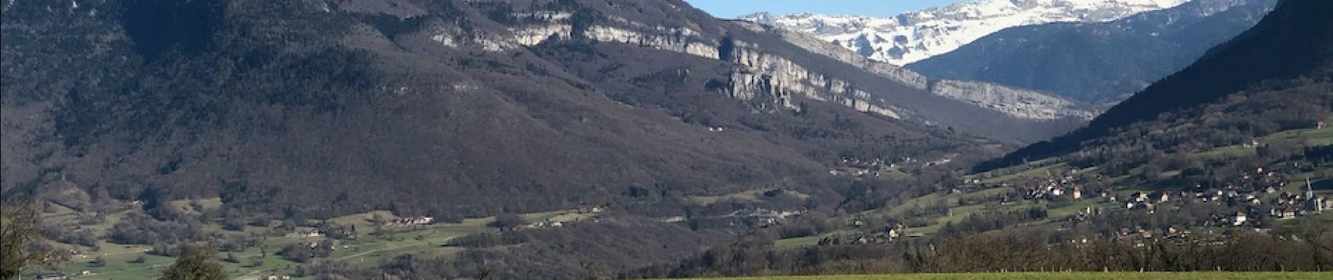
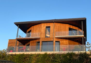
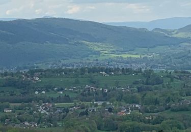
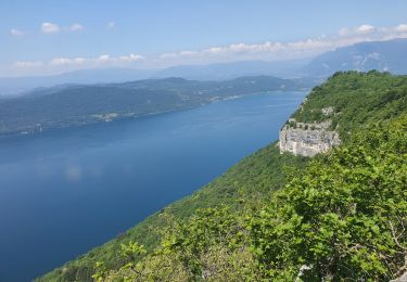
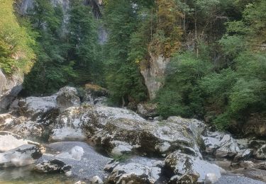
Quitter ensuite la route pour prendre à gauche le chemin qui vous offre un joli panorama sur les Bauges et le Trélod ( voir photos) .
Descendre ensuite vers le Goléron. A l'intersection avec la route de Cusy, prendre à droite puis 100mètres plus loin tourner à gauche en direction du village de Chainaz. Vous passerez dans une cour de maison mais apparemment c'est le bon chemin.
Remonter ensuite par la route pour atteindre le point de départ.
Sur le panneau la distance est indiquée de 10,5km . En réel il n'y a qu'un peu plus de 7km.
Ce circuit est très joli car il domine la plaine de l'Albanais d'un côté et celle du Chéran avec les montagnes des Bauges.
Ort
Kommentare
Touren in der Umgebung
![Tour Wandern Cusy - 13-09-2022 La Grand-Raie au Col de la Cochette - Photo](https://media.geolcdn.com/t/375/260/6cba586f-c088-48b0-8a7d-67e2ef29bd8a.jpg&format=jpg&maxdim=2)
![Wandern Wandern](https://static1.geolcdn.com/sitytour/trail-icons/101.png)
Wandern
![](/images/other/stat-length.png)
![](https://static1.geolcdn.com/siteimages/upload/files/16400158638029165_repeat_loop_refresh_sync_direction_icon.png)
![Tour Wandern Cusy - Les chaos de Cheran - Photo](https://media.geolcdn.com/t/375/260/7e19bf6d-564b-481b-864d-0e6de1762649.jpg&format=jpg&maxdim=2)
![Wandern Wandern](https://static1.geolcdn.com/sitytour/trail-icons/101.png)
Wandern
![](/images/other/stat-length.png)
![](https://static1.geolcdn.com/siteimages/upload/files/16400158638029165_repeat_loop_refresh_sync_direction_icon.png)
![Tour Wandern Cusy - Chaos. du Cheran - Photo](https://media.geolcdn.com/t/375/260/ext.jpg?maxdim=2&url=https%3A%2F%2Fstatic1.geolcdn.com%2Fsiteimages%2Fupload%2Ffiles%2F1553511878bg_sport_marche.png)
![Wandern Wandern](https://static1.geolcdn.com/sitytour/trail-icons/101.png)
Wandern
![](/images/other/stat-length.png)
![](https://static1.geolcdn.com/siteimages/upload/files/16400158638029165_repeat_loop_refresh_sync_direction_icon.png)
![Tour sport Saint-Ours - Saint-Ours/Choitelet - Photo](https://media.geolcdn.com/t/375/260/68734abc-b632-4e0f-a71f-87e6a6e70e99.jpg&format=jpg&maxdim=2)
sport
![](/images/other/stat-length.png)
![](https://static1.geolcdn.com/siteimages/upload/files/16400158638029165_repeat_loop_refresh_sync_direction_icon.png)
![Tour Wandern Saint-Offenge - Saint-Offenge-Dessous Cusy - Photo](https://media.geolcdn.com/t/375/260/9922806d-4eb0-4835-85fc-26210664b335.jpg&format=jpg&maxdim=2)
![Wandern Wandern](https://static1.geolcdn.com/sitytour/trail-icons/101.png)
Wandern
![](/images/other/stat-length.png)
![](https://static1.geolcdn.com/siteimages/upload/files/16400158638029165_repeat_loop_refresh_sync_direction_icon.png)
![Tour Wandern Entrelacs - ERAT 2024 - Photo](https://media.geolcdn.com/t/375/260/e53aa02e-5e29-4cdc-a141-71a7c9a33ac3.jpg&format=jpg&maxdim=2)
![Wandern Wandern](https://static1.geolcdn.com/sitytour/trail-icons/101.png)
Wandern
![](/images/other/stat-length.png)
![](https://static1.geolcdn.com/siteimages/upload/files/16400158638029165_repeat_loop_refresh_sync_direction_icon.png)
![Tour Wandern Entrelacs - 26-05-2023 Belvédère de Chambotte - Retour par Saint Germain et Lépau - Photo](https://media.geolcdn.com/t/375/260/21cca317-b85a-47d7-a962-82924b7d629e.jpg&format=jpg&maxdim=2)
![Wandern Wandern](https://static1.geolcdn.com/sitytour/trail-icons/101.png)
Wandern
![](/images/other/stat-length.png)
![](https://static1.geolcdn.com/siteimages/upload/files/16400158638029165_repeat_loop_refresh_sync_direction_icon.png)
![Tour Wandern Cusy - 14-08-2022 Pont de Cusy - Pont de l'abîme - Photo](https://media.geolcdn.com/t/375/260/afefb47b-f53a-4dff-bf88-24c102fec5de.jpg&format=jpg&maxdim=2)
![Wandern Wandern](https://static1.geolcdn.com/sitytour/trail-icons/101.png)
Wandern
![](/images/other/stat-length.png)
![](https://static1.geolcdn.com/siteimages/upload/files/16400158638029165_repeat_loop_refresh_sync_direction_icon.png)
![Tour Wandern Entrelacs - Ronde des fours Albens - Photo](https://media.geolcdn.com/t/375/260/f2666e0b-68cf-4aa4-9713-51600128943f.jpg&format=jpg&maxdim=2)
![Wandern Wandern](https://static1.geolcdn.com/sitytour/trail-icons/101.png)
Wandern
![](/images/other/stat-length.png)
![](https://static1.geolcdn.com/siteimages/upload/files/16400158638029165_repeat_loop_refresh_sync_direction_icon.png)