![](/images/other/stat-length.png)
![Tour Wandern Weismes - 2021-02-21_12h12m48_f17bbegpxd - Photo](https://media.geolcdn.com/t/1900/400/ext.pjpeg?maxdim=2&url=https%3A%2F%2Fstatic1.geolcdn.com%2Fsiteimages%2Fupload%2Ffiles%2F1553511878bg_sport_marche.png)
2021-02-21_12h12m48_f17bbegpxd
Giltayjean
Benutzer
![Länge](/images/other/stat-length.png)
Länge
8,4 km
![Maximale Höhe](https://static1.geolcdn.com/siteimages/upload/files/1508320355ic_sort_altitude_max_24dp.png)
Maximale Höhe
553 m
![Positive Höhendifferenz](https://static1.geolcdn.com/siteimages/upload/files/1508320355ic_sort_den_pos_24dp.png)
Positive Höhendifferenz
126 m
![Km-Effort](/images/other/stat-length.png)
Km-Effort
10,1 km
![Min. Höhe](https://static1.geolcdn.com/siteimages/upload/files/1508320355ic_sort_altitude_min_24dp.png)
Min. Höhe
498 m
![Negative Höhendifferenz](https://static1.geolcdn.com/siteimages/upload/files/1508320355ic_sort_den_neg_24dp.png)
Negative Höhendifferenz
126 m
![Boucle](https://static1.geolcdn.com/siteimages/upload/files/16400158638029165_repeat_loop_refresh_sync_direction_icon.png)
Boucle
Ja
Erstellungsdatum :
2021-02-21 11:12:48.653
Letzte Änderung :
2021-02-21 18:00:31.719
![Wandern](https://static1.geolcdn.com/sitytour/trail-icons/101.png)
2h17
Schwierigkeit : Medium
![Scannen Sie diesen QR-Code, um die Tour in der SityTrail-Anwendung zu öffnen](https://capi.geolives.com/qq0zvz2zws4bq2lad0pu/sitytour/trails/2678820/qr.png?size=200)
Kostenlosegpshiking-Anwendung
Über SityTrail
Tour Wandern von 8,4 km verfügbar auf Wallonien, Lüttich, Weismes. Diese Tour wird von Giltayjean vorgeschlagen.
Beschreibung
Rando proposée par l'office du tourisme. Quelques passages sur sentiers étroits et avec beaucoup de racines d'arbres. Danger de glissades par temps de pluie, neige ou gel
Ort
Land:
Belgium
Region :
Wallonien
Abteilung/Provinz :
Lüttich
Kommune :
Weismes
Standort:
In der Bivelt
Gehen Sie:(Dec)
Gehen Sie:(UTM)
295731 ; 5593125 (32U) N.
Kommentare
Touren in der Umgebung
![Tour Wandern Weismes - RB-Lg-32_Botrange_via-racc-2 - Photo](https://media.geolcdn.com/t/375/260/ext.jpg?maxdim=2&url=https%3A%2F%2Fservices.sitytrail.com%2FGeolivesWS%2FDownloadMedia.ashx%3FTrailID%3D402164%26Media%3D5ad16311-48f2-4779-8b73-f8bce456ef00.jpg)
![Wandern Wandern](https://static1.geolcdn.com/sitytour/trail-icons/101.png)
RB-Lg-32_Botrange_via-racc-2
Wandern
(6)
Weismes,
Wallonien,
Lüttich,
Belgium
![](/images/other/stat-length.png)
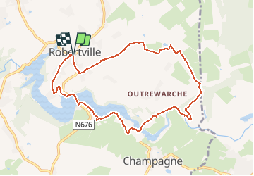
16,7 km | 22 km-effort
5h 4min
![](https://static1.geolcdn.com/siteimages/upload/files/16400158638029165_repeat_loop_refresh_sync_direction_icon.png)
Ja
![Tour Wandern Weismes - RB-Lg-32_Botrange_via-racc-1 - Photo](https://media.geolcdn.com/t/375/260/ext.jpg?maxdim=2&url=https%3A%2F%2Fservices.sitytrail.com%2FGeolivesWS%2FDownloadMedia.ashx%3FTrailID%3D402158%26Media%3D5ad16311-48f2-4779-8b73-f8bce456ef00.jpg)
![Wandern Wandern](https://static1.geolcdn.com/sitytour/trail-icons/101.png)
RB-Lg-32_Botrange_via-racc-1
Wandern
(7)
Weismes,
Wallonien,
Lüttich,
Belgium
![](/images/other/stat-length.png)
12,3 km | 15,7 km-effort
3h 34min
![](https://static1.geolcdn.com/siteimages/upload/files/16400158638029165_repeat_loop_refresh_sync_direction_icon.png)
Ja
![Tour Wandern Weismes - RB-Lg-32_Botrange - Photo](https://media.geolcdn.com/t/375/260/ext.jpg?maxdim=2&url=https%3A%2F%2Fservices.sitytrail.com%2FGeolivesWS%2FDownloadMedia.ashx%3FTrailID%3D402156%26Media%3Dfd59a9ea-7261-4ddd-8af9-0290eaea98e9.jpg)
![Wandern Wandern](https://static1.geolcdn.com/sitytour/trail-icons/101.png)
RB-Lg-32_Botrange
Wandern
(8)
Weismes,
Wallonien,
Lüttich,
Belgium
![](/images/other/stat-length.png)
19,6 km | 26 km-effort
5h 51min
![](https://static1.geolcdn.com/siteimages/upload/files/16400158638029165_repeat_loop_refresh_sync_direction_icon.png)
Ja
![Tour Wandern Weismes - Sourbrodt - Circuit Natura 2000, des sites qui valent le détour - Lg11 - Photo](https://media.geolcdn.com/t/375/260/ext.jpg?maxdim=2&url=https%3A%2F%2Fservices.sitytrail.com%2FGeolivesWS%2FDownloadMedia.ashx%3FTrailID%3D181919%26Media%3Dc17de19f-5f6c-4ae3-b0c2-a0399f656a6f.jpg)
![Wandern Wandern](https://static1.geolcdn.com/sitytour/trail-icons/101.png)
Sourbrodt - Circuit Natura 2000, des sites qui valent le détour - Lg11
Wandern
Einfach
(9)
Weismes,
Wallonien,
Lüttich,
Belgium
![](/images/other/stat-length.png)
7,3 km | 8,3 km-effort
1h 50min
![](https://static1.geolcdn.com/siteimages/upload/files/16400158638029165_repeat_loop_refresh_sync_direction_icon.png)
Ja
![Tour Wandern Weismes - Balade Peak Myrtille avec extension - restaurée - Photo](https://media.geolcdn.com/t/375/260/ext.jpg?maxdim=2&url=https%3A%2F%2Fstatic1.geolcdn.com%2Fsiteimages%2Fupload%2Ffiles%2F1553511878bg_sport_marche.png)
![Wandern Wandern](https://static1.geolcdn.com/sitytour/trail-icons/101.png)
Balade Peak Myrtille avec extension - restaurée
Wandern
Medium
(42)
Weismes,
Wallonien,
Lüttich,
Belgium
![](/images/other/stat-length.png)
4,9 km | 6 km-effort
1h 22min
![](https://static1.geolcdn.com/siteimages/upload/files/16400158638029165_repeat_loop_refresh_sync_direction_icon.png)
Ja
![Tour Wandern Weismes - Balade Peak Myrtille - restaurée - Photo](https://media.geolcdn.com/t/375/260/ext.jpg?maxdim=2&url=https%3A%2F%2Fstatic1.geolcdn.com%2Fsiteimages%2Fupload%2Ffiles%2F1553511878bg_sport_marche.png)
![Wandern Wandern](https://static1.geolcdn.com/sitytour/trail-icons/101.png)
Balade Peak Myrtille - restaurée
Wandern
Einfach
(20)
Weismes,
Wallonien,
Lüttich,
Belgium
![](/images/other/stat-length.png)
2,7 km | 3,3 km-effort
45min
![](https://static1.geolcdn.com/siteimages/upload/files/16400158638029165_repeat_loop_refresh_sync_direction_icon.png)
Ja
![Tour Wandern Weismes - 2023-11-10_22h16m17_t119964214_sur les versants de la warchenne w10.gpx.xml - Photo](https://media.geolcdn.com/t/375/260/ca458986-945b-4d88-aa31-13c1465e60e5.jpg&format=jpg&maxdim=2)
![Wandern Wandern](https://static1.geolcdn.com/sitytour/trail-icons/101.png)
2023-11-10_22h16m17_t119964214_sur les versants de la warchenne w10.gpx.xml
Wandern
Medium
(2)
Weismes,
Wallonien,
Lüttich,
Belgium
![](/images/other/stat-length.png)
6,8 km | 8,6 km-effort
1h 57min
![](https://static1.geolcdn.com/siteimages/upload/files/16400158638029165_repeat_loop_refresh_sync_direction_icon.png)
Ja
![Tour Wandern Weismes - Wanderung Peak Beer IPA (new) - Photo](https://media.geolcdn.com/t/375/260/69787633-7ca3-4264-9ec3-6547631cb468.png&format=jpg&maxdim=2)
![Wandern Wandern](https://static1.geolcdn.com/sitytour/trail-icons/101.png)
Wanderung Peak Beer IPA (new)
Wandern
Medium
(35)
Weismes,
Wallonien,
Lüttich,
Belgium
![](/images/other/stat-length.png)
9,7 km | 12 km-effort
2h 43min
![](https://static1.geolcdn.com/siteimages/upload/files/16400158638029165_repeat_loop_refresh_sync_direction_icon.png)
Ja
![Tour Wandern Weismes - Prak beer brune - Photo](https://media.geolcdn.com/t/375/260/1004a3fe-d135-46da-92fc-7d19402e96c0.jpg&format=jpg&maxdim=2)
![Wandern Wandern](https://static1.geolcdn.com/sitytour/trail-icons/101.png)
Prak beer brune
Wandern
Medium
(2)
Weismes,
Wallonien,
Lüttich,
Belgium
![](/images/other/stat-length.png)
6,2 km | 8 km-effort
1h 38min
![](https://static1.geolcdn.com/siteimages/upload/files/16400158638029165_repeat_loop_refresh_sync_direction_icon.png)
Ja