


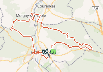

25 km | 32 km-effort


Benutzer GUIDE


Kostenlosegpshiking-Anwendung
 SityTrail
IGN / Geografische Institute
SityTrail World
Die Welt öffnet sich für Sie
Tour Wandern von 25 km verfügbar auf Île-de-France, Essonne, Milly-la-Forêt. Diese Tour wird von chessyca vorgeschlagen.
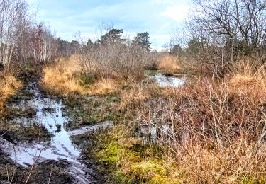
Jolie boucle un peu sportive effectuée avec neige et parfois verglas
De superbes passages dans les platières
superbe
Création Jean Luc


Wandern

Wandern

Wandern

Wandern
Zu Fuß

Zu Fuß

Wandern

Wandern

Wandern