![](/images/other/stat-length.png)
![Tour Wandern Marche-en-Famenne - Balade calestienne avec ancienne carrière St Rémy - Photo](https://media.geolcdn.com/t/1900/400/ext.pjpeg?maxdim=2&url=https%3A%2F%2Fstatic1.geolcdn.com%2Fsiteimages%2Fupload%2Ffiles%2F1553511878bg_sport_marche.png)
Balade calestienne avec ancienne carrière St Rémy
agneslaloux
Benutzer
![Länge](/images/other/stat-length.png)
Länge
7,2 km
![Maximale Höhe](https://static1.geolcdn.com/siteimages/upload/files/1508320355ic_sort_altitude_max_24dp.png)
Maximale Höhe
311 m
![Positive Höhendifferenz](https://static1.geolcdn.com/siteimages/upload/files/1508320355ic_sort_den_pos_24dp.png)
Positive Höhendifferenz
157 m
![Km-Effort](/images/other/stat-length.png)
Km-Effort
9,3 km
![Min. Höhe](https://static1.geolcdn.com/siteimages/upload/files/1508320355ic_sort_altitude_min_24dp.png)
Min. Höhe
205 m
![Negative Höhendifferenz](https://static1.geolcdn.com/siteimages/upload/files/1508320355ic_sort_den_neg_24dp.png)
Negative Höhendifferenz
158 m
![Boucle](https://static1.geolcdn.com/siteimages/upload/files/16400158638029165_repeat_loop_refresh_sync_direction_icon.png)
Boucle
Ja
Erstellungsdatum :
2021-02-11 19:24:37.668
Letzte Änderung :
2021-02-11 19:34:56.116
![Wandern](https://static1.geolcdn.com/sitytour/trail-icons/101.png)
2h06
Schwierigkeit : Medium
![Scannen Sie diesen QR-Code, um die Tour in der SityTrail-Anwendung zu öffnen](https://capi.geolives.com/qq0zvz2zws4bq2lad0pu/sitytour/trails/2667933/qr.png?size=200)
Kostenlosegpshiking-Anwendung
Über SityTrail
Tour Wandern von 7,2 km verfügbar auf Wallonien, Luxemburg, Marche-en-Famenne. Diese Tour wird von agneslaloux vorgeschlagen.
Beschreibung
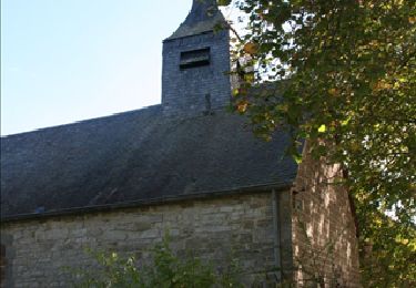
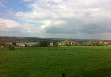
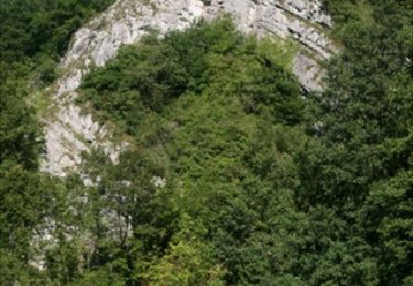
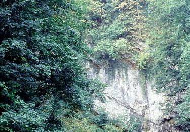
Départ Humain vers la station radioastronomie, Havrenne retour par le chemin St Rémy avec visite de l'ancienne carrière de marbre. Retour vers Humain
Ort
Land:
Belgium
Region :
Wallonien
Abteilung/Provinz :
Luxemburg
Kommune :
Marche-en-Famenne
Standort:
Humain
Gehen Sie:(Dec)
Gehen Sie:(UTM)
660985 ; 5563823 (31U) N.
Kommentare
Touren in der Umgebung
![Tour Wandern Rochefort - Havrenne & de Saint-Remy Trappist Abbey - Photo](https://media.geolcdn.com/t/375/260/ext.jpg?maxdim=2&url=https%3A%2F%2Fservices.sitytrail.com%2FGeolivesWS%2FDownloadMedia.ashx%3FTrailID%3D215623%26Media%3Db529a95c-404d-4caa-9c09-6087624067bf.tif)
![Wandern Wandern](https://static1.geolcdn.com/sitytour/trail-icons/101.png)
Havrenne & de Saint-Remy Trappist Abbey
Wandern
Einfach
(14)
Rochefort,
Wallonien,
Namur,
Belgium
![](/images/other/stat-length.png)
6 km | 7,1 km-effort
2h 0min
![](https://static1.geolcdn.com/siteimages/upload/files/16400158638029165_repeat_loop_refresh_sync_direction_icon.png)
Ja
![Tour Motor Rochefort - Car tour - Heritage : churches, chapels and abbeys - Rochefort - Photo](https://media.geolcdn.com/t/375/260/ext.jpg?maxdim=2&url=https%3A%2F%2Fservices.sitytrail.com%2FGeolivesWS%2FDownloadMedia.ashx%3FTrailID%3D153103%26Media%3D05603f1b-9f7c-481f-bc84-6cc819555dbb.jpg)
![Motor Motor](https://static1.geolcdn.com/sitytour/trail-icons/400.png)
Car tour - Heritage : churches, chapels and abbeys - Rochefort
Motor
Einfach
(5)
Rochefort,
Wallonien,
Namur,
Belgium
![](/images/other/stat-length.png)
65 km | 78 km-effort
2h 40min
![](https://static1.geolcdn.com/siteimages/upload/files/16400158638029165_repeat_loop_refresh_sync_direction_icon.png)
Ja
![Wandern Wandern](https://static1.geolcdn.com/sitytour/trail-icons/101.png)
GG2-Lu-34_Jemelle-Marche-en-Famenne (2021-11-04)
Wandern
Medium
(1)
Rochefort,
Wallonien,
Namur,
Belgium
![](/images/other/stat-length.png)
19,2 km | 24 km-effort
5h 32min
![](https://static1.geolcdn.com/siteimages/upload/files/16400158638029165_repeat_loop_refresh_sync_direction_icon.png)
Nein
![Tour Motor Rochefort - Car tour : History, ruins and castles - Rochefort - Photo](https://media.geolcdn.com/t/375/260/ext.jpg?maxdim=2&url=https%3A%2F%2Fservices.sitytrail.com%2FGeolivesWS%2FDownloadMedia.ashx%3FTrailID%3D151964%26Media%3D42d24ade-2ff4-4533-8bb8-6f4ece52f552.jpg)
![Motor Motor](https://static1.geolcdn.com/sitytour/trail-icons/400.png)
Car tour : History, ruins and castles - Rochefort
Motor
Einfach
(2)
Rochefort,
Wallonien,
Namur,
Belgium
![](/images/other/stat-length.png)
49 km | 60 km-effort
2h 20min
![](https://static1.geolcdn.com/siteimages/upload/files/16400158638029165_repeat_loop_refresh_sync_direction_icon.png)
Ja
![Tour Wandern Marche-en-Famenne - Aye chapelle + Gerny - Photo](https://media.geolcdn.com/t/375/260/ext.jpg?maxdim=2&url=https%3A%2F%2Fservices.sitytrail.com%2FGeolivesWS%2FDownloadMedia.ashx%3FTrailID%3D122579%26Media%3D20120420144516.jpg)
![Wandern Wandern](https://static1.geolcdn.com/sitytour/trail-icons/101.png)
Aye chapelle + Gerny
Wandern
Einfach
(3)
Marche-en-Famenne,
Wallonien,
Luxemburg,
Belgium
![](/images/other/stat-length.png)
6,6 km | 8,1 km-effort
1h 33min
![](https://static1.geolcdn.com/siteimages/upload/files/16400158638029165_repeat_loop_refresh_sync_direction_icon.png)
Nein
![Tour Wandern Marche-en-Famenne - Humain -Serinchamps - Photo](https://media.geolcdn.com/t/375/260/ext.jpg?maxdim=2&url=https%3A%2F%2Fservices.sitytrail.com%2FGeolivesWS%2FDownloadMedia.ashx%3FTrailID%3D611526%26Media%3Dfix__20160809153034.jpg)
![Wandern Wandern](https://static1.geolcdn.com/sitytour/trail-icons/101.png)
Humain -Serinchamps
Wandern
Sehr leicht
(3)
Marche-en-Famenne,
Wallonien,
Luxemburg,
Belgium
![](/images/other/stat-length.png)
9,9 km | 12,3 km-effort
1h 47min
![](https://static1.geolcdn.com/siteimages/upload/files/16400158638029165_repeat_loop_refresh_sync_direction_icon.png)
Ja
![Tour Fahrrad Rochefort - Nature - Cycle tour discovering Rochefort and the villages of Eprave, Lessive and Villers - Photo](https://media.geolcdn.com/t/375/260/ext.jpg?maxdim=2&url=https%3A%2F%2Fservices.sitytrail.com%2FGeolivesWS%2FDownloadMedia.ashx%3FTrailID%3D199291%26Media%3D15dd4efb-10a0-4ba4-87c1-30a3a9be99bf.JPG)
![Fahrrad Fahrrad](https://static1.geolcdn.com/sitytour/trail-icons/200.png)
Nature - Cycle tour discovering Rochefort and the villages of Eprave, Lessive...
Fahrrad
Einfach
(3)
Rochefort,
Wallonien,
Namur,
Belgium
![](/images/other/stat-length.png)
23 km | 26 km-effort
2h 0min
![](https://static1.geolcdn.com/siteimages/upload/files/16400158638029165_repeat_loop_refresh_sync_direction_icon.png)
Ja
![Tour Motor Rochefort - Car - Nature - Discovering the stones - Rochefort - Photo](https://media.geolcdn.com/t/375/260/ext.jpg?maxdim=2&url=https%3A%2F%2Fservices.sitytrail.com%2FGeolivesWS%2FDownloadMedia.ashx%3FTrailID%3D151960%26Media%3D5c8b813d-8d98-4afc-a42b-ee920e93b389.jpg)
![Motor Motor](https://static1.geolcdn.com/sitytour/trail-icons/400.png)
Car - Nature - Discovering the stones - Rochefort
Motor
Einfach
(3)
Rochefort,
Wallonien,
Namur,
Belgium
![](/images/other/stat-length.png)
52 km | 64 km-effort
2h 0min
![](https://static1.geolcdn.com/siteimages/upload/files/16400158638029165_repeat_loop_refresh_sync_direction_icon.png)
Ja
![Tour Reiten Rochefort - SityTrail - Rochefort - Photo](https://media.geolcdn.com/t/375/260/ext.jpg?maxdim=2&url=https%3A%2F%2Fstatic1.geolcdn.com%2Fsiteimages%2Fupload%2Ffiles%2F1524743154cheval.jpg)
![Reiten Reiten](https://static1.geolcdn.com/sitytour/trail-icons/301.png)
SityTrail - Rochefort
Reiten
Einfach
(1)
Rochefort,
Wallonien,
Namur,
Belgium
![](/images/other/stat-length.png)
11,7 km | 14,6 km-effort
1h 54min
![](https://static1.geolcdn.com/siteimages/upload/files/16400158638029165_repeat_loop_refresh_sync_direction_icon.png)
Ja