![](/images/other/stat-length.png)
![Tour Wandern Hannut - 2021-02-11_10h34m30_Cirkwi-Promenade_des_Betteraves - Photo](https://media.geolcdn.com/t/1900/400/ext.pjpeg?maxdim=2&url=https%3A%2F%2Fstatic1.geolcdn.com%2Fsiteimages%2Fupload%2Ffiles%2F1553511878bg_sport_marche.png)
2021-02-11_10h34m30_Cirkwi-Promenade_des_Betteraves
PhilippeetEvelyne
Benutzer
![Länge](/images/other/stat-length.png)
![Maximale Höhe](https://static1.geolcdn.com/siteimages/upload/files/1508320355ic_sort_altitude_max_24dp.png)
![Positive Höhendifferenz](https://static1.geolcdn.com/siteimages/upload/files/1508320355ic_sort_den_pos_24dp.png)
![Km-Effort](/images/other/stat-length.png)
![Min. Höhe](https://static1.geolcdn.com/siteimages/upload/files/1508320355ic_sort_altitude_min_24dp.png)
![Negative Höhendifferenz](https://static1.geolcdn.com/siteimages/upload/files/1508320355ic_sort_den_neg_24dp.png)
![Boucle](https://static1.geolcdn.com/siteimages/upload/files/16400158638029165_repeat_loop_refresh_sync_direction_icon.png)
![Wandern](https://static1.geolcdn.com/sitytour/trail-icons/101.png)
2h18
Schwierigkeit : Sehr leicht
![Scannen Sie diesen QR-Code, um die Tour in der SityTrail-Anwendung zu öffnen](https://capi.geolives.com/qq0zvz2zws4bq2lad0pu/sitytour/trails/2667140/qr.png?size=200)
Kostenlosegpshiking-Anwendung
Über SityTrail
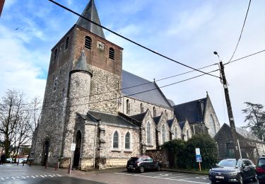
Tour Wandern von 9,4 km verfügbar auf Wallonien, Lüttich, Hannut. Diese Tour wird von PhilippeetEvelyne vorgeschlagen.
Beschreibung
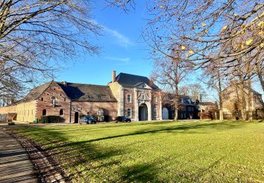
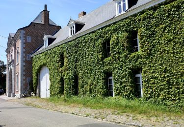
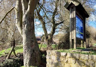
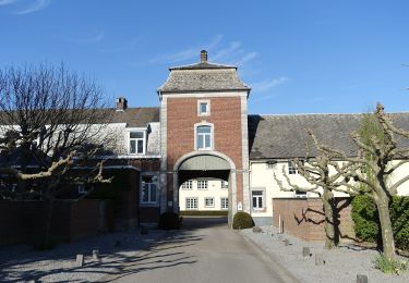
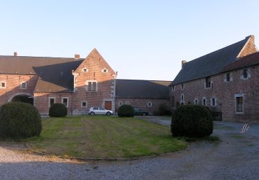
Au coeur de la Hesbaye, majoritairement sur des chemins revêtus faciles, la promenade commence à Poucet et relie ce village à Trognée et Cras-Avernas. La betterave est à l’honneur lors de ce parcours non seulement parce qu’à travers des cheminements calmes dans les vastes champs hesbignons, il permet de découvrir d’impressionnantes fermes en carré typiques mais aussi parce que c’est à Cras-Avernas qu’est née une des premières sucreries en Belgique. Jusqu’en 1976, Trognée a hébergé une des plus importantes sucreries de la région.
Ort
Kommentare
Touren in der Umgebung
![Tour Wandern Hannut - La Balade des Chevées - Photo](https://media.geolcdn.com/t/375/260/c40a8656-229d-4d2b-8925-ffea50baaa2d.jpeg&format=jpg&maxdim=2)
![Wandern Wandern](https://static1.geolcdn.com/sitytour/trail-icons/101.png)
Wandern
![](/images/other/stat-length.png)
![](https://static1.geolcdn.com/siteimages/upload/files/16400158638029165_repeat_loop_refresh_sync_direction_icon.png)
![Tour Wandern Geer - Promenade le long du Geer et réserve - Photo](https://media.geolcdn.com/t/375/260/4fc37dda-e21b-43f8-a27a-3af14e8a0d8e.jpg&format=jpg&maxdim=2)
![Wandern Wandern](https://static1.geolcdn.com/sitytour/trail-icons/101.png)
Wandern
![](/images/other/stat-length.png)
![](https://static1.geolcdn.com/siteimages/upload/files/16400158638029165_repeat_loop_refresh_sync_direction_icon.png)
![Tour Wandern Hannut - La balade des chevées (5km) - Photo](https://media.geolcdn.com/t/375/260/4f5eaa7c-e24d-4247-898f-e668713f7776.jpg&format=jpg&maxdim=2)
![Wandern Wandern](https://static1.geolcdn.com/sitytour/trail-icons/101.png)
Wandern
![](/images/other/stat-length.png)
![](https://static1.geolcdn.com/siteimages/upload/files/16400158638029165_repeat_loop_refresh_sync_direction_icon.png)
![Tour Wandern Hannut - La promenade de la Mouhagne - Photo](https://media.geolcdn.com/t/375/260/992bf509-1491-4136-a1e0-5816e773d65e.jpg&format=jpg&maxdim=2)
![Wandern Wandern](https://static1.geolcdn.com/sitytour/trail-icons/101.png)
Wandern
![](/images/other/stat-length.png)
![](https://static1.geolcdn.com/siteimages/upload/files/16400158638029165_repeat_loop_refresh_sync_direction_icon.png)
![Tour Zu Fuß Geer - Promenade des Peupliers - Photo](https://media.geolcdn.com/t/375/260/f68fd01a-6493-4bfb-8eb0-00aa4284b467.jpeg&format=jpg&maxdim=2)
![Zu Fuß Zu Fuß](https://static1.geolcdn.com/sitytour/trail-icons/100.png)
Zu Fuß
![](/images/other/stat-length.png)
![](https://static1.geolcdn.com/siteimages/upload/files/16400158638029165_repeat_loop_refresh_sync_direction_icon.png)
![Tour Zu Fuß Geer - Promenade du Geer - Photo](https://media.geolcdn.com/t/375/260/b73edfb0-f782-4f6f-af6c-98fa8486e229.jpeg&format=jpg&maxdim=2)
![Zu Fuß Zu Fuß](https://static1.geolcdn.com/sitytour/trail-icons/100.png)
Zu Fuß
![](/images/other/stat-length.png)
![](https://static1.geolcdn.com/siteimages/upload/files/16400158638029165_repeat_loop_refresh_sync_direction_icon.png)
![Tour Wandern Hannut - moxhe reco 12 24 - Photo](https://media.geolcdn.com/t/375/260/2db83a1f-4d18-411e-bd9b-93a1f35a27cd.jpg&format=jpg&maxdim=2)
![Wandern Wandern](https://static1.geolcdn.com/sitytour/trail-icons/101.png)
Wandern
![](/images/other/stat-length.png)
![](https://static1.geolcdn.com/siteimages/upload/files/16400158638029165_repeat_loop_refresh_sync_direction_icon.png)
![Tour Wandern Hannut - Hannut R3 - Photo](https://media.geolcdn.com/t/375/260/351999e5-0250-48b0-befe-e572848e7b6f.jpeg&format=jpg&maxdim=2)
![Wandern Wandern](https://static1.geolcdn.com/sitytour/trail-icons/101.png)
![Tour Wandern Hannut - Hannut R2 - Photo](https://media.geolcdn.com/t/375/260/9358d202-85bd-4dba-8039-3673f9a4abc1.jpeg&format=jpg&maxdim=2)
![Wandern Wandern](https://static1.geolcdn.com/sitytour/trail-icons/101.png)