![](/images/other/stat-length.png)
![Tour Wandern Sainte-Luce - Corps de Garde Bernard en boucle - Photo](https://media.geolcdn.com/t/1900/400/3abfd57a-361b-41c2-8a0b-05dcd1dd9f62.jpg&format=pjpeg&maxdim=2)
Corps de Garde Bernard en boucle
PIERRELOUIS ALEX
Benutzer
![Länge](/images/other/stat-length.png)
Länge
9,3 km
![Maximale Höhe](https://static1.geolcdn.com/siteimages/upload/files/1508320355ic_sort_altitude_max_24dp.png)
Maximale Höhe
109 m
![Positive Höhendifferenz](https://static1.geolcdn.com/siteimages/upload/files/1508320355ic_sort_den_pos_24dp.png)
Positive Höhendifferenz
171 m
![Km-Effort](/images/other/stat-length.png)
Km-Effort
11,6 km
![Min. Höhe](https://static1.geolcdn.com/siteimages/upload/files/1508320355ic_sort_altitude_min_24dp.png)
Min. Höhe
4 m
![Negative Höhendifferenz](https://static1.geolcdn.com/siteimages/upload/files/1508320355ic_sort_den_neg_24dp.png)
Negative Höhendifferenz
171 m
![Boucle](https://static1.geolcdn.com/siteimages/upload/files/16400158638029165_repeat_loop_refresh_sync_direction_icon.png)
Boucle
Ja
Erstellungsdatum :
2021-01-20 11:29:56.492
Letzte Änderung :
2021-01-20 14:07:32.379
![Wandern](https://static1.geolcdn.com/sitytour/trail-icons/101.png)
3h00
Schwierigkeit : Medium
![Scannen Sie diesen QR-Code, um die Tour in der SityTrail-Anwendung zu öffnen](https://capi.geolives.com/qq0zvz2zws4bq2lad0pu/sitytour/trails/2646236/qr.png?size=200)
Kostenlosegpshiking-Anwendung
Über SityTrail
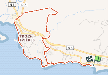
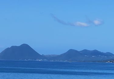
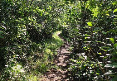
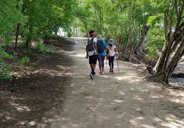
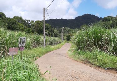
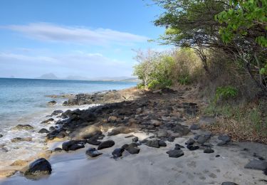
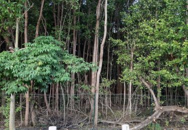
Tour Wandern von 9,3 km verfügbar auf Martinique, Unbekannt, Sainte-Luce. Diese Tour wird von PIERRELOUIS ALEX vorgeschlagen.
Beschreibung
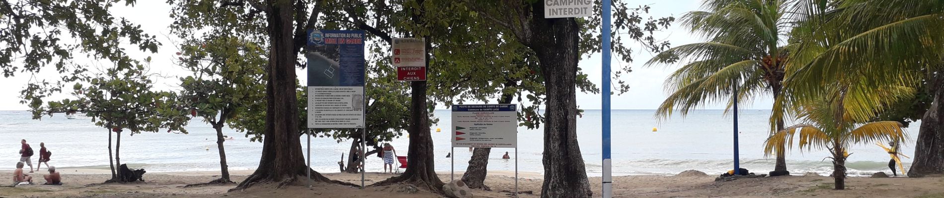
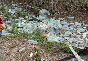
attention au passage de la Ravine St Pierre par temps de grosse pluie
Ort
Land:
France
Region :
Martinique
Abteilung/Provinz :
Unbekannt
Kommune :
Sainte-Luce
Standort:
Unknown
Gehen Sie:(Dec)
Gehen Sie:(UTM)
721856 ; 1600285 (20P) N.
Kommentare
Touren in der Umgebung
![Tour Wandern Sainte-Luce - Plage de Ste Luce, parcours santé - Photo](https://media.geolcdn.com/t/375/260/4fb4e361-9aca-4b4b-89b9-80472ef4145a.jpg&format=jpg&maxdim=2)
![Wandern Wandern](https://static1.geolcdn.com/sitytour/trail-icons/101.png)
Plage de Ste Luce, parcours santé
Wandern
Einfach
Sainte-Luce,
Martinique,
Unbekannt,
France
![](/images/other/stat-length.png)
3,9 km | 4,4 km-effort
1h 1min
![](https://static1.geolcdn.com/siteimages/upload/files/16400158638029165_repeat_loop_refresh_sync_direction_icon.png)
Nein
![Tour Wandern Sainte-Luce - plages du littoral de ste Luce - Photo](https://media.geolcdn.com/t/375/260/67e2d861-2331-4366-b550-056f13e44743.jpg&format=jpg&maxdim=2)
![Wandern Wandern](https://static1.geolcdn.com/sitytour/trail-icons/101.png)
plages du littoral de ste Luce
Wandern
Medium
Sainte-Luce,
Martinique,
Unbekannt,
France
![](/images/other/stat-length.png)
5,7 km | 6,3 km-effort
1h 20min
![](https://static1.geolcdn.com/siteimages/upload/files/16400158638029165_repeat_loop_refresh_sync_direction_icon.png)
Ja
![Tour Wandern Rivière-Pilote - Escapade sur la cote rocheuses de pointe Borgnèse. - Photo](https://media.geolcdn.com/t/375/260/d844497e-dd48-4a75-95e9-00ab38ecc33c.jpg&format=jpg&maxdim=2)
![Wandern Wandern](https://static1.geolcdn.com/sitytour/trail-icons/101.png)
Escapade sur la cote rocheuses de pointe Borgnèse.
Wandern
Medium
(2)
Rivière-Pilote,
Martinique,
Unbekannt,
France
![](/images/other/stat-length.png)
5,7 km | 6,7 km-effort
3h 33min
![](https://static1.geolcdn.com/siteimages/upload/files/16400158638029165_repeat_loop_refresh_sync_direction_icon.png)
Ja
![Tour Wandern Le Marin - La grande aventure, pointe borgnes, petite poterie et Anse figuier - Photo](https://media.geolcdn.com/t/375/260/dcc66156-9b48-42e7-9d37-4996c15cca9d.jpg&format=jpg&maxdim=2)
![Wandern Wandern](https://static1.geolcdn.com/sitytour/trail-icons/101.png)
La grande aventure, pointe borgnes, petite poterie et Anse figuier
Wandern
Medium
Le Marin,
Martinique,
Unbekannt,
France
![](/images/other/stat-length.png)
5,4 km | 6,4 km-effort
2h 48min
![](https://static1.geolcdn.com/siteimages/upload/files/16400158638029165_repeat_loop_refresh_sync_direction_icon.png)
Ja
![Tour Wandern Sainte-Luce - Boucle Corps de Garde - Photo](https://media.geolcdn.com/t/375/260/26d1b830-7b26-4045-a675-9d33e5758a8f.jpg&format=jpg&maxdim=2)
![Wandern Wandern](https://static1.geolcdn.com/sitytour/trail-icons/101.png)
Boucle Corps de Garde
Wandern
Einfach
Sainte-Luce,
Martinique,
Unbekannt,
France
![](/images/other/stat-length.png)
5,2 km | 5,8 km-effort
2h 14min
![](https://static1.geolcdn.com/siteimages/upload/files/16400158638029165_repeat_loop_refresh_sync_direction_icon.png)
Ja
![Tour Wandern Rivière-Pilote - Anse Figuier - Petite Poterie - Photo](https://media.geolcdn.com/t/375/260/d13c17cb-0195-44ec-9e9f-787363935290.jpg&format=jpg&maxdim=2)
![Wandern Wandern](https://static1.geolcdn.com/sitytour/trail-icons/101.png)
Anse Figuier - Petite Poterie
Wandern
Medium
Rivière-Pilote,
Martinique,
Unbekannt,
France
![](/images/other/stat-length.png)
3,6 km | 4,1 km-effort
4h 56min
![](https://static1.geolcdn.com/siteimages/upload/files/16400158638029165_repeat_loop_refresh_sync_direction_icon.png)
Nein
![Tour Wandern Rivière-Pilote - Boucle La Mauny via Morne Vent - Photo](https://media.geolcdn.com/t/375/260/5590a3dc-f0fb-4f70-ac76-325f380ea4ec.jpg&format=jpg&maxdim=2)
![Wandern Wandern](https://static1.geolcdn.com/sitytour/trail-icons/101.png)
Boucle La Mauny via Morne Vent
Wandern
Schwierig
Rivière-Pilote,
Martinique,
Unbekannt,
France
![](/images/other/stat-length.png)
10,7 km | 16,4 km-effort
4h 0min
![](https://static1.geolcdn.com/siteimages/upload/files/16400158638029165_repeat_loop_refresh_sync_direction_icon.png)
Ja
![Tour Wandern Rivière-Pilote - Anse figuier, pointe Borgnese. - Photo](https://media.geolcdn.com/t/375/260/82ab334c-2896-4bf3-b86c-4cf52b057312.jpg&format=jpg&maxdim=2)
![Wandern Wandern](https://static1.geolcdn.com/sitytour/trail-icons/101.png)
Anse figuier, pointe Borgnese.
Wandern
Sehr leicht
Rivière-Pilote,
Martinique,
Unbekannt,
France
![](/images/other/stat-length.png)
3,7 km | 4,7 km-effort
1h 7min
![](https://static1.geolcdn.com/siteimages/upload/files/16400158638029165_repeat_loop_refresh_sync_direction_icon.png)
Ja
![Tour Wandern Sainte-Luce - fond Larion Plage de desert - Photo](https://media.geolcdn.com/t/375/260/66d5ec91-ffd1-4df1-bf0c-5ef46cd79d56.jpg&format=jpg&maxdim=2)
![Wandern Wandern](https://static1.geolcdn.com/sitytour/trail-icons/101.png)
fond Larion Plage de desert
Wandern
Sehr leicht
Sainte-Luce,
Martinique,
Unbekannt,
France
![](/images/other/stat-length.png)
6 km | 6,7 km-effort
1h 24min
![](https://static1.geolcdn.com/siteimages/upload/files/16400158638029165_repeat_loop_refresh_sync_direction_icon.png)
Ja