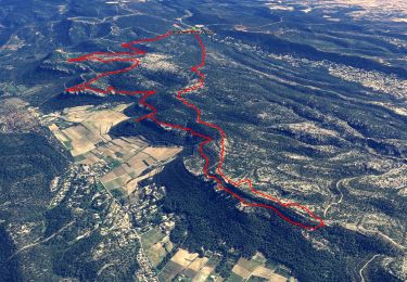
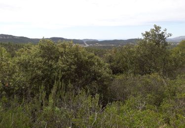
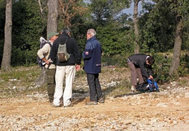
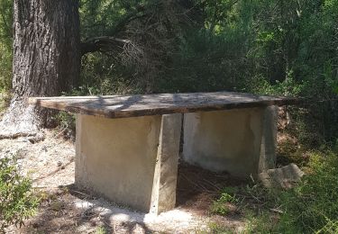
Tour Wandern Roquefort-la-Bédoule - Rochefort la Bedoule - Font Blanche - Photo
 soca
soca

Benutzer

© OpenStreetMap contributors
Länge
Länge
9,4 km
Maximale Höhe
Maximale Höhe
560 m
Positive Höhendifferenz
348 m
Km-Effort
Km-Effort  
14,1 km
Min. Höhe
Min. Höhe
276 m
Negative Höhendifferenz
350 m
Boucle
Boucle
Ja
Erstellungsdatum :
2021-01-19 15:45:49.963
Letzte Änderung :
2021-01-19 15:49:50.419

(0 Nachricht)

Wandern
Wandern
3h30
Schwierigkeit : Medium

Scannen Sie diesen QR-Code, um die Tour in der SityTrail-Anwendung zu öffnen

Kostenlosegpshiking-Anwendung

Logo SityTrail SityTrail

IGN / Geografische Institute

SityTrail aus dem App Store herunterladen SityTrail von Google Play herunterladen

Logo SityTrail SityTrail World

Die Welt öffnet sich für Sie

SityTrail aus dem App Store herunterladen SityTrail von Google Play herunterladen SityTrail auf Huawei AppGallery herunterladen

Über SityTrail

Tour Wandern von 9,4 km verfügbar auf Provence-Alpes-Côte d'Azur, Bouches-du-Rhône, Roquefort-la-Bédoule. Diese Tour wird von soca vorgeschlagen.

Beschreibung

Le grand Caunet - Font Blanche - GR 98 - Le Montonnier - retour

Höhenprofil

Ort

Land:
France
Region :
Provence-Alpes-Côte d'Azur
Abteilung/Provinz :
Bouches-du-Rhône
Kommune :
Roquefort-la-Bédoule
Standort:
Unknown
Gehen Sie:(UTM)
716857 ; 4790362 (31T) N.

Touren in der Umgebung

Tour Wandern Roquefort-la-Bédoule - Grand Caunet, le Montounier - Photo
Wandern
GUIDE
affinetataille

Wandern

Medium
(1)
Roquefort-la-Bédoule, Provence-Alpes-Côte d'Azur, Bouches-du-Rhône, France
16,5 km | 24 km-effort
6h 0min
Ja
Tour Wandern Ceyreste - Autour du Montounier 2eme version - Photo
Wandern
GUIDE
affinetataille

Wandern

Medium
(1)
Ceyreste, Provence-Alpes-Côte d'Azur, Bouches-du-Rhône, France
15,7 km | 24 km-effort
6h 0min
Ja
Tour Wandern Roquefort-la-Bédoule - SityTrail - Grand Caunet, Cabanons, Vigie , Grotte Raymond, Ruines roquefort, Chapelle St andré - Photo
Wandern
GUIDE
affinetataille

Wandern

Einfach
(1)
Roquefort-la-Bédoule, Provence-Alpes-Côte d'Azur, Bouches-du-Rhône, France
14,2 km | 19,9 km-effort
6h 0min
Ja
Tour Wandern Le Castellet - SityTrail - 2361987 - begude - Photo
Wandern
GUIDE
affinetataille

Wandern

Medium
(1)
Le Castellet, Provence-Alpes-Côte d'Azur, Var, France
11,5 km | 15,1 km-effort
4h 0min
Ja
Tour Wandern Roquefort-la-Bédoule - la petite sainte baume - Photo
Wandern
Coryphene

Wandern

Einfach
(1)
Roquefort-la-Bédoule, Provence-Alpes-Côte d'Azur, Bouches-du-Rhône, France
13,9 km | 19,3 km-effort
5h 37min
Ja
Tour Wandern Roquefort-la-Bédoule - Barres de Font Blanche - Photo
Wandern
tracegps

Wandern

Medium
(1)
Roquefort-la-Bédoule, Provence-Alpes-Côte d'Azur, Bouches-du-Rhône, France
10,3 km | 14,4 km-effort
2h 19min
Ja
Tour Nordic Walking La Cadière-d'Azur - 20220329_La Cadière d'Azur - Photo
Nordic Walking
Marcsaintcyr

Nordic Walking

Sehr leicht
(1)
La Cadière-d'Azur, Provence-Alpes-Côte d'Azur, Var, France
6,8 km | 8,6 km-effort
1h 30min
Ja
Tour Nordic Walking La Cadière-d'Azur - 20220329_La Cadière d'Azur - Photo
Nordic Walking
Marcsaintcyr

Nordic Walking

Sehr leicht
(1)
La Cadière-d'Azur, Provence-Alpes-Côte d'Azur, Var, France
6,8 km | 8,6 km-effort
1h 30min
Ja
Tour Wandern Cuges-les-Pins - cuges barres de castillon OK coral - Photo
Wandern
michelpaulin

Wandern

Medium
(1)
Cuges-les-Pins, Provence-Alpes-Côte d'Azur, Bouches-du-Rhône, France
10,9 km | 14,9 km-effort
5h 54min
Ja


Schließen
Meine Abonnements