![](/images/other/stat-length.png)
![Tour Wandern Saint-Amand-les-Eaux - Mesnil. st Amand - Photo](https://media.geolcdn.com/t/1900/400/8721f904-61d7-45b4-8ccf-882922ad0ed2.jpg&format=pjpeg&maxdim=2)
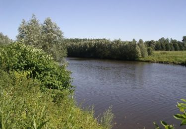
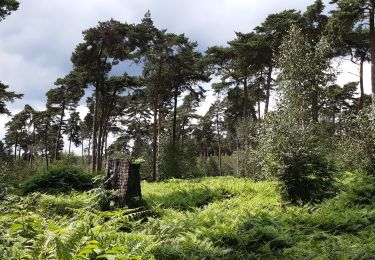
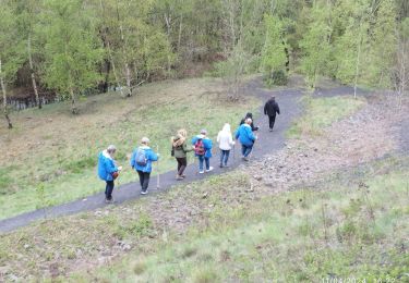
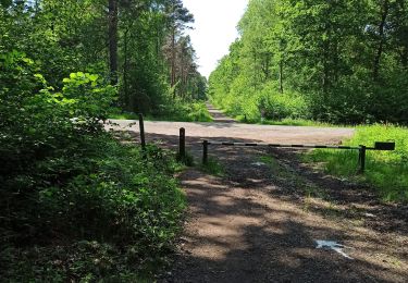
Mesnil. st Amand
papiou
Benutzer
![Länge](/images/other/stat-length.png)
Länge
8,5 km
![Maximale Höhe](https://static1.geolcdn.com/siteimages/upload/files/1508320355ic_sort_altitude_max_24dp.png)
Maximale Höhe
53 m
![Positive Höhendifferenz](https://static1.geolcdn.com/siteimages/upload/files/1508320355ic_sort_den_pos_24dp.png)
Positive Höhendifferenz
80 m
![Km-Effort](/images/other/stat-length.png)
Km-Effort
9,6 km
![Min. Höhe](https://static1.geolcdn.com/siteimages/upload/files/1508320355ic_sort_altitude_min_24dp.png)
Min. Höhe
19 m
![Negative Höhendifferenz](https://static1.geolcdn.com/siteimages/upload/files/1508320355ic_sort_den_neg_24dp.png)
Negative Höhendifferenz
80 m
![Boucle](https://static1.geolcdn.com/siteimages/upload/files/16400158638029165_repeat_loop_refresh_sync_direction_icon.png)
Boucle
Ja
Erstellungsdatum :
2021-01-19 12:51:01.789
Letzte Änderung :
2021-01-19 15:08:16.539
![Wandern](https://static1.geolcdn.com/sitytour/trail-icons/101.png)
1h28
Schwierigkeit : Einfach
![Scannen Sie diesen QR-Code, um die Tour in der SityTrail-Anwendung zu öffnen](https://capi.geolives.com/qq0zvz2zws4bq2lad0pu/sitytour/trails/2645471/qr.png?size=200)
Kostenlosegpshiking-Anwendung
Über SityTrail
Tour Wandern von 8,5 km verfügbar auf Nordfrankreich, Nord, Saint-Amand-les-Eaux. Diese Tour wird von papiou vorgeschlagen.
Beschreibung
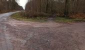
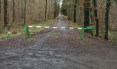
rdv parking carrefour Mesnil (interrogé allée des hêtres-dreve de raismes) puis prendre dreve petit bouze pour rejoindre MF de suchemont puis coucou et revenir par dreve Notre dame en passant par étoiles suchemont et Cernay pour finir BB rose
Ort
Land:
France
Region :
Nordfrankreich
Abteilung/Provinz :
Nord
Kommune :
Saint-Amand-les-Eaux
Standort:
Unknown
Gehen Sie:(Dec)
Gehen Sie:(UTM)
534197 ; 5586850 (31U) N.
Kommentare
Touren in der Umgebung
![Tour Wandern Raismes - Circuit du Terril de Sabatier - Photo](https://media.geolcdn.com/t/375/260/ext.jpg?maxdim=2&url=https%3A%2F%2Fservices.sitytrail.com%2FGeolivesWS%2FDownloadMedia.ashx%3FTrailID%3D479716%26Media%3D781031eb-7ab3-4c80-8a0c-0836d5a81ce2.JPG)
![Wandern Wandern](https://static1.geolcdn.com/sitytour/trail-icons/101.png)
Circuit du Terril de Sabatier
Wandern
Einfach
(1)
Raismes,
Nordfrankreich,
Nord,
France
![](/images/other/stat-length.png)
13 km | 14,9 km-effort
2h 34min
![](https://static1.geolcdn.com/siteimages/upload/files/16400158638029165_repeat_loop_refresh_sync_direction_icon.png)
Ja
![Tour Wandern Hergnies - Entre terre et eaux - Hergnies - Photo](https://media.geolcdn.com/t/375/260/ext.jpg?maxdim=2&url=https%3A%2F%2Fservices.sitytrail.com%2FGeolivesWS%2FDownloadMedia.ashx%3FTrailID%3D111915%26Media%3D8943_6.jpg)
![Wandern Wandern](https://static1.geolcdn.com/sitytour/trail-icons/101.png)
Entre terre et eaux - Hergnies
Wandern
Schwierig
(2)
Hergnies,
Nordfrankreich,
Nord,
France
![](/images/other/stat-length.png)
13,2 km | 13,9 km-effort
3h 19min
![](https://static1.geolcdn.com/siteimages/upload/files/16400158638029165_repeat_loop_refresh_sync_direction_icon.png)
Ja
![Tour Wandern Raismes - Mare à Goriaux - Photo](https://media.geolcdn.com/t/375/260/cb4184f6-3666-47fb-a89a-0644abab2b32.jpg&format=jpg&maxdim=2)
![Wandern Wandern](https://static1.geolcdn.com/sitytour/trail-icons/101.png)
Mare à Goriaux
Wandern
Medium
Raismes,
Nordfrankreich,
Nord,
France
![](/images/other/stat-length.png)
21 km | 23 km-effort
4h 28min
![](https://static1.geolcdn.com/siteimages/upload/files/16400158638029165_repeat_loop_refresh_sync_direction_icon.png)
Ja
![Tour Wandern Raismes - Terril du lavoir Rousseau - Photo](https://media.geolcdn.com/t/375/260/55636772-211b-4a0e-95d1-d18ad30169e0.jpg&format=jpg&maxdim=2)
![Wandern Wandern](https://static1.geolcdn.com/sitytour/trail-icons/101.png)
Terril du lavoir Rousseau
Wandern
Medium
Raismes,
Nordfrankreich,
Nord,
France
![](/images/other/stat-length.png)
5,7 km | 7,2 km-effort
2h 7min
![](https://static1.geolcdn.com/siteimages/upload/files/16400158638029165_repeat_loop_refresh_sync_direction_icon.png)
Ja
![Tour Wandern Saint-Amand-les-Eaux - terril vicoigne - Photo](https://media.geolcdn.com/t/375/260/d8552856-5959-4bc8-a6d2-93f721ca17ec.jpg&format=jpg&maxdim=2)
![Wandern Wandern](https://static1.geolcdn.com/sitytour/trail-icons/101.png)
terril vicoigne
Wandern
Einfach
(1)
Saint-Amand-les-Eaux,
Nordfrankreich,
Nord,
France
![](/images/other/stat-length.png)
8,7 km | 9,7 km-effort
2h 0min
![](https://static1.geolcdn.com/siteimages/upload/files/16400158638029165_repeat_loop_refresh_sync_direction_icon.png)
Ja
![Tour Wandern Raismes - terril du lavoir rousseau - Photo](https://media.geolcdn.com/t/375/260/2a750bf1-1f0f-4ec6-9f4d-4d916d2a14af.jpg&format=jpg&maxdim=2)
![Wandern Wandern](https://static1.geolcdn.com/sitytour/trail-icons/101.png)
terril du lavoir rousseau
Wandern
Medium
Raismes,
Nordfrankreich,
Nord,
France
![](/images/other/stat-length.png)
7,5 km | 9,3 km-effort
2h 0min
![](https://static1.geolcdn.com/siteimages/upload/files/16400158638029165_repeat_loop_refresh_sync_direction_icon.png)
Ja
![Tour Wandern Saint-Amand-les-Eaux - notre dame d'amour(NDA), propose par VDN - Photo](https://media.geolcdn.com/t/375/260/630cd120-0ef0-4a83-86e7-91e6331d9f35.jpg&format=jpg&maxdim=2)
![Wandern Wandern](https://static1.geolcdn.com/sitytour/trail-icons/101.png)
notre dame d'amour(NDA), propose par VDN
Wandern
Medium
Saint-Amand-les-Eaux,
Nordfrankreich,
Nord,
France
![](/images/other/stat-length.png)
9,7 km | 10,6 km-effort
2h 16min
![](https://static1.geolcdn.com/siteimages/upload/files/16400158638029165_repeat_loop_refresh_sync_direction_icon.png)
Ja
![Tour Wandern Raismes - variante de la course des terrils - Photo](https://media.geolcdn.com/t/375/260/f1af6116-6469-445b-a358-4f5a4f22ced7.jpg&format=jpg&maxdim=2)
![Wandern Wandern](https://static1.geolcdn.com/sitytour/trail-icons/101.png)
variante de la course des terrils
Wandern
Medium
(1)
Raismes,
Nordfrankreich,
Nord,
France
![](/images/other/stat-length.png)
8,8 km | 10 km-effort
2h 10min
![](https://static1.geolcdn.com/siteimages/upload/files/16400158638029165_repeat_loop_refresh_sync_direction_icon.png)
Ja
![Tour Wandern Wallers - Mare goraux - Photo](https://media.geolcdn.com/t/375/260/82eaa7c8-ae6a-4094-92a3-48d31e49731d.jpg&format=jpg&maxdim=2)
![Wandern Wandern](https://static1.geolcdn.com/sitytour/trail-icons/101.png)