![](/images/other/stat-length.png)
![Tour Wandern Monoblet - autour de Monoblet par Gourgas - Photo](https://media.geolcdn.com/t/1900/400/ext.pjpeg?maxdim=2&url=https%3A%2F%2Fservices.sitytrail.com%2FGeolivesWS%2FDownloadMedia.ashx%3FTrailID%3D264192%26Media%3D20140407103722.jpg)
autour de Monoblet par Gourgas
genevieve
Benutzer
![Länge](/images/other/stat-length.png)
Länge
12 km
![Maximale Höhe](https://static1.geolcdn.com/siteimages/upload/files/1508320355ic_sort_altitude_max_24dp.png)
Maximale Höhe
392 m
![Positive Höhendifferenz](https://static1.geolcdn.com/siteimages/upload/files/1508320355ic_sort_den_pos_24dp.png)
Positive Höhendifferenz
271 m
![Km-Effort](/images/other/stat-length.png)
Km-Effort
15,7 km
![Min. Höhe](https://static1.geolcdn.com/siteimages/upload/files/1508320355ic_sort_altitude_min_24dp.png)
Min. Höhe
200 m
![Negative Höhendifferenz](https://static1.geolcdn.com/siteimages/upload/files/1508320355ic_sort_den_neg_24dp.png)
Negative Höhendifferenz
272 m
![Boucle](https://static1.geolcdn.com/siteimages/upload/files/16400158638029165_repeat_loop_refresh_sync_direction_icon.png)
Boucle
Ja
Erstellungsdatum :
2014-12-10 00:00:00.0
Letzte Änderung :
2014-12-10 00:00:00.0
![Wandern](https://static1.geolcdn.com/sitytour/trail-icons/101.png)
3h22
Schwierigkeit : Medium
![Scannen Sie diesen QR-Code, um die Tour in der SityTrail-Anwendung zu öffnen](https://capi.geolives.com/qq0zvz2zws4bq2lad0pu/sitytour/trails/264192/qr.png?size=200)
Kostenlosegpshiking-Anwendung
Über SityTrail
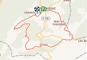
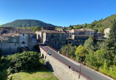
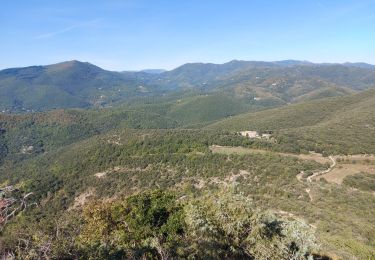
Tour Wandern von 12 km verfügbar auf Okzitanien, Gard, Monoblet. Diese Tour wird von genevieve vorgeschlagen.
Beschreibung
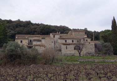
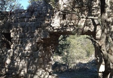
Belle randonnée sans difficulté autour des jumelles et à l'ombre des ruines du château de Fressac. A Gourgas, faire attention pas de sentier balisé mais plus sauvage et de belles vues sur l'autre vallée
Ort
Land:
France
Region :
Okzitanien
Abteilung/Provinz :
Gard
Kommune :
Monoblet
Standort:
Unknown
Gehen Sie:(Dec)
Gehen Sie:(UTM)
570833 ; 4872057 (31T) N.
Kommentare
Touren in der Umgebung
![Tour Wandern Lasalle - Lasalle (la Salendrinque) - Photo](https://media.geolcdn.com/t/375/260/ext.jpg?maxdim=2&url=https%3A%2F%2Fstatic1.geolcdn.com%2Fsiteimages%2Fupload%2Ffiles%2F1553511878bg_sport_marche.png)
![Wandern Wandern](https://static1.geolcdn.com/sitytour/trail-icons/101.png)
Lasalle (la Salendrinque)
Wandern
Medium
(1)
Lasalle,
Okzitanien,
Gard,
France
![](/images/other/stat-length.png)
13,1 km | 19,5 km-effort
4h 26min
![](https://static1.geolcdn.com/siteimages/upload/files/16400158638029165_repeat_loop_refresh_sync_direction_icon.png)
Ja
![Tour Wandern Sauve - Chateau de Freissac / le Crespou - Photo](https://media.geolcdn.com/t/375/260/7c638cf8-dd40-4fbf-83bf-0016c1c94c8e.jpg&format=jpg&maxdim=2)
![Wandern Wandern](https://static1.geolcdn.com/sitytour/trail-icons/101.png)
Chateau de Freissac / le Crespou
Wandern
Medium
Sauve,
Okzitanien,
Gard,
France
![](/images/other/stat-length.png)
16,8 km | 23 km-effort
5h 40min
![](https://static1.geolcdn.com/siteimages/upload/files/16400158638029165_repeat_loop_refresh_sync_direction_icon.png)
Ja
![Tour Zu Fuß Colognac - 30 du Cayrel au Camp Barrat 20/02/24 - Photo](https://media.geolcdn.com/t/375/260/db46be15-0ade-41ce-a4c3-6381b880347f.jpg&format=jpg&maxdim=2)
![Zu Fuß Zu Fuß](https://static1.geolcdn.com/sitytour/trail-icons/100.png)
30 du Cayrel au Camp Barrat 20/02/24
Zu Fuß
Medium
Colognac,
Okzitanien,
Gard,
France
![](/images/other/stat-length.png)
16 km | 25 km-effort
5h 38min
![](https://static1.geolcdn.com/siteimages/upload/files/16400158638029165_repeat_loop_refresh_sync_direction_icon.png)
Ja
![Tour Wandern Lasalle - Lasalle - Photo](https://media.geolcdn.com/t/375/260/f5798f1a-39ae-4247-a0e3-4c9a96cfa841.jpg&format=jpg&maxdim=2)
![Wandern Wandern](https://static1.geolcdn.com/sitytour/trail-icons/101.png)
Lasalle
Wandern
Sehr schwierig
Lasalle,
Okzitanien,
Gard,
France
![](/images/other/stat-length.png)
15,3 km | 22 km-effort
10h 52min
![](https://static1.geolcdn.com/siteimages/upload/files/16400158638029165_repeat_loop_refresh_sync_direction_icon.png)
Nein
![Tour Wandern Lasalle - LaSalle - Photo](https://media.geolcdn.com/t/375/260/7a654ce7-e102-4459-8e43-06423b1a0861.jpg&format=jpg&maxdim=2)
![Wandern Wandern](https://static1.geolcdn.com/sitytour/trail-icons/101.png)
LaSalle
Wandern
Sehr schwierig
Lasalle,
Okzitanien,
Gard,
France
![](/images/other/stat-length.png)
15,3 km | 22 km-effort
5h 31min
![](https://static1.geolcdn.com/siteimages/upload/files/16400158638029165_repeat_loop_refresh_sync_direction_icon.png)
Nein
![Tour Wandern Lasalle - vallée Salindrenque autour de Lasalle - Photo](https://media.geolcdn.com/t/375/260/a73dda74-f27d-4781-8977-cf2b7ac09d72.jpg&format=jpg&maxdim=2)
![Wandern Wandern](https://static1.geolcdn.com/sitytour/trail-icons/101.png)
vallée Salindrenque autour de Lasalle
Wandern
Medium
Lasalle,
Okzitanien,
Gard,
France
![](/images/other/stat-length.png)
13,3 km | 19,7 km-effort
5h 9min
![](https://static1.geolcdn.com/siteimages/upload/files/16400158638029165_repeat_loop_refresh_sync_direction_icon.png)
Ja
![Tour Rennrad Saint-Hippolyte-du-Fort - St hippolyte Sumène - Photo](https://media.geolcdn.com/t/375/260/e61d3303-5780-495f-9530-f8ecc86038ae.jpg&format=jpg&maxdim=2)
![Rennrad Rennrad](https://static1.geolcdn.com/sitytour/trail-icons/201.png)
St hippolyte Sumène
Rennrad
Sehr schwierig
Saint-Hippolyte-du-Fort,
Okzitanien,
Gard,
France
![](/images/other/stat-length.png)
46 km | 54 km-effort
3h 18min
![](https://static1.geolcdn.com/siteimages/upload/files/16400158638029165_repeat_loop_refresh_sync_direction_icon.png)
Ja
![Tour Wandern Saint-Hippolyte-du-Fort - 30 Roquefourcade 16-03_23 - Photo](https://media.geolcdn.com/t/375/260/8923796a-cfdc-4ce7-92ba-22653b18afc1.jpg&format=jpg&maxdim=2)
![Wandern Wandern](https://static1.geolcdn.com/sitytour/trail-icons/101.png)
30 Roquefourcade 16-03_23
Wandern
Sehr schwierig
Saint-Hippolyte-du-Fort,
Okzitanien,
Gard,
France
![](/images/other/stat-length.png)
17,1 km | 24 km-effort
6h 37min
![](https://static1.geolcdn.com/siteimages/upload/files/16400158638029165_repeat_loop_refresh_sync_direction_icon.png)
Ja
![Tour Wandern Conqueyrac - les 2 jumelles près de St hippolythe - Photo](https://media.geolcdn.com/t/375/260/9cbcc03d-0a76-4d68-85e5-d108525f8703.jpg&format=jpg&maxdim=2)
![Wandern Wandern](https://static1.geolcdn.com/sitytour/trail-icons/101.png)
les 2 jumelles près de St hippolythe
Wandern
Medium
Conqueyrac,
Okzitanien,
Gard,
France
![](/images/other/stat-length.png)
17,5 km | 25 km-effort
6h 3min
![](https://static1.geolcdn.com/siteimages/upload/files/16400158638029165_repeat_loop_refresh_sync_direction_icon.png)
Ja
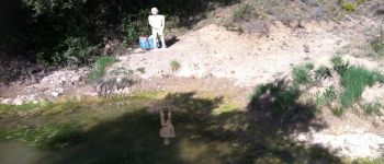
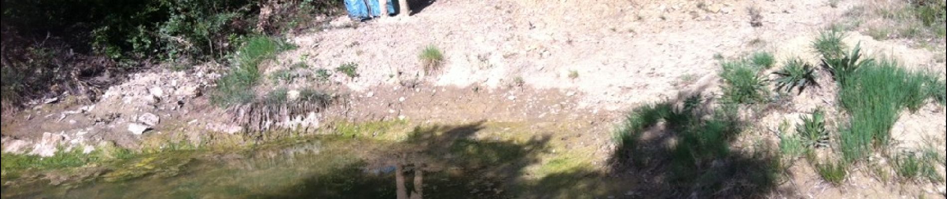
attention, sentier difficile à trouver parfois !!