


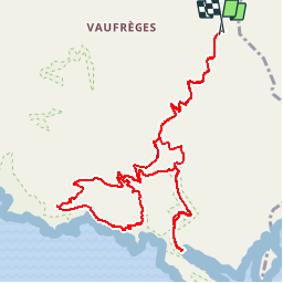


21 km | 26 km-effort


Benutzer GUIDE


Kostenlosegpshiking-Anwendung
 SityTrail
IGN / Geografische Institute
SityTrail World
Die Welt öffnet sich für Sie
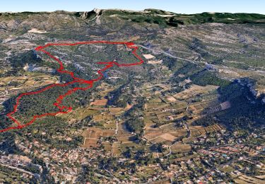
Tour Wandern von 14,6 km verfügbar auf Provence-Alpes-Côte d'Azur, Bouches-du-Rhône, Marseille. Diese Tour wird von R@ph vorgeschlagen.
Une randonnée à la journée au départ du col de la Gardiole vers le col de l'Oule - l'aiguille de Eissadon. On continu sur la crête jusqu'au col du Devenson, suite pique nique à En vau puis retour vers la Gardiole.

Rennrad

Wandern

Wandern

Wandern

Wandern

Wandern

Wandern

Wandern
Wandern