![](/images/other/stat-length.png)
![Tour Wandern Chamrousse - Lac Achard au départ de l'Arselle - Photo](https://media.geolcdn.com/t/1900/400/e1f06ab5-cefc-4833-a88d-46fa67ebebb8.jpg&format=pjpeg&maxdim=2)
Lac Achard au départ de l'Arselle
GuyVachet
Benutzer
![Länge](/images/other/stat-length.png)
![Maximale Höhe](https://static1.geolcdn.com/siteimages/upload/files/1508320355ic_sort_altitude_max_24dp.png)
![Positive Höhendifferenz](https://static1.geolcdn.com/siteimages/upload/files/1508320355ic_sort_den_pos_24dp.png)
![Km-Effort](/images/other/stat-length.png)
![Min. Höhe](https://static1.geolcdn.com/siteimages/upload/files/1508320355ic_sort_altitude_min_24dp.png)
![Negative Höhendifferenz](https://static1.geolcdn.com/siteimages/upload/files/1508320355ic_sort_den_neg_24dp.png)
![Boucle](https://static1.geolcdn.com/siteimages/upload/files/16400158638029165_repeat_loop_refresh_sync_direction_icon.png)
![Wandern](https://static1.geolcdn.com/sitytour/trail-icons/101.png)
4h33
Schwierigkeit : Medium
![Scannen Sie diesen QR-Code, um die Tour in der SityTrail-Anwendung zu öffnen](https://capi.geolives.com/qq0zvz2zws4bq2lad0pu/sitytour/trails/2640529/qr.png?size=200)
Kostenlosegpshiking-Anwendung
Über SityTrail
Tour Wandern von 7 km verfügbar auf Auvergne-Rhone-Alpen, Isère, Chamrousse. Diese Tour wird von GuyVachet vorgeschlagen.
Beschreibung
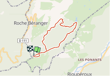
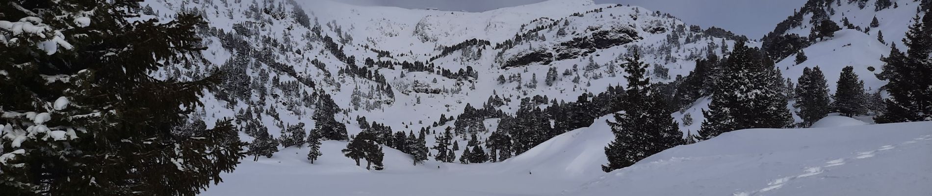
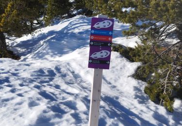
Boucle très classique pour le lac Achard au départ du parc nordique de l'Arselle par le circuit raquettes n°4. La 1ère partie commence relativement à plat (tourbières) puis la montée démarre véritablement à partir du pont de l'Astragale. Arrivé au lac, début de la descente par le retour pour Bachat-Bouloud puis une petite extension en empruntant le départ du circuit n°5 pour profiter du domaine alpin fermé cette année (pistes des Coqs et de l'Ours prises en peu en-dessous de l'arrivée du télésiège de Bachat-Bouloud) avant de revenir au parc nordique sans passer par Bachat-Bouloud.
Ort
Kommentare
Touren in der Umgebung
![Tour Wandern Chamrousse - Boucle Roche Béranger - lacs Robert - Chamrousse - Photo](https://media.geolcdn.com/t/375/260/ext.jpg?maxdim=2&url=https%3A%2F%2Fservices.sitytrail.com%2FGeolivesWS%2FDownloadMedia.ashx%3FTrailID%3D172550%26Media%3D13915_2.jpg)
![Wandern Wandern](https://static1.geolcdn.com/sitytour/trail-icons/101.png)
Wandern
![](/images/other/stat-length.png)
![](https://static1.geolcdn.com/siteimages/upload/files/16400158638029165_repeat_loop_refresh_sync_direction_icon.png)
![Tour Skiwanderen Chamrousse - col de la petite vaudaine - Photo](https://media.geolcdn.com/t/375/260/e327fe41-90ef-426f-99b9-61a7be1ec455.jpg&format=jpg&maxdim=2)
![Skiwanderen Skiwanderen](https://static1.geolcdn.com/sitytour/trail-icons/503.png)
Skiwanderen
![](/images/other/stat-length.png)
![](https://static1.geolcdn.com/siteimages/upload/files/16400158638029165_repeat_loop_refresh_sync_direction_icon.png)
![Tour Zu Fuß Saint-Martin-d'Uriage - Circuit des Curistes - Photo](https://media.geolcdn.com/t/375/260/884736af-6d5e-4498-9816-404871d42486.jpeg&format=jpg&maxdim=2)
![Zu Fuß Zu Fuß](https://static1.geolcdn.com/sitytour/trail-icons/100.png)
Zu Fuß
![](/images/other/stat-length.png)
![](https://static1.geolcdn.com/siteimages/upload/files/16400158638029165_repeat_loop_refresh_sync_direction_icon.png)
![Tour Zu Fuß Saint-Martin-d'Uriage - Circuit des Crêtes - Photo](https://media.geolcdn.com/t/375/260/a077f9fa-48e4-483f-a273-f9f858afd6d0.jpeg&format=jpg&maxdim=2)
![Zu Fuß Zu Fuß](https://static1.geolcdn.com/sitytour/trail-icons/100.png)
Zu Fuß
![](/images/other/stat-length.png)
![](https://static1.geolcdn.com/siteimages/upload/files/16400158638029165_repeat_loop_refresh_sync_direction_icon.png)
![Tour Wandern Chamrousse - lacs Robert - Photo](https://media.geolcdn.com/t/375/260/ext.jpg?maxdim=2&url=https%3A%2F%2Fstatic1.geolcdn.com%2Fsiteimages%2Fupload%2Ffiles%2F1553511878bg_sport_marche.png)
![Wandern Wandern](https://static1.geolcdn.com/sitytour/trail-icons/101.png)
Wandern
![](/images/other/stat-length.png)
![](https://static1.geolcdn.com/siteimages/upload/files/16400158638029165_repeat_loop_refresh_sync_direction_icon.png)
![Tour Wandern Chamrousse - la grande moucherolle et la petite - Photo](https://media.geolcdn.com/t/375/260/e3dde858-ba24-405b-860c-373322d4b17f.jpg&format=jpg&maxdim=2)
![Wandern Wandern](https://static1.geolcdn.com/sitytour/trail-icons/101.png)
Wandern
![](/images/other/stat-length.png)
![](https://static1.geolcdn.com/siteimages/upload/files/16400158638029165_repeat_loop_refresh_sync_direction_icon.png)
![Tour Wandern Séchilienne - Lac de Luitel - Pic de l'oeilly - Photo](https://media.geolcdn.com/t/375/260/392243d2-0bef-4c0e-a978-68f4c5437966.jpg&format=jpg&maxdim=2)
![Wandern Wandern](https://static1.geolcdn.com/sitytour/trail-icons/101.png)
Wandern
![](/images/other/stat-length.png)
![](https://static1.geolcdn.com/siteimages/upload/files/16400158638029165_repeat_loop_refresh_sync_direction_icon.png)
![Tour Wandern Vaulnaveys-le-Haut - Le Lac Achard - Le Col de L'Infernet - Photo](https://media.geolcdn.com/t/375/260/2b2ec1fe-50ad-47bf-b539-f816d718554b.jpg&format=jpg&maxdim=2)
![Wandern Wandern](https://static1.geolcdn.com/sitytour/trail-icons/101.png)
Wandern
![](/images/other/stat-length.png)
![](https://static1.geolcdn.com/siteimages/upload/files/16400158638029165_repeat_loop_refresh_sync_direction_icon.png)
![Tour Wandern Vaulnaveys-le-Haut - col de la botte - Photo](https://media.geolcdn.com/t/375/260/6bdeb5ce-b8bb-4cb6-9f16-db19b5cd3724.jpg&format=jpg&maxdim=2)
![Wandern Wandern](https://static1.geolcdn.com/sitytour/trail-icons/101.png)
Wandern
![](/images/other/stat-length.png)
![](https://static1.geolcdn.com/siteimages/upload/files/16400158638029165_repeat_loop_refresh_sync_direction_icon.png)