![](/images/other/stat-length.png)
![Tour Wandern Marolles-sur-Seine - Boucle Marolles sur Seine - Brays sur Seine 44 km - Photo](https://media.geolcdn.com/t/1900/400/ext.pjpeg?maxdim=2&url=https%3A%2F%2Fstatic1.geolcdn.com%2Fsiteimages%2Fupload%2Ffiles%2F1553511878bg_sport_marche.png)
Boucle Marolles sur Seine - Brays sur Seine 44 km
chessyca
Benutzer GUIDE
![Länge](/images/other/stat-length.png)
Länge
44 km
![Maximale Höhe](https://static1.geolcdn.com/siteimages/upload/files/1508320355ic_sort_altitude_max_24dp.png)
Maximale Höhe
82 m
![Positive Höhendifferenz](https://static1.geolcdn.com/siteimages/upload/files/1508320355ic_sort_den_pos_24dp.png)
Positive Höhendifferenz
240 m
![Km-Effort](/images/other/stat-length.png)
Km-Effort
47 km
![Min. Höhe](https://static1.geolcdn.com/siteimages/upload/files/1508320355ic_sort_altitude_min_24dp.png)
Min. Höhe
47 m
![Negative Höhendifferenz](https://static1.geolcdn.com/siteimages/upload/files/1508320355ic_sort_den_neg_24dp.png)
Negative Höhendifferenz
239 m
![Boucle](https://static1.geolcdn.com/siteimages/upload/files/16400158638029165_repeat_loop_refresh_sync_direction_icon.png)
Boucle
Ja
Erstellungsdatum :
2020-12-30 07:07:25.923
Letzte Änderung :
2020-12-30 19:44:53.158
![Wandern](https://static1.geolcdn.com/sitytour/trail-icons/101.png)
10h08
Schwierigkeit : Sehr leicht
![Scannen Sie diesen QR-Code, um die Tour in der SityTrail-Anwendung zu öffnen](https://capi.geolives.com/qq0zvz2zws4bq2lad0pu/sitytour/trails/2628758/qr.png?size=200)
Kostenlosegpshiking-Anwendung
Über SityTrail
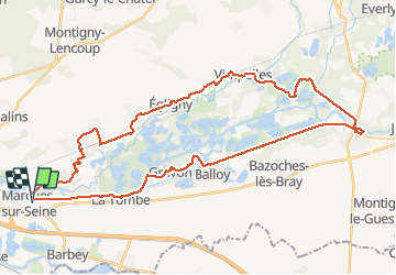
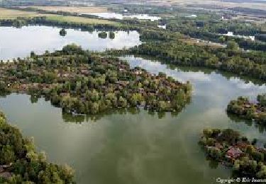
Tour Wandern von 44 km verfügbar auf Île-de-France, Seine-et-Marne, Marolles-sur-Seine. Diese Tour wird von chessyca vorgeschlagen.
Beschreibung
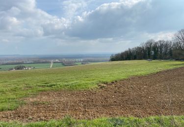
Dernière rando de l'année à l'initiative de Thierry
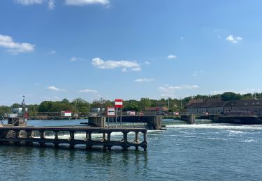
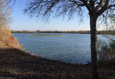
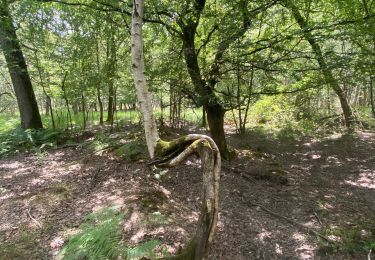
Superbe parcours notamment l'après midi
En cette saison, beaucoup de villages décorés
Ort
Land:
France
Region :
Île-de-France
Abteilung/Provinz :
Seine-et-Marne
Kommune :
Marolles-sur-Seine
Standort:
Unknown
Gehen Sie:(Dec)
Gehen Sie:(UTM)
502520 ; 5359278 (31U) N.
Kommentare
Touren in der Umgebung
![Tour Rennrad Salins - Sortie vélo la tombe - Photo](https://media.geolcdn.com/t/375/260/ext.jpg?maxdim=2&url=https%3A%2F%2Fstatic1.geolcdn.com%2Fsiteimages%2Fupload%2Ffiles%2F1524743154velo.jpg)
![Rennrad Rennrad](https://static1.geolcdn.com/sitytour/trail-icons/201.png)
Sortie vélo la tombe
Rennrad
Sehr schwierig
(1)
Salins,
Île-de-France,
Seine-et-Marne,
France
![](/images/other/stat-length.png)
45 km | 50 km-effort
2h 59min
![](https://static1.geolcdn.com/siteimages/upload/files/16400158638029165_repeat_loop_refresh_sync_direction_icon.png)
Ja
![Tour Nordic Walking Montereau-Fault-Yonne - Boucle les deux fleuves - Photo](https://media.geolcdn.com/t/375/260/47404431-dde2-4b75-ab49-5ba32ced1efd.jpg&format=jpg&maxdim=2)
![Nordic Walking Nordic Walking](https://static1.geolcdn.com/sitytour/trail-icons/102.png)
Boucle les deux fleuves
Nordic Walking
Montereau-Fault-Yonne,
Île-de-France,
Seine-et-Marne,
France
![](/images/other/stat-length.png)
18,6 km | 20 km-effort
3h 38min
![](https://static1.geolcdn.com/siteimages/upload/files/16400158638029165_repeat_loop_refresh_sync_direction_icon.png)
Ja
![Tour Zu Fuß La Brosse-Montceaux - Les Plaines du Sud - Photo](https://media.geolcdn.com/t/375/260/cdecde80-f548-4c94-9166-6aff5ab1ac14.jpeg&format=jpg&maxdim=2)
![Zu Fuß Zu Fuß](https://static1.geolcdn.com/sitytour/trail-icons/100.png)
Les Plaines du Sud
Zu Fuß
Einfach
La Brosse-Montceaux,
Île-de-France,
Seine-et-Marne,
France
![](/images/other/stat-length.png)
11,1 km | 12,7 km-effort
2h 52min
![](https://static1.geolcdn.com/siteimages/upload/files/16400158638029165_repeat_loop_refresh_sync_direction_icon.png)
Nein
![Tour Nordic Walking Salins - Salin jc à l'ombre R - Photo](https://media.geolcdn.com/t/375/260/1d6e0bfb-2946-401b-acf2-cbfe61065054.jpg&format=jpg&maxdim=2)
![Nordic Walking Nordic Walking](https://static1.geolcdn.com/sitytour/trail-icons/102.png)
Salin jc à l'ombre R
Nordic Walking
Sehr leicht
Salins,
Île-de-France,
Seine-et-Marne,
France
![](/images/other/stat-length.png)
16,2 km | 19,3 km-effort
5h 34min
![](https://static1.geolcdn.com/siteimages/upload/files/16400158638029165_repeat_loop_refresh_sync_direction_icon.png)
Ja
![Tour Nordic Walking Montereau-Fault-Yonne - Boucle des deux fleuves - Photo](https://media.geolcdn.com/t/375/260/646fd3a8-ed10-401d-ac12-4f57b15f5f59.jpg&format=jpg&maxdim=2)
![Nordic Walking Nordic Walking](https://static1.geolcdn.com/sitytour/trail-icons/102.png)
Boucle des deux fleuves
Nordic Walking
Sehr schwierig
(1)
Montereau-Fault-Yonne,
Île-de-France,
Seine-et-Marne,
France
![](/images/other/stat-length.png)
18,5 km | 20 km-effort
3h 17min
![](https://static1.geolcdn.com/siteimages/upload/files/16400158638029165_repeat_loop_refresh_sync_direction_icon.png)
Ja
![Tour Wandern Salins - Le bois du Maulny - Photo](https://media.geolcdn.com/t/375/260/3951737e-4fd5-4f06-9c31-f23f3c7d35af.jpg&format=jpg&maxdim=2)
![Wandern Wandern](https://static1.geolcdn.com/sitytour/trail-icons/101.png)
Le bois du Maulny
Wandern
Sehr schwierig
Salins,
Île-de-France,
Seine-et-Marne,
France
![](/images/other/stat-length.png)
17,8 km | 0 m-effort
4h 10min
![](https://static1.geolcdn.com/siteimages/upload/files/16400158638029165_repeat_loop_refresh_sync_direction_icon.png)
Ja
![Tour Nordic Walking Salins - Le dimanche 21 Mars - Photo](https://media.geolcdn.com/t/375/260/e335de20-700d-4d98-83a8-071b77d81b3e.jpg&format=jpg&maxdim=2)
![Nordic Walking Nordic Walking](https://static1.geolcdn.com/sitytour/trail-icons/102.png)
Le dimanche 21 Mars
Nordic Walking
Medium
Salins,
Île-de-France,
Seine-et-Marne,
France
![](/images/other/stat-length.png)
19,8 km | 24 km-effort
4h 2min
![](https://static1.geolcdn.com/siteimages/upload/files/16400158638029165_repeat_loop_refresh_sync_direction_icon.png)
Ja
![Tour Wandern Misy-sur-Yonne - JC 03 Misy sur Yonne Les sablières - Photo](https://media.geolcdn.com/t/375/260/836c8c29-92cc-4234-9bf1-467fa8145080.jpg&format=jpg&maxdim=2)
![Wandern Wandern](https://static1.geolcdn.com/sitytour/trail-icons/101.png)
JC 03 Misy sur Yonne Les sablières
Wandern
Schwierig
Misy-sur-Yonne,
Île-de-France,
Seine-et-Marne,
France
![](/images/other/stat-length.png)
22 km | 23 km-effort
4h 33min
![](https://static1.geolcdn.com/siteimages/upload/files/16400158638029165_repeat_loop_refresh_sync_direction_icon.png)
Ja
![Tour Wandern Salins - Essai 316 avec bcp de photos - Photo](https://media.geolcdn.com/t/375/260/0d393317-2752-4286-9c1e-e5f7fb57183f.jpg&format=jpg&maxdim=2)
![Wandern Wandern](https://static1.geolcdn.com/sitytour/trail-icons/101.png)
Essai 316 avec bcp de photos
Wandern
Einfach
Salins,
Île-de-France,
Seine-et-Marne,
France
![](/images/other/stat-length.png)
6,8 km | 7,8 km-effort
1h 40min
![](https://static1.geolcdn.com/siteimages/upload/files/16400158638029165_repeat_loop_refresh_sync_direction_icon.png)
Ja