![](/images/other/stat-length.png)
![Tour Wandern Loisy - LES HAUTEURS DE LOISY - Le Grand Couronné - Photo](https://media.geolcdn.com/t/1900/400/84e6ed9f-4df9-4427-8394-ed16ead909c1.jpg&format=pjpeg&maxdim=2)
LES HAUTEURS DE LOISY - Le Grand Couronné
jean-marie.parachini
Benutzer
![Länge](/images/other/stat-length.png)
![Maximale Höhe](https://static1.geolcdn.com/siteimages/upload/files/1508320355ic_sort_altitude_max_24dp.png)
![Positive Höhendifferenz](https://static1.geolcdn.com/siteimages/upload/files/1508320355ic_sort_den_pos_24dp.png)
![Km-Effort](/images/other/stat-length.png)
![Min. Höhe](https://static1.geolcdn.com/siteimages/upload/files/1508320355ic_sort_altitude_min_24dp.png)
![Negative Höhendifferenz](https://static1.geolcdn.com/siteimages/upload/files/1508320355ic_sort_den_neg_24dp.png)
![Boucle](https://static1.geolcdn.com/siteimages/upload/files/16400158638029165_repeat_loop_refresh_sync_direction_icon.png)
![Wandern](https://static1.geolcdn.com/sitytour/trail-icons/101.png)
2h42
Schwierigkeit : Einfach
![Scannen Sie diesen QR-Code, um die Tour in der SityTrail-Anwendung zu öffnen](https://capi.geolives.com/qq0zvz2zws4bq2lad0pu/sitytour/trails/2628738/qr.png?size=200)
Kostenlosegpshiking-Anwendung
Über SityTrail
Tour Wandern von 10,5 km verfügbar auf Großer Osten, Mörthe und Mosel, Loisy. Diese Tour wird von jean-marie.parachini vorgeschlagen.
Beschreibung
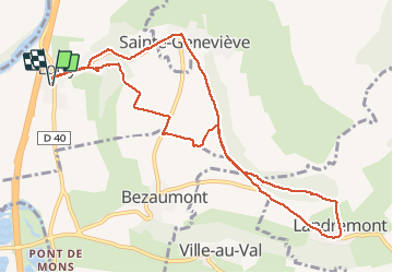
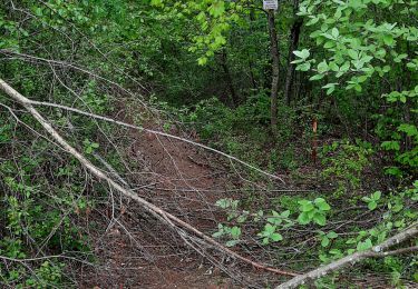
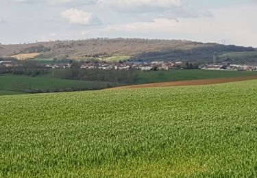
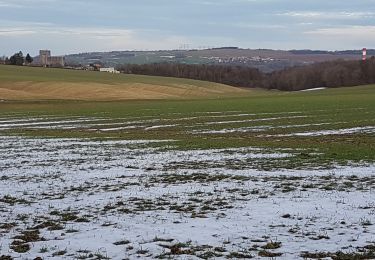
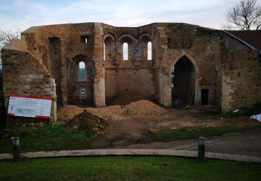
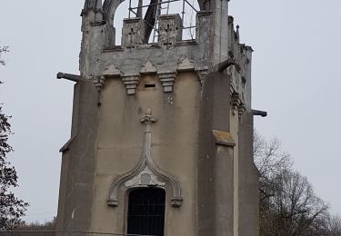
boucle de Loisy vers Landremont et Sainte-Geneviève et retour à Loisy : Parking le Couarail – Grand’rue – tourner à droite – rue de l’église – à la sortie du village, tourner à droite – Grand Sart – Elnonchamps – tourner à droite D10F – le Chaufour – la Côte – tourner à droite vers Landremont – dans Landremont tourner à gauche vers cimetière – vers gîte d’étape – monument du Grand Couronné – Sainte Geneviève – D10C – retour vers Loisy – parking
Ort
Kommentare
Touren in der Umgebung
![Tour Fahrrad Dieulouard - La petite Suisse Lorraine - Circuit n° 11 - Photo](https://media.geolcdn.com/t/375/260/ext.jpg?maxdim=2&url=https%3A%2F%2Fservices.sitytrail.com%2FGeolivesWS%2FDownloadMedia.ashx%3FTrailID%3D111711%26Media%3D8026_6.jpg)
![Fahrrad Fahrrad](https://static1.geolcdn.com/sitytour/trail-icons/200.png)
Fahrrad
![](/images/other/stat-length.png)
![](https://static1.geolcdn.com/siteimages/upload/files/16400158638029165_repeat_loop_refresh_sync_direction_icon.png)
![Tour Zu Fuß Sainte-Geneviève - Boucle de la Colline - Photo](https://media.geolcdn.com/t/375/260/959f6021-7f3e-47f9-9958-dc2cd4363673.jpeg&format=jpg&maxdim=2)
![Zu Fuß Zu Fuß](https://static1.geolcdn.com/sitytour/trail-icons/100.png)
Zu Fuß
![](/images/other/stat-length.png)
![](https://static1.geolcdn.com/siteimages/upload/files/16400158638029165_repeat_loop_refresh_sync_direction_icon.png)
![Tour Fahrrad Blénod-lès-Pont-à-Mousson - blenod arnaville xonville gorce blenod - Photo](https://media.geolcdn.com/t/375/260/ext.jpg?maxdim=2&url=https%3A%2F%2Fstatic1.geolcdn.com%2Fsiteimages%2Fupload%2Ffiles%2F1524743154velo.jpg)
![Fahrrad Fahrrad](https://static1.geolcdn.com/sitytour/trail-icons/200.png)
Fahrrad
![](/images/other/stat-length.png)
![](https://static1.geolcdn.com/siteimages/upload/files/16400158638029165_repeat_loop_refresh_sync_direction_icon.png)
![Tour Rennrad Blénod-lès-Pont-à-Mousson - ST JULIEN GORCE NOVEANT - Photo](https://media.geolcdn.com/t/375/260/ext.jpg?maxdim=2&url=https%3A%2F%2Fstatic1.geolcdn.com%2Fsiteimages%2Fupload%2Ffiles%2F1524743154velo.jpg)
![Rennrad Rennrad](https://static1.geolcdn.com/sitytour/trail-icons/201.png)
Rennrad
![](/images/other/stat-length.png)
![](https://static1.geolcdn.com/siteimages/upload/files/16400158638029165_repeat_loop_refresh_sync_direction_icon.png)
![Tour Mountainbike Moselbrück - essai 4 LEVO SL - Photo](https://media.geolcdn.com/t/375/260/1b697b40-eb3d-4f3b-a0f5-9841bd4ac5cb.jpg&format=jpg&maxdim=2)
![Mountainbike Mountainbike](https://static1.geolcdn.com/sitytour/trail-icons/202.png)
Mountainbike
![](/images/other/stat-length.png)
![](https://static1.geolcdn.com/siteimages/upload/files/16400158638029165_repeat_loop_refresh_sync_direction_icon.png)
![Tour Wandern Dieulouard - DIEULOUARD - VERS BELLEVILLE ET SAIZERAIS - Photo](https://media.geolcdn.com/t/375/260/c2018011-1bfa-47ce-b819-34efd5861339.jpg&format=jpg&maxdim=2)
![Wandern Wandern](https://static1.geolcdn.com/sitytour/trail-icons/101.png)
Wandern
![](/images/other/stat-length.png)
![](https://static1.geolcdn.com/siteimages/upload/files/16400158638029165_repeat_loop_refresh_sync_direction_icon.png)
![Tour Wandern Dieulouard - LA VIERGE DE BELLEVILLE - Photo](https://media.geolcdn.com/t/375/260/92071029-0e02-4fd1-a34a-416f4acba2b2.jpg&format=jpg&maxdim=2)
![Wandern Wandern](https://static1.geolcdn.com/sitytour/trail-icons/101.png)
Wandern
![](/images/other/stat-length.png)
![](https://static1.geolcdn.com/siteimages/upload/files/16400158638029165_repeat_loop_refresh_sync_direction_icon.png)
![Tour Wandern Moselbrück - Mousson par les remparts - Photo](https://media.geolcdn.com/t/375/260/876227b4-e8e9-479d-b39a-c6acedbd043a.jpg&format=jpg&maxdim=2)
![Wandern Wandern](https://static1.geolcdn.com/sitytour/trail-icons/101.png)
Wandern
![](/images/other/stat-length.png)
![](https://static1.geolcdn.com/siteimages/upload/files/16400158638029165_repeat_loop_refresh_sync_direction_icon.png)
![Tour Wandern Jezainville - NOTRE DAME DES AIRS - Photo](https://media.geolcdn.com/t/375/260/24f7b021-d058-487b-be2f-20686a96cb67.jpg&format=jpg&maxdim=2)
![Wandern Wandern](https://static1.geolcdn.com/sitytour/trail-icons/101.png)
Wandern
![](/images/other/stat-length.png)
![](https://static1.geolcdn.com/siteimages/upload/files/16400158638029165_repeat_loop_refresh_sync_direction_icon.png)