![](/images/other/stat-length.png)
![Tour Wandern Conand - CHARVIEUX (BUGEY) (15 km - D. 609 m) - Photo](https://media.geolcdn.com/t/1900/400/1f9d60b4-4ebd-4eb4-a17a-f41ecb461abf.jpg&format=pjpeg&maxdim=2)
CHARVIEUX (BUGEY) (15 km - D. 609 m)
Thomasdanielle
Benutzer
![Länge](/images/other/stat-length.png)
Länge
14,8 km
![Maximale Höhe](https://static1.geolcdn.com/siteimages/upload/files/1508320355ic_sort_altitude_max_24dp.png)
Maximale Höhe
1019 m
![Positive Höhendifferenz](https://static1.geolcdn.com/siteimages/upload/files/1508320355ic_sort_den_pos_24dp.png)
Positive Höhendifferenz
609 m
![Km-Effort](/images/other/stat-length.png)
Km-Effort
23 km
![Min. Höhe](https://static1.geolcdn.com/siteimages/upload/files/1508320355ic_sort_altitude_min_24dp.png)
Min. Höhe
564 m
![Negative Höhendifferenz](https://static1.geolcdn.com/siteimages/upload/files/1508320355ic_sort_den_neg_24dp.png)
Negative Höhendifferenz
608 m
![Boucle](https://static1.geolcdn.com/siteimages/upload/files/16400158638029165_repeat_loop_refresh_sync_direction_icon.png)
Boucle
Ja
Erstellungsdatum :
2020-10-28 08:51:12.0
Letzte Änderung :
2020-10-30 10:26:21.649
![Wandern](https://static1.geolcdn.com/sitytour/trail-icons/101.png)
6h20
Schwierigkeit : Medium
![Scannen Sie diesen QR-Code, um die Tour in der SityTrail-Anwendung zu öffnen](https://capi.geolives.com/qq0zvz2zws4bq2lad0pu/sitytour/trails/2590160/qr.png?size=200)
Kostenlosegpshiking-Anwendung
Über SityTrail
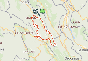
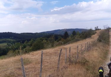
Tour Wandern von 14,8 km verfügbar auf Auvergne-Rhone-Alpen, Ain, Conand. Diese Tour wird von Thomasdanielle vorgeschlagen.
Beschreibung
D/A : Petit parking dans Charvieux (Le 27/10/2020)
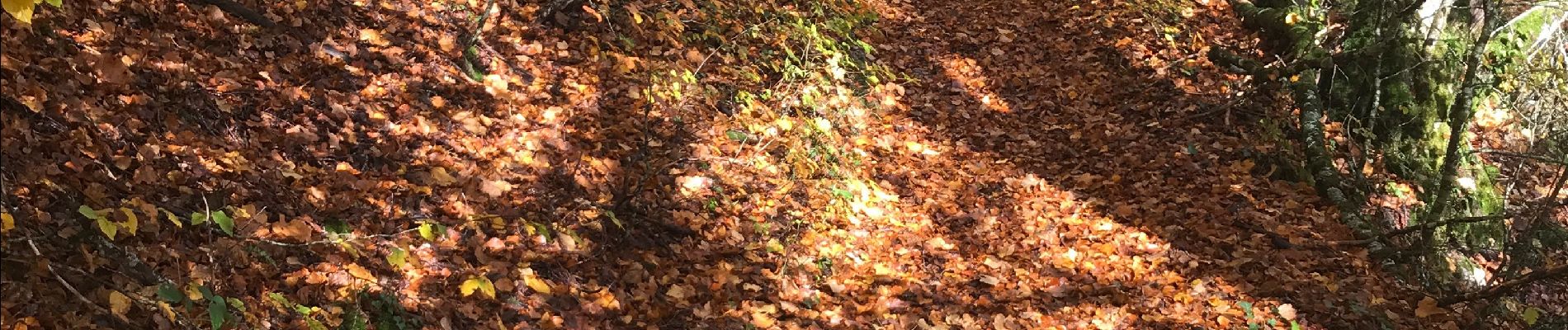
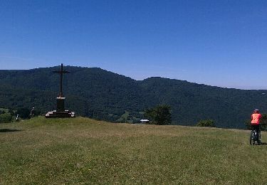
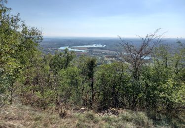
Randonnée jusqu'au Calvaire de portes
Magnifique randonnées en automne, pourrait être refaite en été
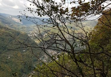
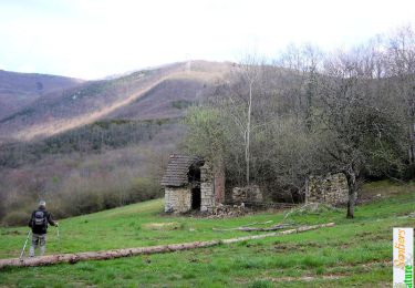
Ort
Land:
France
Region :
Auvergne-Rhone-Alpen
Abteilung/Provinz :
Ain
Kommune :
Conand
Standort:
Unknown
Gehen Sie:(Dec)
Gehen Sie:(UTM)
693471 ; 5083547 (31T) N.
Kommentare
Touren in der Umgebung
![Tour Mountainbike Arandas - Arandas-Plomb-Plateau de Suerme - Photo](https://media.geolcdn.com/t/375/260/ext.jpg?maxdim=2&url=https%3A%2F%2Fservices.sitytrail.com%2FGeolivesWS%2FDownloadMedia.ashx%3FTrailID%3D790474%26Media%3Dfix__20170716121750.jpg)
![Mountainbike Mountainbike](https://static1.geolcdn.com/sitytour/trail-icons/202.png)
Arandas-Plomb-Plateau de Suerme
Mountainbike
Schwierig
(1)
Arandas,
Auvergne-Rhone-Alpen,
Ain,
France
![](/images/other/stat-length.png)
21 km | 31 km-effort
1h 56min
![](https://static1.geolcdn.com/siteimages/upload/files/16400158638029165_repeat_loop_refresh_sync_direction_icon.png)
Ja
![Tour Wandern Villebois - les balcons de souclin hameau de buis - Photo](https://media.geolcdn.com/t/375/260/3b5f007f-b409-4554-ba2e-def6bfe006e4.jpg&format=jpg&maxdim=2)
![Wandern Wandern](https://static1.geolcdn.com/sitytour/trail-icons/101.png)
les balcons de souclin hameau de buis
Wandern
Medium
(1)
Villebois,
Auvergne-Rhone-Alpen,
Ain,
France
![](/images/other/stat-length.png)
16,1 km | 24 km-effort
5h 3min
![](https://static1.geolcdn.com/siteimages/upload/files/16400158638029165_repeat_loop_refresh_sync_direction_icon.png)
Ja
![Tour Wandern Plateau d'Hauteville - Saint Sulpice: tour d'Hostiaz - Photo](https://media.geolcdn.com/t/375/260/c554f42c-abc6-4f2c-b771-49f481a5791f.jpg&format=jpg&maxdim=2)
![Wandern Wandern](https://static1.geolcdn.com/sitytour/trail-icons/101.png)
Saint Sulpice: tour d'Hostiaz
Wandern
Medium
Plateau d'Hauteville,
Auvergne-Rhone-Alpen,
Ain,
France
![](/images/other/stat-length.png)
15 km | 22 km-effort
4h 24min
![](https://static1.geolcdn.com/siteimages/upload/files/16400158638029165_repeat_loop_refresh_sync_direction_icon.png)
Ja
![Tour Reiten Bénonces - col de portes - Photo](https://media.geolcdn.com/t/375/260/54810e80-f5d5-4cbb-9935-a749da2f45af.jpg&format=jpg&maxdim=2)
![Reiten Reiten](https://static1.geolcdn.com/sitytour/trail-icons/301.png)
col de portes
Reiten
Medium
Bénonces,
Auvergne-Rhone-Alpen,
Ain,
France
![](/images/other/stat-length.png)
39 km | 61 km-effort
4h 11min
![](https://static1.geolcdn.com/siteimages/upload/files/16400158638029165_repeat_loop_refresh_sync_direction_icon.png)
Nein
![Tour Wandern Plateau d'Hauteville - Hostiaz - Photo](https://media.geolcdn.com/t/375/260/174de8a4-c0c4-4d4c-a165-835bed7f1254.jpg&format=jpg&maxdim=2)
![Wandern Wandern](https://static1.geolcdn.com/sitytour/trail-icons/101.png)
Hostiaz
Wandern
Plateau d'Hauteville,
Auvergne-Rhone-Alpen,
Ain,
France
![](/images/other/stat-length.png)
4,5 km | 5,9 km-effort
1h 18min
![](https://static1.geolcdn.com/siteimages/upload/files/16400158638029165_repeat_loop_refresh_sync_direction_icon.png)
Ja
![Tour Schneeschuhwandern Villebois - Le Crêt de Pont 1059m, depuis Bouis - Photo](https://media.geolcdn.com/t/375/260/ext.jpg?maxdim=2&url=https%3A%2F%2Fservices.sitytrail.com%2FGeolivesWS%2FDownloadMedia.ashx%3FTrailID%3D317286%26Media%3D16473_1.jpg)
![Schneeschuhwandern Schneeschuhwandern](https://static1.geolcdn.com/sitytour/trail-icons/504.png)
Le Crêt de Pont 1059m, depuis Bouis
Schneeschuhwandern
Einfach
Villebois,
Auvergne-Rhone-Alpen,
Ain,
France
![](/images/other/stat-length.png)
14,1 km | 24 km-effort
5h 30min
![](https://static1.geolcdn.com/siteimages/upload/files/16400158638029165_repeat_loop_refresh_sync_direction_icon.png)
Ja
![Tour Wandern Villebois - Le Crêt de Pont 1059m, depuis Bouis - Photo](https://media.geolcdn.com/t/375/260/ext.jpg?maxdim=2&url=https%3A%2F%2Fservices.sitytrail.com%2FGeolivesWS%2FDownloadMedia.ashx%3FTrailID%3D317285%26Media%3D16473_1.jpg)
![Wandern Wandern](https://static1.geolcdn.com/sitytour/trail-icons/101.png)
Le Crêt de Pont 1059m, depuis Bouis
Wandern
Einfach
Villebois,
Auvergne-Rhone-Alpen,
Ain,
France
![](/images/other/stat-length.png)
14,1 km | 24 km-effort
5h 0min
![](https://static1.geolcdn.com/siteimages/upload/files/16400158638029165_repeat_loop_refresh_sync_direction_icon.png)
Ja
![Tour Wandern Villebois - Le Creux de la Boulie par la Grange Lambert, depuis Villebois - Photo](https://media.geolcdn.com/t/375/260/ext.jpg?maxdim=2&url=https%3A%2F%2Fservices.sitytrail.com%2FGeolivesWS%2FDownloadMedia.ashx%3FTrailID%3D102365%26Media%3D2902_1.jpg)
![Wandern Wandern](https://static1.geolcdn.com/sitytour/trail-icons/101.png)
Le Creux de la Boulie par la Grange Lambert, depuis Villebois
Wandern
Medium
Villebois,
Auvergne-Rhone-Alpen,
Ain,
France
![](/images/other/stat-length.png)
7,8 km | 14,6 km-effort
3h 0min
![](https://static1.geolcdn.com/siteimages/upload/files/16400158638029165_repeat_loop_refresh_sync_direction_icon.png)
Ja
![Tour Wandern Villebois - la croix de Cuny par Villebois - Photo](https://media.geolcdn.com/t/375/260/ext.jpg?maxdim=2&url=https%3A%2F%2Fstatic1.geolcdn.com%2Fsiteimages%2Fupload%2Ffiles%2F1553511878bg_sport_marche.png)
![Wandern Wandern](https://static1.geolcdn.com/sitytour/trail-icons/101.png)
la croix de Cuny par Villebois
Wandern
Schwierig
Villebois,
Auvergne-Rhone-Alpen,
Ain,
France
![](/images/other/stat-length.png)
12 km | 20 km-effort
3h 44min
![](https://static1.geolcdn.com/siteimages/upload/files/16400158638029165_repeat_loop_refresh_sync_direction_icon.png)
Ja