![](/images/other/stat-length.png)
![Tour Wandern Zoutleeuw - Zoutleeuw 16 km - Photo](https://media.geolcdn.com/t/1900/400/b3a37ac3-8fca-4eba-bd9d-831054990cdb.jpg&format=pjpeg&maxdim=2)
Zoutleeuw 16 km
rvapeldo
Benutzer GUIDE
![Länge](/images/other/stat-length.png)
![Maximale Höhe](https://static1.geolcdn.com/siteimages/upload/files/1508320355ic_sort_altitude_max_24dp.png)
![Positive Höhendifferenz](https://static1.geolcdn.com/siteimages/upload/files/1508320355ic_sort_den_pos_24dp.png)
![Km-Effort](/images/other/stat-length.png)
![Min. Höhe](https://static1.geolcdn.com/siteimages/upload/files/1508320355ic_sort_altitude_min_24dp.png)
![Negative Höhendifferenz](https://static1.geolcdn.com/siteimages/upload/files/1508320355ic_sort_den_neg_24dp.png)
![Boucle](https://static1.geolcdn.com/siteimages/upload/files/16400158638029165_repeat_loop_refresh_sync_direction_icon.png)
![Wandern](https://static1.geolcdn.com/sitytour/trail-icons/101.png)
3h59
Schwierigkeit : Sehr leicht
![Scannen Sie diesen QR-Code, um die Tour in der SityTrail-Anwendung zu öffnen](https://capi.geolives.com/qq0zvz2zws4bq2lad0pu/sitytour/trails/2579768/qr.png?size=200)
Kostenlosegpshiking-Anwendung
Über SityTrail
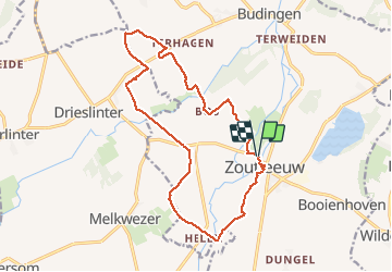
Tour Wandern von 15,6 km verfügbar auf Flandern, Flämisch-Brabant, Zoutleeuw. Diese Tour wird von rvapeldo vorgeschlagen.
Beschreibung
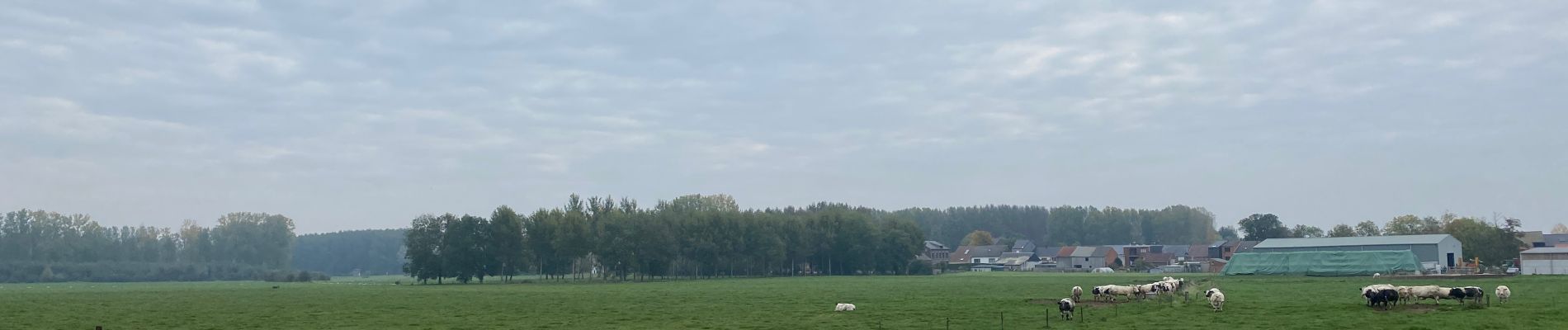
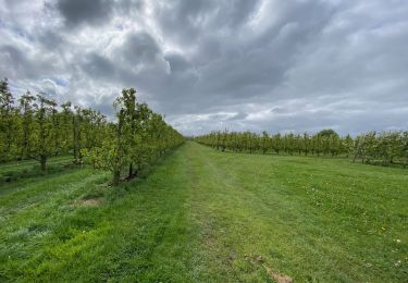
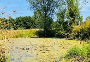
Une belle surprise que la campagne environnant la charmante ville de Zoutleeuw (église et hotel de ville remarquables), sillonnée par de nombreux cours d’eau et canaux (Leigracht, Kleine Gete, Grote Gete,...), où sont cultivés poiriers et pommiers. Le parcours peut aisément être allongé.
Een leuke verrassing dat het platteland rondom het charmante stadje Zoutleeuw (opmerkelijke kerk en stadhuis), doorkruist door talloze rivieren en kanalen (Leigracht, Kleine Gete, Grote Gete, ...), waar perenbomen worden gekweekt en appelbomen. De route kan eenvoudig worden verlengd.
Ort
Kommentare
Touren in der Umgebung
![Tour Zu Fuß Kortenaken - A Speculowandelpad - Photo](https://media.geolcdn.com/t/375/260/e8a891a7-8e5d-4d65-ada1-9dd128a1791b.jpeg&format=jpg&maxdim=2)
![Zu Fuß Zu Fuß](https://static1.geolcdn.com/sitytour/trail-icons/100.png)
Zu Fuß
![](/images/other/stat-length.png)
![](https://static1.geolcdn.com/siteimages/upload/files/16400158638029165_repeat_loop_refresh_sync_direction_icon.png)
![Tour Zu Fuß Sint-Truiden - Staaien rode driehoek - Photo](https://media.geolcdn.com/t/375/260/cd3d1f60-3cd2-4539-a2b4-06ec7df817c9.jpeg&format=jpg&maxdim=2)
![Zu Fuß Zu Fuß](https://static1.geolcdn.com/sitytour/trail-icons/100.png)
Zu Fuß
![](/images/other/stat-length.png)
![](https://static1.geolcdn.com/siteimages/upload/files/16400158638029165_repeat_loop_refresh_sync_direction_icon.png)
![Tour Zu Fuß Sint-Truiden - Staaien oranje bol - Photo](https://media.geolcdn.com/t/375/260/7b137b54-411c-4e68-8c6c-aeb3fad0dd86.jpeg&format=jpg&maxdim=2)
![Zu Fuß Zu Fuß](https://static1.geolcdn.com/sitytour/trail-icons/100.png)
Zu Fuß
![](/images/other/stat-length.png)
![](https://static1.geolcdn.com/siteimages/upload/files/16400158638029165_repeat_loop_refresh_sync_direction_icon.png)
![Tour Zu Fuß Zoutleeuw - Kempinnewandeling - Photo](https://media.geolcdn.com/t/375/260/fc67a971-5072-4fc1-b052-2b5bd59bf268.jpeg&format=jpg&maxdim=2)
![Zu Fuß Zu Fuß](https://static1.geolcdn.com/sitytour/trail-icons/100.png)
Zu Fuß
![](/images/other/stat-length.png)
![](https://static1.geolcdn.com/siteimages/upload/files/16400158638029165_repeat_loop_refresh_sync_direction_icon.png)
![Tour Zu Fuß Zoutleeuw - Panbruggewandeling - Photo](https://media.geolcdn.com/t/375/260/96714c06-dac1-4b7c-b690-c79a4c973766.jpeg&format=jpg&maxdim=2)
![Zu Fuß Zu Fuß](https://static1.geolcdn.com/sitytour/trail-icons/100.png)
Zu Fuß
![](/images/other/stat-length.png)
![](https://static1.geolcdn.com/siteimages/upload/files/16400158638029165_repeat_loop_refresh_sync_direction_icon.png)
![Tour Wandern Linter - Melkwezer Haspengouw GroteGetewandeling - 11 km RT - Photo](https://media.geolcdn.com/t/375/260/ext.jpg?maxdim=2&url=https%3A%2F%2Fstatic1.geolcdn.com%2Fsiteimages%2Fupload%2Ffiles%2F1553511878bg_sport_marche.png)
![Wandern Wandern](https://static1.geolcdn.com/sitytour/trail-icons/101.png)
Wandern
![](/images/other/stat-length.png)
![](https://static1.geolcdn.com/siteimages/upload/files/16400158638029165_repeat_loop_refresh_sync_direction_icon.png)
![Tour Wandern Zoutleeuw - S-GR Hageland : Terhagen - Diest - Photo](https://media.geolcdn.com/t/375/260/0bcaa454-b723-4dae-8870-b6599e62c5b1.jpeg&format=jpg&maxdim=2)
![Wandern Wandern](https://static1.geolcdn.com/sitytour/trail-icons/101.png)
Wandern
![](/images/other/stat-length.png)
![](https://static1.geolcdn.com/siteimages/upload/files/16400158638029165_repeat_loop_refresh_sync_direction_icon.png)
![Tour Wandern Sint-Truiden - La reserve naturelle Op d’Hei à Runkelen - Photo](https://media.geolcdn.com/t/375/260/66426e65-b121-47ad-be3c-c041b27709ce.jpeg&format=jpg&maxdim=2)
![Wandern Wandern](https://static1.geolcdn.com/sitytour/trail-icons/101.png)
Wandern
![](/images/other/stat-length.png)
![](https://static1.geolcdn.com/siteimages/upload/files/16400158638029165_repeat_loop_refresh_sync_direction_icon.png)
![Tour Wandern Zoutleeuw - Promenade romantique dans la Vallée de la Gette - Photo](https://media.geolcdn.com/t/375/260/057fed0c-a346-40f4-a8e3-ef5b6be90d5d.jpg&format=jpg&maxdim=2)
![Wandern Wandern](https://static1.geolcdn.com/sitytour/trail-icons/101.png)
Wandern
![](/images/other/stat-length.png)
![](https://static1.geolcdn.com/siteimages/upload/files/16400158638029165_repeat_loop_refresh_sync_direction_icon.png)