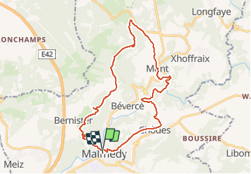
![](/images/other/stat-length.png)
![Tour Wandern Malmedy - Malmedy (Bévercé - Ferme Libert- Mont - Chôdes) - Photo](https://media.geolcdn.com/t/1900/400/7d4899ab-de48-4f64-b4bd-575fbc0353f2.jpg&format=pjpeg&maxdim=2)
Malmedy (Bévercé - Ferme Libert- Mont - Chôdes)
mumu.larandonneuse
Benutzer GUIDE
![Länge](/images/other/stat-length.png)
Länge
16,8 km
![Maximale Höhe](https://static1.geolcdn.com/siteimages/upload/files/1508320355ic_sort_altitude_max_24dp.png)
Maximale Höhe
544 m
![Positive Höhendifferenz](https://static1.geolcdn.com/siteimages/upload/files/1508320355ic_sort_den_pos_24dp.png)
Positive Höhendifferenz
523 m
![Km-Effort](/images/other/stat-length.png)
Km-Effort
24 km
![Min. Höhe](https://static1.geolcdn.com/siteimages/upload/files/1508320355ic_sort_altitude_min_24dp.png)
Min. Höhe
334 m
![Negative Höhendifferenz](https://static1.geolcdn.com/siteimages/upload/files/1508320355ic_sort_den_neg_24dp.png)
Negative Höhendifferenz
521 m
![Boucle](https://static1.geolcdn.com/siteimages/upload/files/16400158638029165_repeat_loop_refresh_sync_direction_icon.png)
Boucle
Ja
Erstellungsdatum :
2020-09-27 08:03:32.156
Letzte Änderung :
2020-09-27 13:08:16.788
![Wandern](https://static1.geolcdn.com/sitytour/trail-icons/101.png)
3h50
Schwierigkeit : Medium
![Scannen Sie diesen QR-Code, um die Tour in der SityTrail-Anwendung zu öffnen](https://capi.geolives.com/qq0zvz2zws4bq2lad0pu/sitytour/trails/2562829/qr.png?size=200)
Kostenlosegpshiking-Anwendung
Über SityTrail
Tour Wandern von 16,8 km verfügbar auf Wallonien, Lüttich, Malmedy. Diese Tour wird von mumu.larandonneuse vorgeschlagen.
Beschreibung
Magnifique parcours dans la vallée de la Warche.
D/A : Parking Malmundaria.
Descriptif complet sur www.wandelgidszuidlimburg.com n°1091
!!!! Petite erreur de ma part : à la Ferme Libert bien suivre le GR.
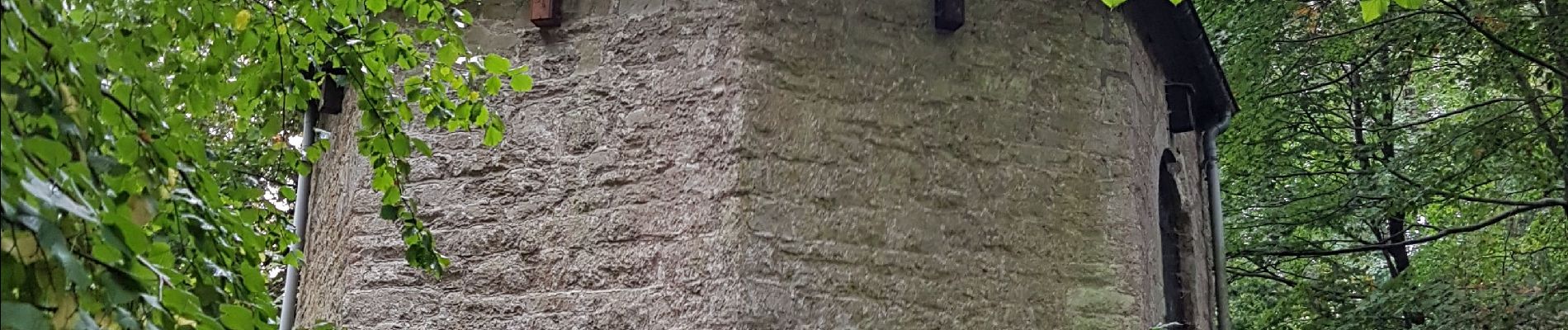
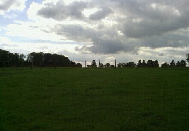
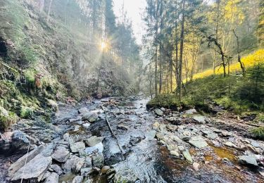
Ort
Land:
Belgium
Region :
Wallonien
Abteilung/Provinz :
Lüttich
Kommune :
Malmedy
Standort:
Malmedy
Gehen Sie:(Dec)
Gehen Sie:(UTM)
288858 ; 5590400 (32U) N.
Kommentare
Touren in der Umgebung
![Tour Wandern Malmedy - RB-Lg-31_Malmedy - Photo](https://media.geolcdn.com/t/375/260/ext.jpg?maxdim=2&url=https%3A%2F%2Fservices.sitytrail.com%2FGeolivesWS%2FDownloadMedia.ashx%3FTrailID%3D402114%26Media%3D216d2e53-3b66-4632-8b4d-0cea30889665.jpg)
![Wandern Wandern](https://static1.geolcdn.com/sitytour/trail-icons/101.png)
![Tour Wandern Malmedy - Le trôs Maret - Photo](https://media.geolcdn.com/t/375/260/97b4be7b-87c1-46c9-b673-d6e164fd84f1.jpg&format=jpg&maxdim=2)
![Wandern Wandern](https://static1.geolcdn.com/sitytour/trail-icons/101.png)
Le trôs Maret
Wandern
Medium
(14)
Malmedy,
Wallonien,
Lüttich,
Belgium
![](/images/other/stat-length.png)
7,3 km | 10,1 km-effort
2h 11min
![](https://static1.geolcdn.com/siteimages/upload/files/16400158638029165_repeat_loop_refresh_sync_direction_icon.png)
Ja
![Tour Wandern Malmedy - La petite vallée sauvage du Trôs Marets - Photo](https://media.geolcdn.com/t/375/260/ext.jpg?maxdim=2&url=https%3A%2F%2Fstatic1.geolcdn.com%2Fsiteimages%2Fupload%2Ffiles%2F1553511878bg_sport_marche.png)
![Wandern Wandern](https://static1.geolcdn.com/sitytour/trail-icons/101.png)
La petite vallée sauvage du Trôs Marets
Wandern
Medium
(8)
Malmedy,
Wallonien,
Lüttich,
Belgium
![](/images/other/stat-length.png)
9,1 km | 12 km-effort
2h 37min
![](https://static1.geolcdn.com/siteimages/upload/files/16400158638029165_repeat_loop_refresh_sync_direction_icon.png)
Ja
![Tour Wandern Malmedy - Malmedy - Baugnez - Photo](https://media.geolcdn.com/t/375/260/a34fa6e8-977c-4cba-8883-b5a7429035f5.jpg&format=jpg&maxdim=2)
![Wandern Wandern](https://static1.geolcdn.com/sitytour/trail-icons/101.png)
Malmedy - Baugnez
Wandern
Medium
(1)
Malmedy,
Wallonien,
Lüttich,
Belgium
![](/images/other/stat-length.png)
14,8 km | 18,9 km-effort
3h 15min
![](https://static1.geolcdn.com/siteimages/upload/files/16400158638029165_repeat_loop_refresh_sync_direction_icon.png)
Ja
![Tour Wandern Malmedy - 2021-10-22_19h44m15_1102 - Photo](https://media.geolcdn.com/t/375/260/f624bfad-0543-4f87-8b2e-a4874ba371b1.jpg&format=jpg&maxdim=2)
![Wandern Wandern](https://static1.geolcdn.com/sitytour/trail-icons/101.png)
2021-10-22_19h44m15_1102
Wandern
Medium
(2)
Malmedy,
Wallonien,
Lüttich,
Belgium
![](/images/other/stat-length.png)
15,2 km | 21 km-effort
4h 41min
![](https://static1.geolcdn.com/siteimages/upload/files/16400158638029165_repeat_loop_refresh_sync_direction_icon.png)
Ja
![Tour Wandern Malmedy - ferme libert tro maret - Photo](https://media.geolcdn.com/t/375/260/ext.jpg?maxdim=2&url=https%3A%2F%2Fservices.sitytrail.com%2FGeolivesWS%2FDownloadMedia.ashx%3FTrailID%3D202740%26Media%3D20130704170612.jpeg)
![Wandern Wandern](https://static1.geolcdn.com/sitytour/trail-icons/101.png)
ferme libert tro maret
Wandern
Medium
(1)
Malmedy,
Wallonien,
Lüttich,
Belgium
![](/images/other/stat-length.png)
5,5 km | 7,4 km-effort
1h 35min
![](https://static1.geolcdn.com/siteimages/upload/files/16400158638029165_repeat_loop_refresh_sync_direction_icon.png)
Ja
![Tour Wandern Malmedy - RB-LG-09 - Sur les hauteurs dominant la haute vallée de l’Amblève et la Warche - Photo](https://media.geolcdn.com/t/375/260/ext.jpg?maxdim=2&url=https%3A%2F%2Fservices.sitytrail.com%2FGeolivesWS%2FDownloadMedia.ashx%3FTrailID%3D179567%26Media%3D798cfc5d-29e8-4b87-852c-cc68a99be049.jpg)
![Wandern Wandern](https://static1.geolcdn.com/sitytour/trail-icons/101.png)
RB-LG-09 - Sur les hauteurs dominant la haute vallée de l’Amblève et la Warche
Wandern
Medium
(4)
Malmedy,
Wallonien,
Lüttich,
Belgium
![](/images/other/stat-length.png)
26 km | 34 km-effort
7h 12min
![](https://static1.geolcdn.com/siteimages/upload/files/16400158638029165_repeat_loop_refresh_sync_direction_icon.png)
Ja
![Tour Wandern Malmedy - Balade de rêve 4 - Le canyon des Trôs Marets - Photo](https://media.geolcdn.com/t/375/260/00b47c34-b42a-48f8-a2cb-09ee85e4736c.jpg&format=jpg&maxdim=2)
![Wandern Wandern](https://static1.geolcdn.com/sitytour/trail-icons/101.png)
Balade de rêve 4 - Le canyon des Trôs Marets
Wandern
Medium
(2)
Malmedy,
Wallonien,
Lüttich,
Belgium
![](/images/other/stat-length.png)
5 km | 6,8 km-effort
1h 32min
![](https://static1.geolcdn.com/siteimages/upload/files/16400158638029165_repeat_loop_refresh_sync_direction_icon.png)
Ja
![Tour Wandern Malmedy - xhoffraix . cheneux . moulin et cascade bayehon . vieux chêne . longfaye . xhoffraix - Photo](https://media.geolcdn.com/t/375/260/d03e0c64-90c0-4767-998e-9e240f1eb32e.jpg&format=jpg&maxdim=2)
![Wandern Wandern](https://static1.geolcdn.com/sitytour/trail-icons/101.png)
xhoffraix . cheneux . moulin et cascade bayehon . vieux chêne . longfaye . xh...
Wandern
Einfach
(2)
Malmedy,
Wallonien,
Lüttich,
Belgium
![](/images/other/stat-length.png)
12,3 km | 15,9 km-effort
3h 7min
![](https://static1.geolcdn.com/siteimages/upload/files/16400158638029165_repeat_loop_refresh_sync_direction_icon.png)
Ja