![](/images/other/stat-length.png)
![Tour Wandern Bièvre - Bièvre Les Maurzies - Photo](https://media.geolcdn.com/t/1900/400/c68c9577-3a0d-49de-ba96-6e63bcf132be.jpg&format=pjpeg&maxdim=2)
Bièvre Les Maurzies
De Streek van Bouillon in de Ardennen
In het Hart van de echte Ardennen GUIDE+
![Länge](/images/other/stat-length.png)
Länge
6 km
![Maximale Höhe](https://static1.geolcdn.com/siteimages/upload/files/1508320355ic_sort_altitude_max_24dp.png)
Maximale Höhe
416 m
![Positive Höhendifferenz](https://static1.geolcdn.com/siteimages/upload/files/1508320355ic_sort_den_pos_24dp.png)
Positive Höhendifferenz
82 m
![Km-Effort](/images/other/stat-length.png)
Km-Effort
7 km
![Min. Höhe](https://static1.geolcdn.com/siteimages/upload/files/1508320355ic_sort_altitude_min_24dp.png)
Min. Höhe
363 m
![Negative Höhendifferenz](https://static1.geolcdn.com/siteimages/upload/files/1508320355ic_sort_den_neg_24dp.png)
Negative Höhendifferenz
82 m
![Boucle](https://static1.geolcdn.com/siteimages/upload/files/16400158638029165_repeat_loop_refresh_sync_direction_icon.png)
Boucle
Ja
Erstellungsdatum :
2020-09-17 12:10:56.943
Letzte Änderung :
2021-03-21 10:32:13.831
![Wandern](https://static1.geolcdn.com/sitytour/trail-icons/101.png)
1h16
Schwierigkeit : Einfach
![Scannen Sie diesen QR-Code, um die Tour in der SityTrail-Anwendung zu öffnen](https://capi.geolives.com/qq0zvz2zws4bq2lad0pu/sitytour/trails/2557996/qr.png?size=200)
Kostenlosegpshiking-Anwendung
Über SityTrail
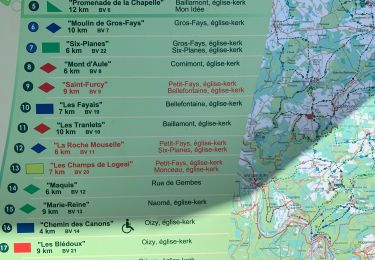
Tour Wandern von 6 km verfügbar auf Wallonien, Namur, Bièvre. Diese Tour wird von De Streek van Bouillon in de Ardennen vorgeschlagen.
Beschreibung
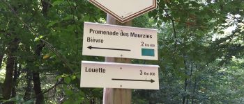
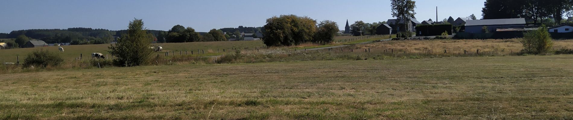
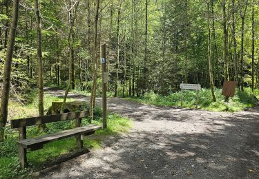
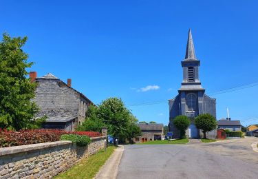
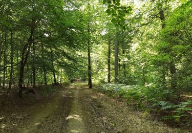
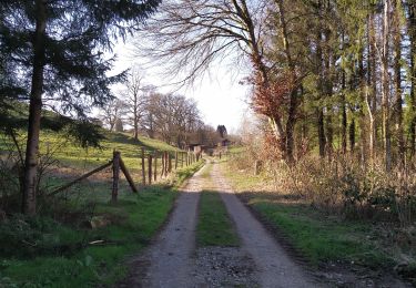
Belle découverte des alentours champêtres de Bièvre. Agréable partie en forêt.
Aangename kennismaking met de omgeving van Bièvre met een deel in het bos.
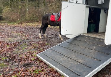
Ort
Land:
Belgium
Region :
Wallonien
Abteilung/Provinz :
Namur
Kommune :
Bièvre
Standort:
Bièvre
Gehen Sie:(Dec)
Gehen Sie:(UTM)
644702 ; 5534029 (31U) N.
Kommentare
Touren in der Umgebung
![Reiten Reiten](https://static1.geolcdn.com/sitytour/trail-icons/301.png)
Graide manege 10km ZZW
Reiten
Einfach
(2)
Bièvre,
Wallonien,
Namur,
Belgium
![](/images/other/stat-length.png)
10,1 km | 13,1 km-effort
1h 43min
![](https://static1.geolcdn.com/siteimages/upload/files/16400158638029165_repeat_loop_refresh_sync_direction_icon.png)
Ja
![Tour Wandern Bièvre - La roche mouselle bv11 - Photo](https://media.geolcdn.com/t/375/260/180021d9-3dfc-4c34-835a-76474bb7f028.jpg&format=jpg&maxdim=2)
![Wandern Wandern](https://static1.geolcdn.com/sitytour/trail-icons/101.png)
La roche mouselle bv11
Wandern
Einfach
(2)
Bièvre,
Wallonien,
Namur,
Belgium
![](/images/other/stat-length.png)
5,5 km | 7,2 km-effort
1h 27min
![](https://static1.geolcdn.com/siteimages/upload/files/16400158638029165_repeat_loop_refresh_sync_direction_icon.png)
Ja
![Tour Wandern Bièvre - Promenade de la Roche Mouselle - Petit-Fays - Photo](https://media.geolcdn.com/t/375/260/501e45df-6a5c-4127-b2f5-d1b068aa8215.jpg&format=jpg&maxdim=2)
![Wandern Wandern](https://static1.geolcdn.com/sitytour/trail-icons/101.png)
Promenade de la Roche Mouselle - Petit-Fays
Wandern
Medium
Bièvre,
Wallonien,
Namur,
Belgium
![](/images/other/stat-length.png)
5,5 km | 7,2 km-effort
1h 38min
![](https://static1.geolcdn.com/siteimages/upload/files/16400158638029165_repeat_loop_refresh_sync_direction_icon.png)
Ja
![Tour Wandern Bièvre - Balade à Bellefontaine - Bièvre - Photo](https://media.geolcdn.com/t/375/260/479b792a-217f-4a9c-be19-91532b972e2a.jpeg&format=jpg&maxdim=2)
![Wandern Wandern](https://static1.geolcdn.com/sitytour/trail-icons/101.png)
Balade à Bellefontaine - Bièvre
Wandern
Schwierig
Bièvre,
Wallonien,
Namur,
Belgium
![](/images/other/stat-length.png)
10 km | 12,9 km-effort
2h 56min
![](https://static1.geolcdn.com/siteimages/upload/files/16400158638029165_repeat_loop_refresh_sync_direction_icon.png)
Ja
![Tour Wandern Bièvre - Marche ADEPS 10KM400 à Graide. - Photo](https://media.geolcdn.com/t/375/260/f5dfd78c-f060-4d8c-b9fd-b47c4cdcaa0b.jpg&format=jpg&maxdim=2)
![Wandern Wandern](https://static1.geolcdn.com/sitytour/trail-icons/101.png)
Marche ADEPS 10KM400 à Graide.
Wandern
Medium
Bièvre,
Wallonien,
Namur,
Belgium
![](/images/other/stat-length.png)
10,4 km | 13 km-effort
2h 12min
![](https://static1.geolcdn.com/siteimages/upload/files/16400158638029165_repeat_loop_refresh_sync_direction_icon.png)
Ja
![Tour Zu Fuß Bièvre - Les Fayais - Photo](https://media.geolcdn.com/t/375/260/ext.jpg?maxdim=2&url=https%3A%2F%2Fpivotmedia.tourismewallonie.be%2FOTH-A0-005G-2KXD%2FOTH-A0-005G-2KXD.jpg)
![Zu Fuß Zu Fuß](https://static1.geolcdn.com/sitytour/trail-icons/100.png)
![Tour Zu Fuß Bièvre - Les Maurzies - Photo](https://media.geolcdn.com/t/375/260/ext.jpg?maxdim=2&url=https%3A%2F%2Fpivotmedia.tourismewallonie.be%2FOTH-A0-005I-0I7U%2FOTH-A0-005I-0I7U.jpg)
![Zu Fuß Zu Fuß](https://static1.geolcdn.com/sitytour/trail-icons/100.png)
![Tour Zu Fuß Bièvre - La Roche Mouselle - Photo](https://media.geolcdn.com/t/375/260/ext.jpg?maxdim=2&url=https%3A%2F%2Fpivotmedia.tourismewallonie.be%2FOTH-A0-005E-1WZO%2FOTH-A0-005E-1WZO.jpg)
![Zu Fuß Zu Fuß](https://static1.geolcdn.com/sitytour/trail-icons/100.png)
La Roche Mouselle
Zu Fuß
Einfach
(1)
Bièvre,
Wallonien,
Namur,
Belgium
![](/images/other/stat-length.png)
5,4 km | 7 km-effort
1h 34min
![](https://static1.geolcdn.com/siteimages/upload/files/16400158638029165_repeat_loop_refresh_sync_direction_icon.png)
Ja
![Tour Zu Fuß Bièvre - Promenade du Maquis - Photo](https://media.geolcdn.com/t/375/260/ext.jpg?maxdim=2&url=https%3A%2F%2Fpivotmedia.tourismewallonie.be%2FOTH-A0-005I-0N0A%2FOTH-A0-005I-0N0A.jpg)
![Zu Fuß Zu Fuß](https://static1.geolcdn.com/sitytour/trail-icons/100.png)
Promenade du Maquis
Zu Fuß
Einfach
(1)
Bièvre,
Wallonien,
Namur,
Belgium
![](/images/other/stat-length.png)
4,8 km | 6,1 km-effort
1h 23min
![](https://static1.geolcdn.com/siteimages/upload/files/16400158638029165_repeat_loop_refresh_sync_direction_icon.png)
Ja