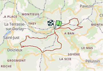
![](/images/other/stat-length.png)
![Tour Wandern Doizieux - 42 croix Montvieux collet de Doizieux 19km 650m - Photo](https://media.geolcdn.com/t/1900/400/fa909af6-2d36-4768-9cc3-571d8ef136f5.jpg&format=pjpeg&maxdim=2)
42 croix Montvieux collet de Doizieux 19km 650m
SyMA
Benutzer
![Länge](/images/other/stat-length.png)
![Maximale Höhe](https://static1.geolcdn.com/siteimages/upload/files/1508320355ic_sort_altitude_max_24dp.png)
![Positive Höhendifferenz](https://static1.geolcdn.com/siteimages/upload/files/1508320355ic_sort_den_pos_24dp.png)
![Km-Effort](/images/other/stat-length.png)
![Min. Höhe](https://static1.geolcdn.com/siteimages/upload/files/1508320355ic_sort_altitude_min_24dp.png)
![Negative Höhendifferenz](https://static1.geolcdn.com/siteimages/upload/files/1508320355ic_sort_den_neg_24dp.png)
![Boucle](https://static1.geolcdn.com/siteimages/upload/files/16400158638029165_repeat_loop_refresh_sync_direction_icon.png)
![Wandern](https://static1.geolcdn.com/sitytour/trail-icons/101.png)
5h42
Schwierigkeit : Einfach
![Scannen Sie diesen QR-Code, um die Tour in der SityTrail-Anwendung zu öffnen](https://capi.geolives.com/qq0zvz2zws4bq2lad0pu/sitytour/trails/2553987/qr.png?size=200)
Kostenlosegpshiking-Anwendung
Über SityTrail
Tour Wandern von 19 km verfügbar auf Auvergne-Rhone-Alpen, Loire, Doizieux. Diese Tour wird von SyMA vorgeschlagen.
Beschreibung
parking le long de route de départ car parking restaurant ...
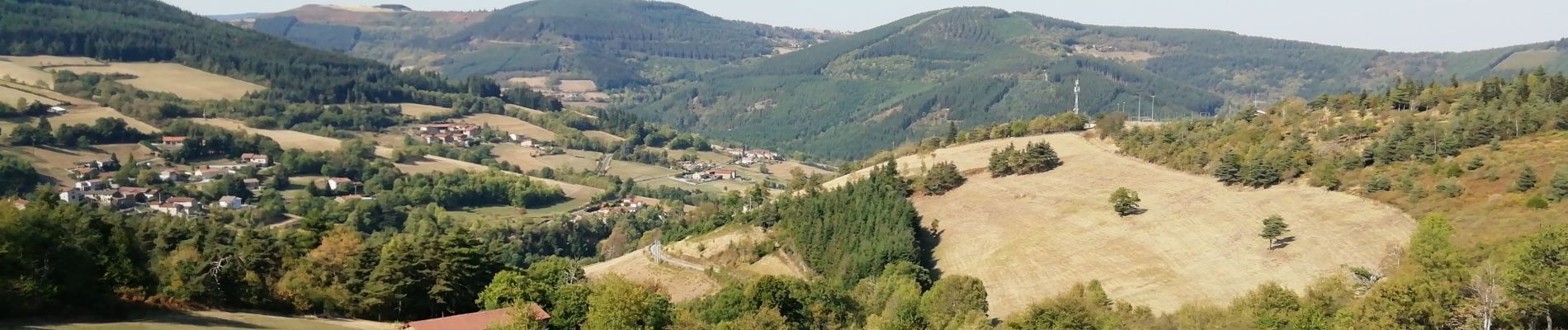
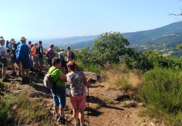
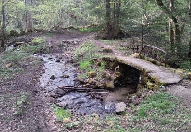
Belle balade ombragée avec chemin facile
attention crêt de QUATREGRAINS est devenu PRIVE donc détour par Grange Rouet
en reco passages autour de Janorey vers Bois de Veylon impraticables (coupes et passages forts ravinés )
Ort
Kommentare
Touren in der Umgebung
![Tour Wandern Pélussin - Randonnée du tacot à Pelussin - Photo](https://media.geolcdn.com/t/375/260/7e686509-b711-4cd0-bc14-adc2cf5f6ca7.jpg&format=jpg&maxdim=2)
![Wandern Wandern](https://static1.geolcdn.com/sitytour/trail-icons/101.png)
Wandern
![](/images/other/stat-length.png)
![](https://static1.geolcdn.com/siteimages/upload/files/16400158638029165_repeat_loop_refresh_sync_direction_icon.png)
![Tour Wandern Pélussin - 42 pelussin - Photo](https://media.geolcdn.com/t/375/260/2803f447-e16b-468d-b827-f0cbcd60ef5a.jpg&format=jpg&maxdim=2)
![Wandern Wandern](https://static1.geolcdn.com/sitytour/trail-icons/101.png)
Wandern
![](/images/other/stat-length.png)
![](https://static1.geolcdn.com/siteimages/upload/files/16400158638029165_repeat_loop_refresh_sync_direction_icon.png)
![Tour Wandern Pélussin - 42 pelussin organise - Photo](https://media.geolcdn.com/t/375/260/0e825505-ecc8-4c56-8aaf-cbc4b45ef104.jpg&format=jpg&maxdim=2)
![Wandern Wandern](https://static1.geolcdn.com/sitytour/trail-icons/101.png)
Wandern
![](/images/other/stat-length.png)
![](https://static1.geolcdn.com/siteimages/upload/files/16400158638029165_repeat_loop_refresh_sync_direction_icon.png)
![Tour Wandern Chuyer - Autour du mont Ministre - Photo](https://media.geolcdn.com/t/375/260/ext.jpg?maxdim=2&url=https%3A%2F%2Fstatic1.geolcdn.com%2Fsiteimages%2Fupload%2Ffiles%2F1553511878bg_sport_marche.png)
![Wandern Wandern](https://static1.geolcdn.com/sitytour/trail-icons/101.png)
Wandern
![](/images/other/stat-length.png)
![](https://static1.geolcdn.com/siteimages/upload/files/16400158638029165_repeat_loop_refresh_sync_direction_icon.png)
![Tour Wandern Chuyer - 42-Chuyer-mont-Ministre-19km-685m-été - Photo](https://media.geolcdn.com/t/375/260/effa4503-778b-47fa-ac8d-c1f86e2f0d53.jpg&format=jpg&maxdim=2)
![Wandern Wandern](https://static1.geolcdn.com/sitytour/trail-icons/101.png)
Wandern
![](/images/other/stat-length.png)
![](https://static1.geolcdn.com/siteimages/upload/files/16400158638029165_repeat_loop_refresh_sync_direction_icon.png)
![Tour Wandern Sainte-Croix-en-Jarez - 42-ste-Croix-Jarez-12km-440m-mai22 - Photo](https://media.geolcdn.com/t/375/260/4e225a4d-cf8c-4893-9030-0d43b85a590b.jpg&format=jpg&maxdim=2)
![Wandern Wandern](https://static1.geolcdn.com/sitytour/trail-icons/101.png)
Wandern
![](/images/other/stat-length.png)
![](https://static1.geolcdn.com/siteimages/upload/files/16400158638029165_repeat_loop_refresh_sync_direction_icon.png)
![Tour Wandern Pélussin - 42-Croix-Montvieux-20km-630m-juin21 - Photo](https://media.geolcdn.com/t/375/260/20c1773f-9ba7-496a-98ab-580798c2bffd.jpg&format=jpg&maxdim=2)
![Wandern Wandern](https://static1.geolcdn.com/sitytour/trail-icons/101.png)
Wandern
![](/images/other/stat-length.png)
![](https://static1.geolcdn.com/siteimages/upload/files/16400158638029165_repeat_loop_refresh_sync_direction_icon.png)
![Tour Wandern Pavezin - Crêt de Baronnette - Photo](https://media.geolcdn.com/t/375/260/2f4da85c-3fa3-4300-b643-85e7fca45333.jpg&format=jpg&maxdim=2)
![Wandern Wandern](https://static1.geolcdn.com/sitytour/trail-icons/101.png)
Wandern
![](/images/other/stat-length.png)
![](https://static1.geolcdn.com/siteimages/upload/files/16400158638029165_repeat_loop_refresh_sync_direction_icon.png)
![Tour Wandern Pélussin - La Boucharie Chez Forest - Photo](https://media.geolcdn.com/t/375/260/ext.jpg?maxdim=2&url=https%3A%2F%2Fservices.sitytrail.com%2FGeolivesWS%2FDownloadMedia.ashx%3FTrailID%3D949416%26Media%3Dfix__20180422183621.jpg)
![Wandern Wandern](https://static1.geolcdn.com/sitytour/trail-icons/101.png)
Wandern
![](/images/other/stat-length.png)
![](https://static1.geolcdn.com/siteimages/upload/files/16400158638029165_repeat_loop_refresh_sync_direction_icon.png)