


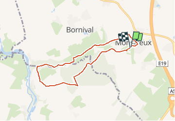


12,8 km | 15 km-effort


Benutzer


Kostenlosegpshiking-Anwendung
 SityTrail
IGN / Geografische Institute
SityTrail World
Die Welt öffnet sich für Sie
Tour Zu Fuß von 6,5 km verfügbar auf Wallonien, Wallonisch-Brabant, Nivelles. Diese Tour wird von calofrancis vorgeschlagen.
version MDJ avec arrêts didactiques
Monstreux thines et moulin
Maison facade en cimorné
Chapelle du curé Smars
Le Castia
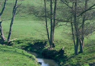
Vallée de la Thines
Bois de l'hopitai/Planti
Ferme de l'Abbaye

Wandern

Wandern

Wandern

Wandern

Wandern
Wandern

Wandern

Wandern
Wandern