Tour Wandern Freissinières - 2020-09-08 Marche Dormillouse Lacs Palluel Faravel Fangeas - Photo

2020-09-08 Marche Dormillouse Lacs Palluel Faravel Fangeas

 holtzv
holtzv

Benutzer GUIDE

© OpenStreetMap contributors
Länge
Länge
16,1 km
Maximale Höhe
Maximale Höhe
2482 m
Positive Höhendifferenz
1094 m
Km-Effort
Km-Effort  
31 km
Min. Höhe
Min. Höhe
1429 m
Negative Höhendifferenz
1097 m
Boucle
Boucle
Ja
Erstellungsdatum :
2020-09-08 07:54:44.657
Letzte Änderung :
2020-09-21 16:32:48.578

(0 Nachricht)

Wandern
Wandern
5h57
Schwierigkeit : Medium

Scannen Sie diesen QR-Code, um die Tour in der SityTrail-Anwendung zu öffnen

Kostenlosegpshiking-Anwendung

Logo SityTrail SityTrail

IGN / Geografische Institute

SityTrail aus dem App Store herunterladen SityTrail von Google Play herunterladen

Logo SityTrail SityTrail World

Die Welt öffnet sich für Sie

SityTrail aus dem App Store herunterladen SityTrail von Google Play herunterladen SityTrail auf Huawei AppGallery herunterladen

Über SityTrail

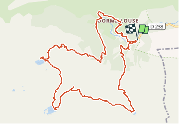
Tour Wandern von 16,1 km verfügbar auf Provence-Alpes-Côte d'Azur, Hochalpen, Freissinières. Diese Tour wird von holtzv vorgeschlagen.

Beschreibung

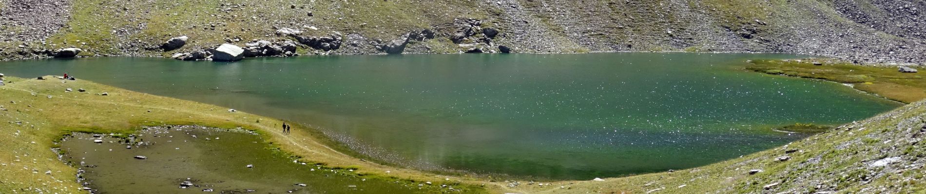
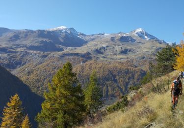
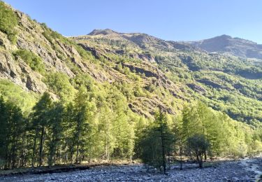
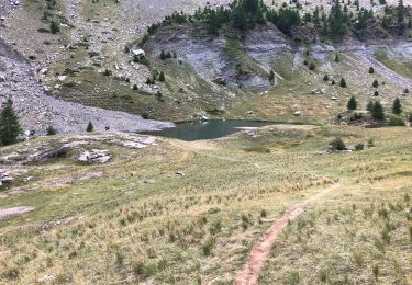
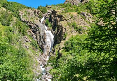
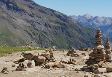
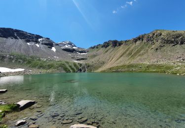
Le début de la marche se fait à travers les petits hameaux de Dormillouse avant de continuer la montée au frais dans la forêt. Arrivée au premier lac de la journée, le lac Palluel (alt 2468m), pour la pause de midi, on enchaine avec le lac de Faravel (alt 2386m) en passant par une mer de Kern. On atteint le troisième Lac de Fangeas (alt 1990m) en passant par le pont de fer. La redescente à travers la forêt offre de beaux points de vue sur le torrent des Oules et la cascade de Dormillouse.

Höhenprofil

Foto-Galerie

Ort

Land:
France
Region :
Provence-Alpes-Côte d'Azur
Abteilung/Provinz :
Hochalpen
Kommune :
Freissinières
Standort:
Unknown
Gehen Sie:(Dec)
Gehen Sie:(UTM)
298154 ; 4956550 (32T) N.

Touren in der Umgebung

Tour Wandern Freissinières - les 3 lacs : Palluel, Faravel et Fangeas + montée grand Pinier - Photo
Wandern
dalla.anthony

Wandern

Medium
(2)
Freissinières, Provence-Alpes-Côte d'Azur, Hochalpen, France
23 km | 47 km-effort
9h 0min
Ja
Tour Wandern Freissinières - Trois lacs de Dormillouse - Photo
Wandern
jlv05

Wandern

Medium
(1)
Freissinières, Provence-Alpes-Côte d'Azur, Hochalpen, France
16,3 km | 30 km-effort
6h 28min
Ja
Tour Wandern Freissinières - les Violins  Dormillouse  - Photo
Wandern
GUIDE
orsel

Wandern

Einfach
Freissinières, Provence-Alpes-Côte d'Azur, Hochalpen, France
14,8 km | 28 km-effort
9h 14min
Ja
Tour Wandern Freissinières - 05-Dormillouse-lac-Fangeas-pont-fer-11km740m - Photo
Wandern
SyMA

Wandern

Medium
Freissinières, Provence-Alpes-Côte d'Azur, Hochalpen, France
11 km | 21 km-effort
5h 25min
Ja
Tour Wandern Freissinières - Les 3 lacs. Paluel Faravel Frangeas - Photo
Wandern
chamouilley

Wandern

Schwierig
Freissinières, Provence-Alpes-Côte d'Azur, Hochalpen, France
15 km | 29 km-effort
7h 21min
Ja
Tour Wandern Freissinières - Vallon et lac du Fangeas/20/07/21 - Photo
Wandern
Dervalmarc

Wandern

Einfach
Freissinières, Provence-Alpes-Côte d'Azur, Hochalpen, France
6 km | 13,3 km-effort
5h 25min
Ja
Tour Wandern Freissinières - parking des cascades, lac de Palluel, lac de Fara vel retour par Dormillouse et le sentier d'hiver  - Photo
Wandern
rgoujon

Wandern

Sehr schwierig
Freissinières, Provence-Alpes-Côte d'Azur, Hochalpen, France
15,7 km | 31 km-effort
8h 1min
Ja
Tour Wandern Freissinières - lacs de Fangeas , Faravel et palluel - Photo
Wandern
GUIDE
amiral13

Wandern

Medium
Freissinières, Provence-Alpes-Côte d'Azur, Hochalpen, France
15,8 km | 30 km-effort
7h 37min
Ja
Tour Wandern Freissinières - fangeas - Photo
Wandern
jmgeffrin

Wandern

Sehr leicht
(1)
Freissinières, Provence-Alpes-Côte d'Azur, Hochalpen, France
7,7 km | 15,1 km-effort
5h 19min
Ja


Schließen
Meine Abonnements