![](/images/other/stat-length.png)
Durbuy
Jacques Guisse
Benutzer
![Länge](/images/other/stat-length.png)
Länge
9,7 km
![Maximale Höhe](https://static1.geolcdn.com/siteimages/upload/files/1508320355ic_sort_altitude_max_24dp.png)
Maximale Höhe
230 m
![Positive Höhendifferenz](https://static1.geolcdn.com/siteimages/upload/files/1508320355ic_sort_den_pos_24dp.png)
Positive Höhendifferenz
175 m
![Km-Effort](/images/other/stat-length.png)
Km-Effort
12,1 km
![Min. Höhe](https://static1.geolcdn.com/siteimages/upload/files/1508320355ic_sort_altitude_min_24dp.png)
Min. Höhe
137 m
![Negative Höhendifferenz](https://static1.geolcdn.com/siteimages/upload/files/1508320355ic_sort_den_neg_24dp.png)
Negative Höhendifferenz
179 m
![Boucle](https://static1.geolcdn.com/siteimages/upload/files/16400158638029165_repeat_loop_refresh_sync_direction_icon.png)
Boucle
Ja
Erstellungsdatum :
2020-09-04 11:54:40.0
Letzte Änderung :
2020-09-04 18:29:52.158
![Wandern](https://static1.geolcdn.com/sitytour/trail-icons/101.png)
2h19
Schwierigkeit : Unbekannt
![Scannen Sie diesen QR-Code, um die Tour in der SityTrail-Anwendung zu öffnen](https://capi.geolives.com/qq0zvz2zws4bq2lad0pu/sitytour/trails/2537797/qr.png?size=200)
Kostenlosegpshiking-Anwendung
Über SityTrail
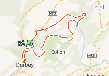
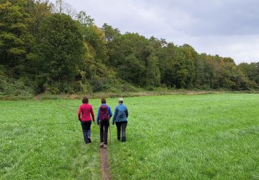
Tour Wandern von 9,7 km verfügbar auf Wallonien, Luxemburg, Durbuy. Diese Tour wird von Jacques Guisse vorgeschlagen.
Beschreibung
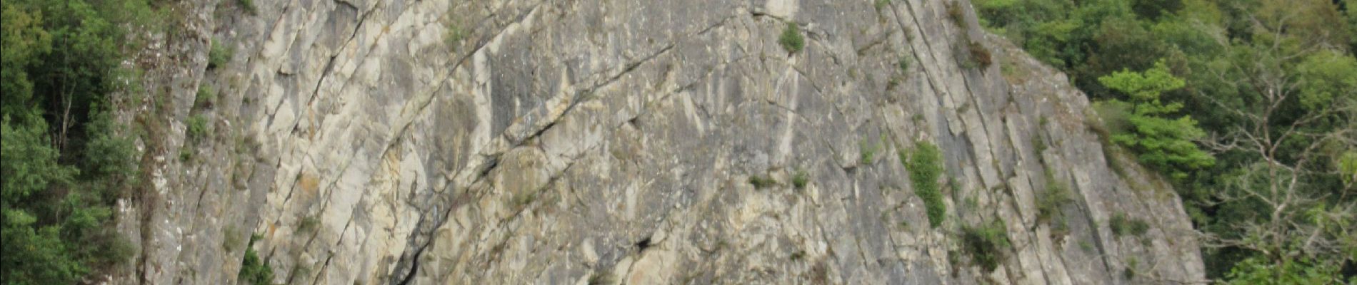
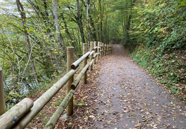
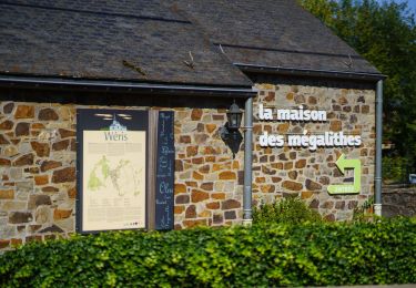
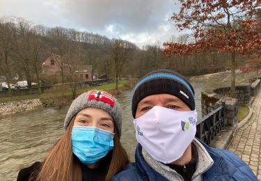
Très jolie marche axée sur la vallée de l'Ourthe. Une belle grimpette pour arriver dans le magnifique village de Warre. Une réserve naturelle, des sentiers boisés suivis d'un cheminement Ravel ravissant en longeant l'Ourthe pour aboutir à la jolie ville de Durbuy.
Ort
Land:
Belgium
Region :
Wallonien
Abteilung/Provinz :
Luxemburg
Kommune :
Durbuy
Standort:
Tohogne
Gehen Sie:(Dec)
Gehen Sie:(UTM)
674754 ; 5581327 (31U) N.
Kommentare
Touren in der Umgebung
![Tour Wandern Durbuy - RB-Lu-01 - Un petit bout de Condroz - Photo](https://media.geolcdn.com/t/375/260/ext.jpg?maxdim=2&url=https%3A%2F%2Fservices.sitytrail.com%2FGeolivesWS%2FDownloadMedia.ashx%3FTrailID%3D179610%26Media%3Dbae66ec4-955f-4295-8f2d-e1b21fcea213.jpg)
![Wandern Wandern](https://static1.geolcdn.com/sitytour/trail-icons/101.png)
RB-Lu-01 - Un petit bout de Condroz
Wandern
Schwierig
(5)
Durbuy,
Wallonien,
Luxemburg,
Belgium
![](/images/other/stat-length.png)
24 km | 30 km-effort
6h 27min
![](https://static1.geolcdn.com/siteimages/upload/files/16400158638029165_repeat_loop_refresh_sync_direction_icon.png)
Ja
![Tour Wandern Durbuy - Durbuy belle boucle depuis le centre - Photo](https://media.geolcdn.com/t/375/260/cfedd71b-4855-4bd5-865e-f677c4301a64.jpg&format=jpg&maxdim=2)
![Wandern Wandern](https://static1.geolcdn.com/sitytour/trail-icons/101.png)
Durbuy belle boucle depuis le centre
Wandern
Medium
(11)
Durbuy,
Wallonien,
Luxemburg,
Belgium
![](/images/other/stat-length.png)
5,9 km | 7,6 km-effort
1h 27min
![](https://static1.geolcdn.com/siteimages/upload/files/16400158638029165_repeat_loop_refresh_sync_direction_icon.png)
Ja
![Tour Wandern Durbuy - RF-Lu-02 - Variante Ravel - Au fils de l'Ourthe : Barvaux - Photo](https://media.geolcdn.com/t/375/260/ext.jpg?maxdim=2&url=https%3A%2F%2Fstatic1.geolcdn.com%2Fsiteimages%2Fupload%2Ffiles%2F1553511878bg_sport_marche.png)
![Wandern Wandern](https://static1.geolcdn.com/sitytour/trail-icons/101.png)
RF-Lu-02 - Variante Ravel - Au fils de l'Ourthe : Barvaux
Wandern
Sehr leicht
(6)
Durbuy,
Wallonien,
Luxemburg,
Belgium
![](/images/other/stat-length.png)
10,5 km | 13,1 km-effort
2h 45min
![](https://static1.geolcdn.com/siteimages/upload/files/16400158638029165_repeat_loop_refresh_sync_direction_icon.png)
Ja
![Tour Wandern Durbuy - Balade à Bomal sur Ourthe - Photo](https://media.geolcdn.com/t/375/260/5741dd62-7ff1-40d2-b9aa-0e0aed97da9a.jpg&format=jpg&maxdim=2)
![Wandern Wandern](https://static1.geolcdn.com/sitytour/trail-icons/101.png)
Balade à Bomal sur Ourthe
Wandern
Einfach
(4)
Durbuy,
Wallonien,
Luxemburg,
Belgium
![](/images/other/stat-length.png)
4,4 km | 5,9 km-effort
1h 20min
![](https://static1.geolcdn.com/siteimages/upload/files/16400158638029165_repeat_loop_refresh_sync_direction_icon.png)
Ja
![Tour Fahrrad Durbuy - À vélo, autour de Durbuy - Photo](https://media.geolcdn.com/t/375/260/0cd5bc92-78b0-4b7d-8ab6-58af53446b64.jpg&format=jpg&maxdim=2)
![Fahrrad Fahrrad](https://static1.geolcdn.com/sitytour/trail-icons/200.png)
À vélo, autour de Durbuy
Fahrrad
Sehr leicht
(2)
Durbuy,
Wallonien,
Luxemburg,
Belgium
![](/images/other/stat-length.png)
39 km | 45 km-effort
Unbekannt
![](https://static1.geolcdn.com/siteimages/upload/files/16400158638029165_repeat_loop_refresh_sync_direction_icon.png)
Ja
![Tour Wandern Durbuy - Durbuy - Photo](https://media.geolcdn.com/t/375/260/bb012fd3-a2b7-4b11-a73c-1b9130d29f16.jpg&format=jpg&maxdim=2)
![Wandern Wandern](https://static1.geolcdn.com/sitytour/trail-icons/101.png)
![Tour Wandern Ferrières - GG-Lu-15_Sy - Barvaux - Photo](https://media.geolcdn.com/t/375/260/4cf6fb9a-77d5-4c51-bb72-4b6ca6a27202.jpg&format=jpg&maxdim=2)
![Wandern Wandern](https://static1.geolcdn.com/sitytour/trail-icons/101.png)
GG-Lu-15_Sy - Barvaux
Wandern
Sehr schwierig
(1)
Ferrières,
Wallonien,
Lüttich,
Belgium
![](/images/other/stat-length.png)
18,9 km | 26 km-effort
5h 58min
![](https://static1.geolcdn.com/siteimages/upload/files/16400158638029165_repeat_loop_refresh_sync_direction_icon.png)
Nein
![Tour Wandern Durbuy - Petit Han - Circuit Natura 2000, des sites qui valent le détour - Lx21 - Photo](https://media.geolcdn.com/t/375/260/ext.jpg?maxdim=2&url=https%3A%2F%2Fservices.sitytrail.com%2FGeolivesWS%2FDownloadMedia.ashx%3FTrailID%3D542958%26Media%3Dd5b73723-81c8-45b8-923f-fe30b72cf695.JPG)
![Wandern Wandern](https://static1.geolcdn.com/sitytour/trail-icons/101.png)
Petit Han - Circuit Natura 2000, des sites qui valent le détour - Lx21
Wandern
Einfach
(6)
Durbuy,
Wallonien,
Luxemburg,
Belgium
![](/images/other/stat-length.png)
5,6 km | 6,3 km-effort
1h 23min
![](https://static1.geolcdn.com/siteimages/upload/files/16400158638029165_repeat_loop_refresh_sync_direction_icon.png)
Ja
![Tour Wandern Durbuy - Autour de Tohogne (Durbuy) - Photo](https://media.geolcdn.com/t/375/260/2a8689fc-6e11-44ce-8f89-67705d1757ba.jpg&format=jpg&maxdim=2)
![Wandern Wandern](https://static1.geolcdn.com/sitytour/trail-icons/101.png)
Autour de Tohogne (Durbuy)
Wandern
Medium
(1)
Durbuy,
Wallonien,
Luxemburg,
Belgium
![](/images/other/stat-length.png)
15,7 km | 19,7 km-effort
3h 42min
![](https://static1.geolcdn.com/siteimages/upload/files/16400158638029165_repeat_loop_refresh_sync_direction_icon.png)
Ja