![](/images/other/stat-length.png)
![Tour Elektrofahrrad Chorges - le tour du lac de Serre Ponçon - Photo](https://media.geolcdn.com/t/1900/400/8cb0f775-5936-4555-9e74-01671e45efa5.jpg&format=pjpeg&maxdim=2)
le tour du lac de Serre Ponçon
cailloux54
Benutzer
![Länge](/images/other/stat-length.png)
Länge
83 km
![Maximale Höhe](https://static1.geolcdn.com/siteimages/upload/files/1508320355ic_sort_altitude_max_24dp.png)
Maximale Höhe
1149 m
![Positive Höhendifferenz](https://static1.geolcdn.com/siteimages/upload/files/1508320355ic_sort_den_pos_24dp.png)
Positive Höhendifferenz
2084 m
![Km-Effort](/images/other/stat-length.png)
Km-Effort
110 km
![Min. Höhe](https://static1.geolcdn.com/siteimages/upload/files/1508320355ic_sort_altitude_min_24dp.png)
Min. Höhe
654 m
![Negative Höhendifferenz](https://static1.geolcdn.com/siteimages/upload/files/1508320355ic_sort_den_neg_24dp.png)
Negative Höhendifferenz
2103 m
![Boucle](https://static1.geolcdn.com/siteimages/upload/files/16400158638029165_repeat_loop_refresh_sync_direction_icon.png)
Boucle
Nein
Erstellungsdatum :
2020-08-22 04:39:54.041
Letzte Änderung :
2020-08-24 06:48:40.5
![Elektrofahrrad](https://static1.geolcdn.com/sitytour/trail-icons/205.png)
4h54
Schwierigkeit : Medium
![Scannen Sie diesen QR-Code, um die Tour in der SityTrail-Anwendung zu öffnen](https://capi.geolives.com/qq0zvz2zws4bq2lad0pu/sitytour/trails/2525870/qr.png?size=200)
Kostenlosegpshiking-Anwendung
Über SityTrail
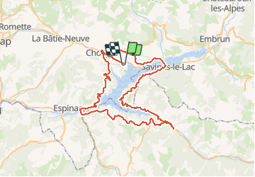
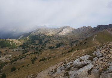
Tour Elektrofahrrad von 83 km verfügbar auf Provence-Alpes-Côte d'Azur, Hochalpen, Chorges. Diese Tour wird von cailloux54 vorgeschlagen.
Beschreibung
Jolie tour a faire de bonne heure le matin pour eviter la circulation automobile
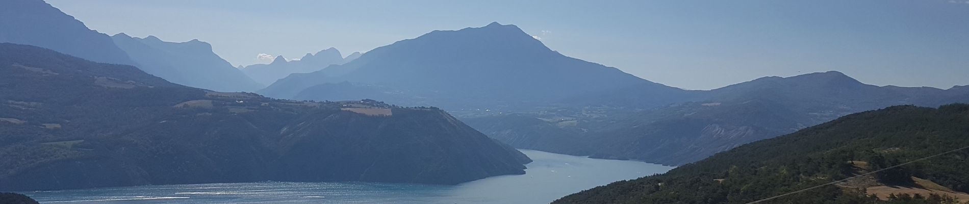
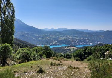
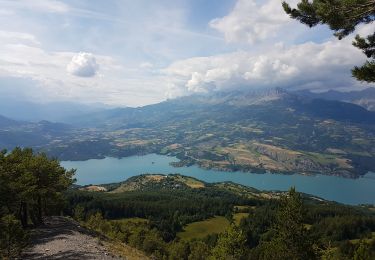
Ort
Land:
France
Region :
Provence-Alpes-Côte d'Azur
Abteilung/Provinz :
Hochalpen
Kommune :
Chorges
Standort:
Unknown
Gehen Sie:(Dec)
Gehen Sie:(UTM)
287156 ; 4933915 (32T) N.
Kommentare
Touren in der Umgebung
![Tour Wandern Pontis - PONTIS , le dolmen - Photo](https://media.geolcdn.com/t/375/260/d93d41b4-eb7a-4763-938e-68a4d680a655.jpg&format=jpg&maxdim=2)
![Wandern Wandern](https://static1.geolcdn.com/sitytour/trail-icons/101.png)
PONTIS , le dolmen
Wandern
Medium
(1)
Pontis,
Provence-Alpes-Côte d'Azur,
Alpes-de-Haute-Provence,
France
![](/images/other/stat-length.png)
12,9 km | 21 km-effort
3h 50min
![](https://static1.geolcdn.com/siteimages/upload/files/16400158638029165_repeat_loop_refresh_sync_direction_icon.png)
Ja
![Tour Wandern Chorges - Chanteloube et lac de Serre Ponçon - Photo](https://media.geolcdn.com/t/375/260/ext.jpg?maxdim=2&url=https%3A%2F%2Fservices.sitytrail.com%2FGeolivesWS%2FDownloadMedia.ashx%3FTrailID%3D337864%26Media%3Dfix__20140822114842.jpg)
![Wandern Wandern](https://static1.geolcdn.com/sitytour/trail-icons/101.png)
Chanteloube et lac de Serre Ponçon
Wandern
Sehr leicht
(2)
Chorges,
Provence-Alpes-Côte d'Azur,
Hochalpen,
France
![](/images/other/stat-length.png)
5,9 km | 8,2 km-effort
1h 47min
![](https://static1.geolcdn.com/siteimages/upload/files/16400158638029165_repeat_loop_refresh_sync_direction_icon.png)
Ja
![Tour Wandern Chorges - clôt c l'avais sur fein - Photo](https://media.geolcdn.com/t/375/260/ext.jpg?maxdim=2&url=https%3A%2F%2Fservices.sitytrail.com%2FGeolivesWS%2FDownloadMedia.ashx%3FTrailID%3D306998%26Media%3Dfix__20140529172433.jpg)
![Wandern Wandern](https://static1.geolcdn.com/sitytour/trail-icons/101.png)
clôt c l'avais sur fein
Wandern
Sehr leicht
(2)
Chorges,
Provence-Alpes-Côte d'Azur,
Hochalpen,
France
![](/images/other/stat-length.png)
8 km | 12,6 km-effort
2h 24min
![](https://static1.geolcdn.com/siteimages/upload/files/16400158638029165_repeat_loop_refresh_sync_direction_icon.png)
Ja
![Tour Wandern Pontis - pic de Morgon par les ortals et les traverses - Photo](https://media.geolcdn.com/t/375/260/cb777f72-56d2-4b64-b456-51d964e0cfaa.jpg&format=jpg&maxdim=2)
![Wandern Wandern](https://static1.geolcdn.com/sitytour/trail-icons/101.png)
pic de Morgon par les ortals et les traverses
Wandern
Schwierig
Pontis,
Provence-Alpes-Côte d'Azur,
Alpes-de-Haute-Provence,
France
![](/images/other/stat-length.png)
12,3 km | 26 km-effort
8h 49min
![](https://static1.geolcdn.com/siteimages/upload/files/16400158638029165_repeat_loop_refresh_sync_direction_icon.png)
Ja
![Tour Wandern Pontis - Le Grand Morgon par la face nord 07/09/23 - Photo](https://media.geolcdn.com/t/375/260/a64e7d52-33b6-427f-a518-e6356f0ffab5.jpg&format=jpg&maxdim=2)
![Wandern Wandern](https://static1.geolcdn.com/sitytour/trail-icons/101.png)
Le Grand Morgon par la face nord 07/09/23
Wandern
Schwierig
Pontis,
Provence-Alpes-Côte d'Azur,
Alpes-de-Haute-Provence,
France
![](/images/other/stat-length.png)
7,8 km | 18,9 km-effort
4h 18min
![](https://static1.geolcdn.com/siteimages/upload/files/16400158638029165_repeat_loop_refresh_sync_direction_icon.png)
Ja
![Tour Wandern Pontis - Morgon par les Traverses, retour par les Ortals - Photo](https://media.geolcdn.com/t/375/260/11e2532a-2629-4e4d-ad92-dc03a7dece44.jpg&format=jpg&maxdim=2)
![Wandern Wandern](https://static1.geolcdn.com/sitytour/trail-icons/101.png)
Morgon par les Traverses, retour par les Ortals
Wandern
Sehr schwierig
Pontis,
Provence-Alpes-Côte d'Azur,
Alpes-de-Haute-Provence,
France
![](/images/other/stat-length.png)
17,1 km | 33 km-effort
5h 49min
![](https://static1.geolcdn.com/siteimages/upload/files/16400158638029165_repeat_loop_refresh_sync_direction_icon.png)
Nein
![Tour Wandern Pontis - Le Morgonnet - Photo](https://media.geolcdn.com/t/375/260/c7e993fb-0242-4eef-8121-d454bffdb753.jpg&format=jpg&maxdim=2)
![Wandern Wandern](https://static1.geolcdn.com/sitytour/trail-icons/101.png)
Le Morgonnet
Wandern
Medium
Pontis,
Provence-Alpes-Côte d'Azur,
Alpes-de-Haute-Provence,
France
![](/images/other/stat-length.png)
5,9 km | 10,6 km-effort
2h 46min
![](https://static1.geolcdn.com/siteimages/upload/files/16400158638029165_repeat_loop_refresh_sync_direction_icon.png)
Ja
![Tour Wandern Pontis - Morgon par les Ortals - Photo](https://media.geolcdn.com/t/375/260/fd36861f-7d8b-4d62-ae9b-8457e11ee381.jpg&format=jpg&maxdim=2)
![Wandern Wandern](https://static1.geolcdn.com/sitytour/trail-icons/101.png)
Morgon par les Ortals
Wandern
Schwierig
Pontis,
Provence-Alpes-Côte d'Azur,
Alpes-de-Haute-Provence,
France
![](/images/other/stat-length.png)
15,6 km | 32 km-effort
6h 29min
![](https://static1.geolcdn.com/siteimages/upload/files/16400158638029165_repeat_loop_refresh_sync_direction_icon.png)
Ja
![Tour Wandern Pontis - Pic du Morgon par Serre-Chiret - Photo](https://media.geolcdn.com/t/375/260/0174d625-4fef-4ce6-9a4b-92bd42e46150.jpg&format=jpg&maxdim=2)
![Wandern Wandern](https://static1.geolcdn.com/sitytour/trail-icons/101.png)
Pic du Morgon par Serre-Chiret
Wandern
Schwierig
Pontis,
Provence-Alpes-Côte d'Azur,
Alpes-de-Haute-Provence,
France
![](/images/other/stat-length.png)
14 km | 27 km-effort
4h 2min
![](https://static1.geolcdn.com/siteimages/upload/files/16400158638029165_repeat_loop_refresh_sync_direction_icon.png)
Ja