


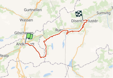

7,6 km | 10,5 km-effort


Benutzer


Kostenlosegpshiking-Anwendung
 SityTrail
IGN / Geografische Institute
SityTrail World
Die Welt öffnet sich für Sie
Tour Mountainbike von 45 km verfügbar auf Uri, Korporation Ursern, Andermatt. Diese Tour wird von ovronne vorgeschlagen.
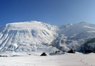
Douzième étape de la traversée des Alpes Suisse de St-Gingolph à Scuol.
Départ d''Andermatt, montée jusqu''au Pass Maighels, descente sur Tschamut puis Mompé Medel et Disentis
Zu Fuß
Zu Fuß
Zu Fuß
Zu Fuß
Zu Fuß
Zu Fuß
Zu Fuß

Zu Fuß

Zu Fuß