


14,5 km | 26 km-effort


Benutzer


Kostenlosegpshiking-Anwendung
 SityTrail
IGN / Geografische Institute
SityTrail World
Die Welt öffnet sich für Sie
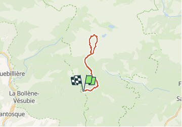
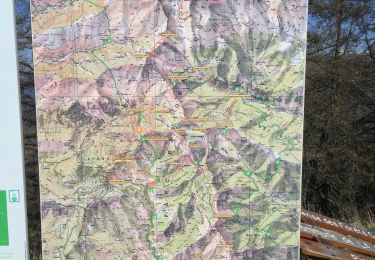
Tour Wandern von 19,6 km verfügbar auf Provence-Alpes-Côte d'Azur, Seealpen, Moulinet. Diese Tour wird von AntoineBM vorgeschlagen.
Topo de la rando jusqu'à la cime du Diable : https://randoxygene.departement06.fr/haute-vesubie/cime-du-diable-9209.html
Pour éviter de revenir par le même chemin, l'itinéraire proposé diffère du topo en passant par le sentier qui longe le Mont Capelet Supérieur.
Le temps indiqué (6h15 de marche avec les pauses) suppose un rythme de marche assez soutenu.


Zu Fuß

Zu Fuß

Zu Fuß
Zu Fuß
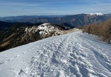
Schneeschuhwandern
Wandern

Wandern
Wandern
Wandern