![](/images/other/stat-length.png)
![Tour Wandern Anderlecht - RB-BXL-05 - Photo](https://media.geolcdn.com/t/1900/400/ext.pjpeg?maxdim=2&url=https%3A%2F%2Fservices.sitytrail.com%2FGeolivesWS%2FDownloadMedia.ashx%3FTrailID%3D247884%26Media%3Defa9a3b4-e0b1-4a00-9376-0ef985b02cd6.jpg)
RB-BXL-05
GR Rando
Randonnez sur et autour des GR ® wallons (Sentiers de Grande Randonnée). PRO
![Länge](/images/other/stat-length.png)
![Maximale Höhe](https://static1.geolcdn.com/siteimages/upload/files/1508320355ic_sort_altitude_max_24dp.png)
![Positive Höhendifferenz](https://static1.geolcdn.com/siteimages/upload/files/1508320355ic_sort_den_pos_24dp.png)
![Km-Effort](/images/other/stat-length.png)
![Min. Höhe](https://static1.geolcdn.com/siteimages/upload/files/1508320355ic_sort_altitude_min_24dp.png)
![Negative Höhendifferenz](https://static1.geolcdn.com/siteimages/upload/files/1508320355ic_sort_den_neg_24dp.png)
![Boucle](https://static1.geolcdn.com/siteimages/upload/files/16400158638029165_repeat_loop_refresh_sync_direction_icon.png)
![Wandern](https://static1.geolcdn.com/sitytour/trail-icons/101.png)
6h08
Schwierigkeit : Schwierig
![Scannen Sie diesen QR-Code, um die Tour in der SityTrail-Anwendung zu öffnen](https://capi.geolives.com/qq0zvz2zws4bq2lad0pu/sitytour/trails/247884/qr.png?size=200)
Kostenlosegpshiking-Anwendung
Über SityTrail
Tour Wandern von 23 km verfügbar auf Brüssel-Hauptstadt, Unbekannt, Anderlecht. Diese Tour wird von GR Rando vorgeschlagen.
Beschreibung
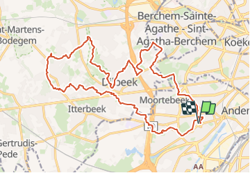
D’Anderlecht à Dilbeek, une verte excursion aux portes de Bruxelles
Pour un provincial, entamer une randonnée au départ d’une station de métro d’Anderlecht, cela semble surréaliste.
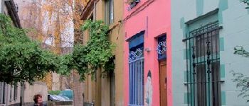
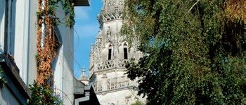
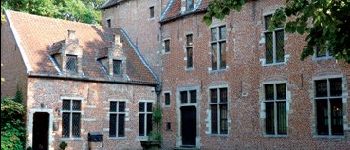
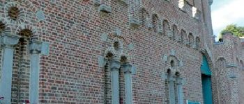
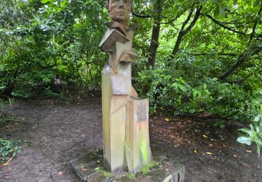
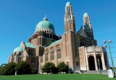
L’itinéraire débute de manière intéressante car, sur peu de distance, le randonneur entre dans l’enceinte de la Maison d’Érasme et son jardin de plantes médicinales, jette un coup d’oeil au vieux béguinage et passe devant le porche de l’imposante collégiale Saints-Pierre-et-Guidon. (Entrez, vous ne le regretterez pas !)
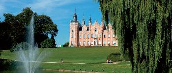
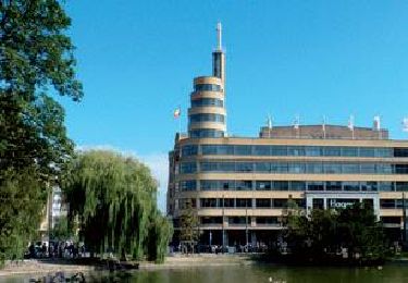
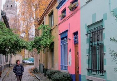
Plus loin, le parcours traverse presque consécutivement deux parcs (Astrid et Scherdemael), espaces verts calmes et reposants. Après un passage plus urbanisé, « notre » circuit entre en Brabant flamand. Le paysage devient plus campagnard.
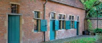
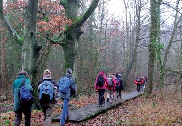
Sentiers sinueux, vallonnés, boueux (si, si !), petits chemins champêtres alternent avec des lieux citadins agréables. Vous serez étonné de découvrir des réserves naturelles, certaines visitées à l’aide de caillebotis, et stupéfait de découvrir de paisibles bovins dans le « Scheutbos », sur le territoire de Molenbeek-Saint-Jean. Au point le plus éloigné de la randonnée, nous ne sommes qu’à huit kilomètres du centre de Bruxelles !
Atteindre le départ de la randonnée :
> Gares de Bruxelles-Central ou de Bruxelles-Schuman.
> Métro, ligne 5 vers Érasme.
> Station Saint-Guidon.
À Anderlecht, cours Saint-Guidon, avenue Paul Janson.
POIs
Ort
Kommentare
Touren in der Umgebung
![Tour Wandern Saint-Josse-ten-Noode - Sint-Joost-ten-Node - RB-BXL-12 - Photo](https://media.geolcdn.com/t/375/260/ext.jpg?maxdim=2&url=https%3A%2F%2Fservices.sitytrail.com%2FGeolivesWS%2FDownloadMedia.ashx%3FTrailID%3D247909%26Media%3D1e73b1c1-685b-4b18-8885-19b8987940e4.jpg)
![Wandern Wandern](https://static1.geolcdn.com/sitytour/trail-icons/101.png)
Wandern
![](/images/other/stat-length.png)
![](https://static1.geolcdn.com/siteimages/upload/files/16400158638029165_repeat_loop_refresh_sync_direction_icon.png)
![Tour Wandern Stadt Brüssel - Nuit du scoutisme - Bruxelles - Photo](https://media.geolcdn.com/t/375/260/f0d47147-f47c-4200-a98a-0900b420d45c.jpg&format=jpg&maxdim=2)
![Wandern Wandern](https://static1.geolcdn.com/sitytour/trail-icons/101.png)
Wandern
![](/images/other/stat-length.png)
![](https://static1.geolcdn.com/siteimages/upload/files/16400158638029165_repeat_loop_refresh_sync_direction_icon.png)
![Tour Wandern Forest - Vorst - Forest National - Uccle - Photo](https://media.geolcdn.com/t/375/260/3deb4e32-c7c7-4612-9f7e-c6f2572a529a.jpg&format=jpg&maxdim=2)
![Wandern Wandern](https://static1.geolcdn.com/sitytour/trail-icons/101.png)
Wandern
![](/images/other/stat-length.png)
![](https://static1.geolcdn.com/siteimages/upload/files/16400158638029165_repeat_loop_refresh_sync_direction_icon.png)
![Tour Wandern Saint-Gilles - Sint-Gillis - RB-BX-08-Rac01 - Photo](https://media.geolcdn.com/t/375/260/ext.jpg?maxdim=2&url=https%3A%2F%2Fservices.sitytrail.com%2FGeolivesWS%2FDownloadMedia.ashx%3FTrailID%3D247898%26Media%3D4fb0a10c-9273-4113-a6c1-a6c226665b8a.jpg)
![Wandern Wandern](https://static1.geolcdn.com/sitytour/trail-icons/101.png)
Wandern
![](/images/other/stat-length.png)
![](https://static1.geolcdn.com/siteimages/upload/files/16400158638029165_repeat_loop_refresh_sync_direction_icon.png)
![Tour Wandern Uccle - Ukkel - RB-BX-07-Rac01 - Photo](https://media.geolcdn.com/t/375/260/ext.jpg?maxdim=2&url=https%3A%2F%2Fservices.sitytrail.com%2FGeolivesWS%2FDownloadMedia.ashx%3FTrailID%3D247895%26Media%3Df2f46971-c44e-4a53-867b-6dea0848e49c.jpg)
![Wandern Wandern](https://static1.geolcdn.com/sitytour/trail-icons/101.png)
Wandern
![](/images/other/stat-length.png)
![](https://static1.geolcdn.com/siteimages/upload/files/16400158638029165_repeat_loop_refresh_sync_direction_icon.png)
![Tour Wandern Uccle - Ukkel - RB-BXL-07 - Photo](https://media.geolcdn.com/t/375/260/ext.jpg?maxdim=2&url=https%3A%2F%2Fservices.sitytrail.com%2FGeolivesWS%2FDownloadMedia.ashx%3FTrailID%3D247894%26Media%3Df2f46971-c44e-4a53-867b-6dea0848e49c.jpg)
![Wandern Wandern](https://static1.geolcdn.com/sitytour/trail-icons/101.png)
Wandern
![](/images/other/stat-length.png)
![](https://static1.geolcdn.com/siteimages/upload/files/16400158638029165_repeat_loop_refresh_sync_direction_icon.png)
![Tour Wandern Anderlecht - RB-BX-05-Rac02 - Photo](https://media.geolcdn.com/t/375/260/ext.jpg?maxdim=2&url=https%3A%2F%2Fservices.sitytrail.com%2FGeolivesWS%2FDownloadMedia.ashx%3FTrailID%3D247888%26Media%3Defa9a3b4-e0b1-4a00-9376-0ef985b02cd6.jpg)
![Wandern Wandern](https://static1.geolcdn.com/sitytour/trail-icons/101.png)
Wandern
![](/images/other/stat-length.png)
![](https://static1.geolcdn.com/siteimages/upload/files/16400158638029165_repeat_loop_refresh_sync_direction_icon.png)
![Tour Wandern Molenbeek-Saint-Jean - Sint-Jans-Molenbeek - RB-BXL-04 - Photo](https://media.geolcdn.com/t/375/260/ext.jpg?maxdim=2&url=https%3A%2F%2Fservices.sitytrail.com%2FGeolivesWS%2FDownloadMedia.ashx%3FTrailID%3D247883%26Media%3De6a7a7ca-c658-4857-8e1b-9ec70ca63e16.jpg)
![Wandern Wandern](https://static1.geolcdn.com/sitytour/trail-icons/101.png)
Wandern
![](/images/other/stat-length.png)
![](https://static1.geolcdn.com/siteimages/upload/files/16400158638029165_repeat_loop_refresh_sync_direction_icon.png)
![Wandern Wandern](https://static1.geolcdn.com/sitytour/trail-icons/101.png)
Wandern
![](/images/other/stat-length.png)
![](https://static1.geolcdn.com/siteimages/upload/files/16400158638029165_repeat_loop_refresh_sync_direction_icon.png)