![](/images/other/stat-length.png)
![Tour Wandern Sérilhac - Randonnée du 19 juillet 2020 - Photo](https://media.geolcdn.com/t/1900/400/ext.pjpeg?maxdim=2&url=https%3A%2F%2Fstatic1.geolcdn.com%2Fsiteimages%2Fupload%2Ffiles%2F1553511878bg_sport_marche.png)
Randonnée du 19 juillet 2020
Gpoujade
Benutzer
![Länge](/images/other/stat-length.png)
Länge
6,2 km
![Maximale Höhe](https://static1.geolcdn.com/siteimages/upload/files/1508320355ic_sort_altitude_max_24dp.png)
Maximale Höhe
441 m
![Positive Höhendifferenz](https://static1.geolcdn.com/siteimages/upload/files/1508320355ic_sort_den_pos_24dp.png)
Positive Höhendifferenz
256 m
![Km-Effort](/images/other/stat-length.png)
Km-Effort
9,6 km
![Min. Höhe](https://static1.geolcdn.com/siteimages/upload/files/1508320355ic_sort_altitude_min_24dp.png)
Min. Höhe
236 m
![Negative Höhendifferenz](https://static1.geolcdn.com/siteimages/upload/files/1508320355ic_sort_den_neg_24dp.png)
Negative Höhendifferenz
257 m
![Boucle](https://static1.geolcdn.com/siteimages/upload/files/16400158638029165_repeat_loop_refresh_sync_direction_icon.png)
Boucle
Ja
Erstellungsdatum :
2020-07-14 16:06:56.923
Letzte Änderung :
2020-07-14 16:14:22.485
![Wandern](https://static1.geolcdn.com/sitytour/trail-icons/101.png)
1h59
Schwierigkeit : Medium
![Scannen Sie diesen QR-Code, um die Tour in der SityTrail-Anwendung zu öffnen](https://capi.geolives.com/qq0zvz2zws4bq2lad0pu/sitytour/trails/2475779/qr.png?size=200)
Kostenlosegpshiking-Anwendung
Über SityTrail
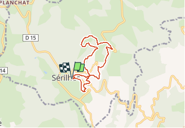
Tour Wandern von 6,2 km verfügbar auf Neu-Aquitanien, Corrèze, Sérilhac. Diese Tour wird von Gpoujade vorgeschlagen.
Beschreibung
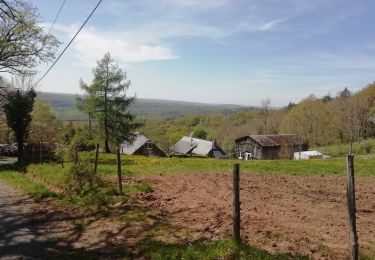
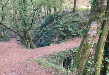
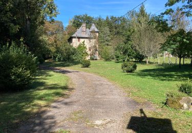
Belle rando , avec des points de vues un peu partout, pour la découverte d'une partie de la commune de Sérilhac .
Ort
Land:
France
Region :
Neu-Aquitanien
Abteilung/Provinz :
Corrèze
Kommune :
Sérilhac
Standort:
Unknown
Gehen Sie:(Dec)
Gehen Sie:(UTM)
399888 ; 4993591 (31T) N.
Kommentare
Touren in der Umgebung
![Tour Mountainbike Meyssac - Boucle de Meyssac à Beynat - Photo](https://media.geolcdn.com/t/375/260/ext.jpg?maxdim=2&url=https%3A%2F%2Fstatic1.geolcdn.com%2Fsiteimages%2Fupload%2Ffiles%2F1524743154velo.jpg)
![Mountainbike Mountainbike](https://static1.geolcdn.com/sitytour/trail-icons/202.png)
Boucle de Meyssac à Beynat
Mountainbike
Schwierig
(1)
Meyssac,
Neu-Aquitanien,
Corrèze,
France
![](/images/other/stat-length.png)
40 km | 53 km-effort
3h 0min
![](https://static1.geolcdn.com/siteimages/upload/files/16400158638029165_repeat_loop_refresh_sync_direction_icon.png)
Ja
![Tour Mountainbike Lostanges - SityTrail - 2034969 - monts-et-vallees-de-lostanges-variante - Photo](https://media.geolcdn.com/t/375/260/ext.jpg?maxdim=2&url=https%3A%2F%2Fstatic1.geolcdn.com%2Fsiteimages%2Fupload%2Ffiles%2F1524743154velo.jpg)
![Mountainbike Mountainbike](https://static1.geolcdn.com/sitytour/trail-icons/202.png)
SityTrail - 2034969 - monts-et-vallees-de-lostanges-variante
Mountainbike
Schwierig
(1)
Lostanges,
Neu-Aquitanien,
Corrèze,
France
![](/images/other/stat-length.png)
23 km | 34 km-effort
2h 22min
![](https://static1.geolcdn.com/siteimages/upload/files/16400158638029165_repeat_loop_refresh_sync_direction_icon.png)
Ja
![Tour Mountainbike Meyssac - Sortie du 6 juin 2021 - Photo](https://media.geolcdn.com/t/375/260/ext.jpg?maxdim=2&url=https%3A%2F%2Fstatic1.geolcdn.com%2Fsiteimages%2Fupload%2Ffiles%2F1524743154velo.jpg)
![Mountainbike Mountainbike](https://static1.geolcdn.com/sitytour/trail-icons/202.png)
Sortie du 6 juin 2021
Mountainbike
Schwierig
(1)
Meyssac,
Neu-Aquitanien,
Corrèze,
France
![](/images/other/stat-length.png)
27 km | 35 km-effort
2h 34min
![](https://static1.geolcdn.com/siteimages/upload/files/16400158638029165_repeat_loop_refresh_sync_direction_icon.png)
Ja
![Tour Mountainbike Meyssac - Meyssac 30 - Photo](https://media.geolcdn.com/t/375/260/ext.jpg?maxdim=2&url=https%3A%2F%2Fstatic1.geolcdn.com%2Fsiteimages%2Fupload%2Ffiles%2F1524743154velo.jpg)
![Mountainbike Mountainbike](https://static1.geolcdn.com/sitytour/trail-icons/202.png)
Meyssac 30
Mountainbike
Schwierig
(1)
Meyssac,
Neu-Aquitanien,
Corrèze,
France
![](/images/other/stat-length.png)
29 km | 37 km-effort
1h 50min
![](https://static1.geolcdn.com/siteimages/upload/files/16400158638029165_repeat_loop_refresh_sync_direction_icon.png)
Ja
![Tour Mountainbike Meyssac - 2020-10-09_21h28m24_collonges-turenne-chaise du diable - Photo](https://media.geolcdn.com/t/375/260/ext.jpg?maxdim=2&url=https%3A%2F%2Fmedia.geolcdn.com%2Ff%2Fd7120558-7175-4ce2-b6ad-fdb1d079b06a.jpg)
![Mountainbike Mountainbike](https://static1.geolcdn.com/sitytour/trail-icons/202.png)
2020-10-09_21h28m24_collonges-turenne-chaise du diable
Mountainbike
Sehr schwierig
Meyssac,
Neu-Aquitanien,
Corrèze,
France
![](/images/other/stat-length.png)
46 km | 62 km-effort
4h 35min
![](https://static1.geolcdn.com/siteimages/upload/files/16400158638029165_repeat_loop_refresh_sync_direction_icon.png)
Ja
![Tour Wandern Lostanges - Lostanges - Photo](https://media.geolcdn.com/t/375/260/ext.jpg?maxdim=2&url=https%3A%2F%2Fmedia.geolcdn.com%2Ff%2F5b875a5f-59f0-429c-b2e1-4616cf8385da.jpg)
![Wandern Wandern](https://static1.geolcdn.com/sitytour/trail-icons/101.png)
Lostanges
Wandern
Medium
Lostanges,
Neu-Aquitanien,
Corrèze,
France
![](/images/other/stat-length.png)
13,9 km | 21 km-effort
4h 8min
![](https://static1.geolcdn.com/siteimages/upload/files/16400158638029165_repeat_loop_refresh_sync_direction_icon.png)
Ja
![Tour Wandern Lagleygeolle - Lagleygeolle - Le Pescher - Photo](https://media.geolcdn.com/t/375/260/ext.jpg?maxdim=2&url=https%3A%2F%2Fmedia.geolcdn.com%2Ff%2F2bbcbc6f-5a56-4987-9499-dd044f8a5e39.jpg)
![Wandern Wandern](https://static1.geolcdn.com/sitytour/trail-icons/101.png)
Lagleygeolle - Le Pescher
Wandern
Medium
Lagleygeolle,
Neu-Aquitanien,
Corrèze,
France
![](/images/other/stat-length.png)
17,1 km | 24 km-effort
4h 48min
![](https://static1.geolcdn.com/siteimages/upload/files/16400158638029165_repeat_loop_refresh_sync_direction_icon.png)
Ja
![Tour Wandern Meyssac - Meyssac Collonges - Photo](https://media.geolcdn.com/t/375/260/ext.jpg?maxdim=2&url=https%3A%2F%2Fmedia.geolcdn.com%2Ff%2F11eaa255-f2ef-4789-833b-d345b75d4baa.jpg)
![Wandern Wandern](https://static1.geolcdn.com/sitytour/trail-icons/101.png)
Meyssac Collonges
Wandern
Medium
Meyssac,
Neu-Aquitanien,
Corrèze,
France
![](/images/other/stat-length.png)
16,2 km | 22 km-effort
4h 32min
![](https://static1.geolcdn.com/siteimages/upload/files/16400158638029165_repeat_loop_refresh_sync_direction_icon.png)
Ja
![Tour Wandern Meyssac - meyssac - Photo](https://media.geolcdn.com/t/375/260/ext.jpg?maxdim=2&url=https%3A%2F%2Fmedia.geolcdn.com%2Ff%2F1177967c-e07d-49d0-935b-3b1283abe266.jpg)
![Wandern Wandern](https://static1.geolcdn.com/sitytour/trail-icons/101.png)
meyssac
Wandern
Sehr schwierig
Meyssac,
Neu-Aquitanien,
Corrèze,
France
![](/images/other/stat-length.png)
15,2 km | 22 km-effort
5h 9min
![](https://static1.geolcdn.com/siteimages/upload/files/16400158638029165_repeat_loop_refresh_sync_direction_icon.png)
Ja