![](/images/other/stat-length.png)
![Tour Hybrid-Bike Champeaux - SityTrail - De Melun à Champeaux - Photo](https://media.geolcdn.com/t/1900/400/2b1bb30f-5440-479e-aa11-f32d5141f790.bmp&format=pjpeg&maxdim=2)
SityTrail - De Melun à Champeaux
Bntg
Benutzer
![Länge](/images/other/stat-length.png)
![Maximale Höhe](https://static1.geolcdn.com/siteimages/upload/files/1508320355ic_sort_altitude_max_24dp.png)
![Positive Höhendifferenz](https://static1.geolcdn.com/siteimages/upload/files/1508320355ic_sort_den_pos_24dp.png)
![Km-Effort](/images/other/stat-length.png)
![Min. Höhe](https://static1.geolcdn.com/siteimages/upload/files/1508320355ic_sort_altitude_min_24dp.png)
![Negative Höhendifferenz](https://static1.geolcdn.com/siteimages/upload/files/1508320355ic_sort_den_neg_24dp.png)
![Boucle](https://static1.geolcdn.com/siteimages/upload/files/16400158638029165_repeat_loop_refresh_sync_direction_icon.png)
![Hybrid-Bike](https://static1.geolcdn.com/sitytour/trail-icons/203.png)
--
Schwierigkeit : Medium
![Scannen Sie diesen QR-Code, um die Tour in der SityTrail-Anwendung zu öffnen](https://capi.geolives.com/qq0zvz2zws4bq2lad0pu/sitytour/trails/2466372/qr.png?size=200)
Kostenlosegpshiking-Anwendung
Über SityTrail
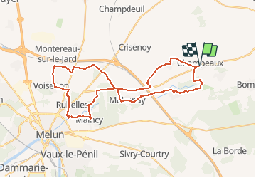
Tour Hybrid-Bike von 35 km verfügbar auf Île-de-France, Seine-et-Marne, Champeaux. Diese Tour wird von Bntg vorgeschlagen.
Beschreibung
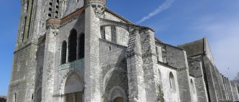
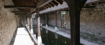
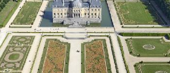
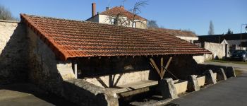
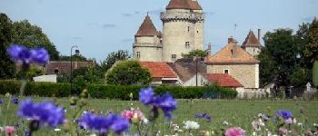
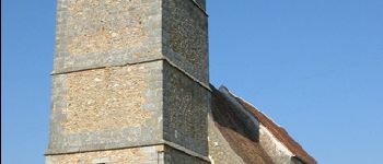
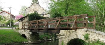
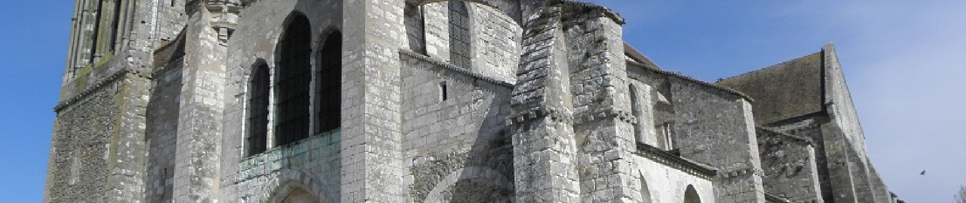
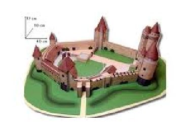
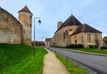
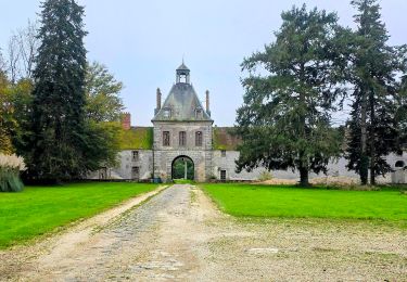
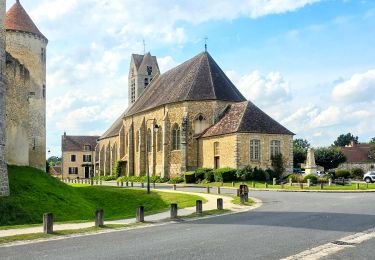
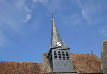
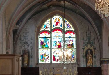
Un petit tour dans la Brie en passant par de magnifiques villages et devant des lavoirs, édifices religieux, et châteaux dont celui de Vaux-le -Vicomte.
Quelques Km sur routes moins agréables que d'autres mais difficile de faire autrement dans la région.
Pour les amateurs de VTT, choisissez la Rando: "Boucle Champeaux" normale; il y a un passage pour vous.
Ort
Kommentare
Touren in der Umgebung
![Tour Wandern Blandy - Eglises Médiévales de la Brie - La Collégiale Saint-Martin de Champeaux - Photo](https://media.geolcdn.com/t/375/260/aed965fb-0abe-4a92-b759-defb35e3ca63.jpg&format=jpg&maxdim=2)
![Wandern Wandern](https://static1.geolcdn.com/sitytour/trail-icons/101.png)
Wandern
![](/images/other/stat-length.png)
![](https://static1.geolcdn.com/siteimages/upload/files/16400158638029165_repeat_loop_refresh_sync_direction_icon.png)
![Tour Wandern Blandy - Boucle 23 km Blandy - St Merry - Bombon - Champeaux - Photo](https://media.geolcdn.com/t/375/260/810a2001-48d6-47b8-9b9c-600abddda76e.jpg&format=jpg&maxdim=2)
![Wandern Wandern](https://static1.geolcdn.com/sitytour/trail-icons/101.png)
Wandern
![](/images/other/stat-length.png)
![](https://static1.geolcdn.com/siteimages/upload/files/16400158638029165_repeat_loop_refresh_sync_direction_icon.png)
![Tour Zu Fuß Bombon - Boucle 30 km autour de Bombon - Photo](https://media.geolcdn.com/t/375/260/3c20580b-5dc5-4b7b-ad19-7338a4cd3174.jpg&format=jpg&maxdim=2)
![Zu Fuß Zu Fuß](https://static1.geolcdn.com/sitytour/trail-icons/100.png)
Zu Fuß
![](/images/other/stat-length.png)
![](https://static1.geolcdn.com/siteimages/upload/files/16400158638029165_repeat_loop_refresh_sync_direction_icon.png)
![Tour Wandern Blandy - Boucle 21 km Blandy - Bombom - St Mery - Champeaux - Photo](https://media.geolcdn.com/t/375/260/a365a7e1-c890-4e35-bd6d-01d4e699b3cc.jpg&format=jpg&maxdim=2)
![Wandern Wandern](https://static1.geolcdn.com/sitytour/trail-icons/101.png)
Wandern
![](/images/other/stat-length.png)
![](https://static1.geolcdn.com/siteimages/upload/files/16400158638029165_repeat_loop_refresh_sync_direction_icon.png)
![Tour Wandern Blandy - Boucle autour de Blandy par Corinne - Photo](https://media.geolcdn.com/t/375/260/e1753442-473d-4613-9ca0-8082f000c750.jpg&format=jpg&maxdim=2)
![Wandern Wandern](https://static1.geolcdn.com/sitytour/trail-icons/101.png)
Wandern
![](/images/other/stat-length.png)
![](https://static1.geolcdn.com/siteimages/upload/files/16400158638029165_repeat_loop_refresh_sync_direction_icon.png)
![Tour Wandern Blandy - De Maincy à Blandy les Tours - Photo](https://media.geolcdn.com/t/375/260/ext.jpg?maxdim=2&url=https%3A%2F%2Fstatic1.geolcdn.com%2Fsiteimages%2Fupload%2Ffiles%2F1553511878bg_sport_marche.png)
![Wandern Wandern](https://static1.geolcdn.com/sitytour/trail-icons/101.png)
Wandern
![](/images/other/stat-length.png)
![](https://static1.geolcdn.com/siteimages/upload/files/16400158638029165_repeat_loop_refresh_sync_direction_icon.png)
![Tour Wandern Saint-Méry - Boucle autour de Saint Mery 20 km - Photo](https://media.geolcdn.com/t/375/260/8aa4e70e-d8ab-4b1b-897f-cd1520e1f018.jpg&format=jpg&maxdim=2)
![Wandern Wandern](https://static1.geolcdn.com/sitytour/trail-icons/101.png)
Wandern
![](/images/other/stat-length.png)
![](https://static1.geolcdn.com/siteimages/upload/files/16400158638029165_repeat_loop_refresh_sync_direction_icon.png)
![Tour Wandern Moisenay - Boucle 29 km autour de Moisenay - Photo](https://media.geolcdn.com/t/375/260/ext.jpg?maxdim=2&url=https%3A%2F%2Fstatic1.geolcdn.com%2Fsiteimages%2Fupload%2Ffiles%2F1553511878bg_sport_marche.png)
![Wandern Wandern](https://static1.geolcdn.com/sitytour/trail-icons/101.png)
Wandern
![](/images/other/stat-length.png)
![](https://static1.geolcdn.com/siteimages/upload/files/16400158638029165_repeat_loop_refresh_sync_direction_icon.png)
![Tour Wandern Bombon - Bombon 2023 - Photo](https://media.geolcdn.com/t/375/260/c3a1b84c-b69d-45b3-8086-587b8bb5cc10.jpg&format=jpg&maxdim=2)
![Wandern Wandern](https://static1.geolcdn.com/sitytour/trail-icons/101.png)
Wandern
![](/images/other/stat-length.png)
![](https://static1.geolcdn.com/siteimages/upload/files/16400158638029165_repeat_loop_refresh_sync_direction_icon.png)