


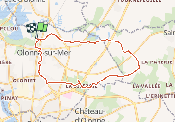

54 km | 63 km-effort


Benutzer


Kostenlosegpshiking-Anwendung
 SityTrail
IGN / Geografische Institute
SityTrail World
Die Welt öffnet sich für Sie
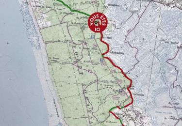
Tour Wandern von 16,1 km verfügbar auf Pays de la Loire, Vendée, Les Sables-d'Olonne. Diese Tour wird von Gregory Herlaud vorgeschlagen.
Départ du Havre d'Olonne.
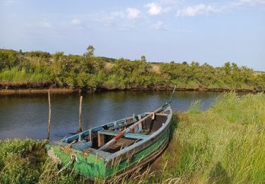
A voir : le parc de la Jarrie ; le Fossé des Sarrasins ; les haies bocagères ; vue sur les marais.
Sentier cyclable de 17 km.
Balisage en vert.
Mountainbike

Mountainbike
Wandern
Fahrrad
Andere Aktivitäten
Andere Aktivitäten

Wandern
Wandern
Wandern